
Great Sand Dunes Map: Layout, Areas, and the Official Map to Download
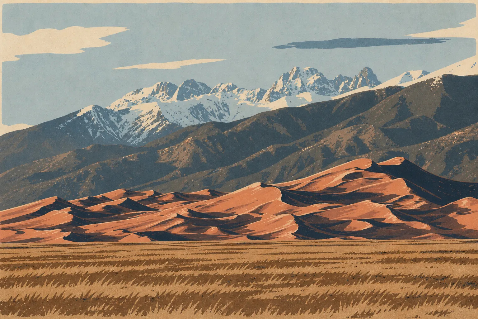
Great Sand Dunes National Park and Preserve fills the floor of the San Luis Valley in southern Colorado, at the foot of the Sangre de Cristo Mountains. The park is home to North America's tallest sand dunes, rising to 750 feet at Star Dune. You can download the official PDF map for free from the NPS website (nps.gov/grsa/planyourvisit/maps.htm). It's the first thing to check before you arrive.
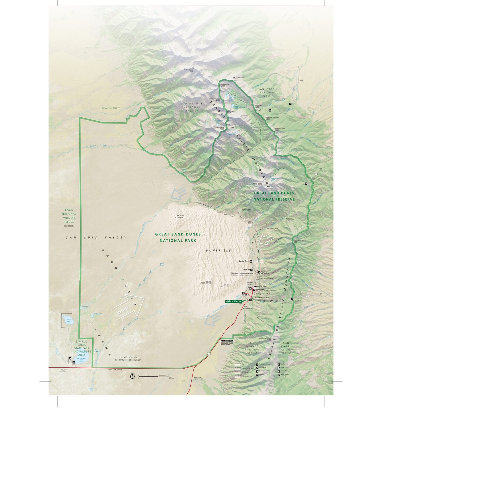
The official park map handed out at entrance stations, with roads, areas, visitor centers and services. View it here or download it for offline use.
Download the map (PDF) Public domain · National Park ServiceWhere Is Great Sand Dunes?
Great Sand Dunes sits in southern Colorado, along the eastern edge of the San Luis Valley. This semiarid plain, at roughly 7,500 feet in elevation, is framed to the east by the Sangre de Cristo Mountains, whose rocky walls form the dunes' immediate backdrop.
On a map of the United States, the park lies about 236 miles south of Denver and 22 miles northeast of Alamosa, the closest town with services. The Regions section places the park in the broader geographic context of the Southern Rockies.
Download the Official Great Sand Dunes Map (NPS Unigrid)
The NPS publishes a free Unigrid map of Great Sand Dunes. It shows the dune field, internal roads, marked trails outside the sand field, the Visitor Center, campgrounds, and picnic areas. Download it at nps.gov/grsa/planyourvisit/maps.htm.
Print it before you leave if you're planning to travel in the backcountry. There is no cell service there.
Keep one thing in mind. The dunes themselves are an open walking area with no established trails through the sand. The map outlines the field but doesn't show marked routes inside it.
Great Sand Dunes Areas
The Dune Field and Visitor Center Area
This is the central area, where you'll find the vast majority of visitors. It includes the Dunes Parking Lot, the Visitor Center, Piñon Flats Campground, and the dune field itself. You can reach the dunes on foot from the parking lot by crossing Medano Creek, which is seasonal. High Dune, the first major summit, is about 0.9 miles from the parking lot. Star Dune, at 750 feet, requires about 1.9 additional miles across the sand.
The Medano Creek Corridor
Medano Creek runs along the base of the dunes for several miles before disappearing into the sand. This seasonal stream creates a rare phenomenon: waves of wet sand that are most visible from May through early July. This strip of low vegetation forms the natural transition between the dune field and the surrounding plain.
Sangre de Cristo Wilderness and the Backcountry
Behind the dunes, the preserve extends into the foothills of the Sangre de Cristo Mountains. You can reach it via Medano Pass Primitive Road, a route reserved for high-clearance four-wheel-drive vehicles. Pine and aspen forests, wild trails, and sweeping views of the sand field from the ridges await hikers there. The Great Sand Dunes hiking guide lists the trails accessible in this area.
Park Entrances and Driving Access
Great Sand Dunes has just one entrance, on CO 150. The Visitor Center and Dunes Parking Lot are at the road's northern terminus. For directions from Denver, Colorado Springs, or Alamosa, see the Great Sand Dunes access guide. For entrance fees and annual passes, see the National Parks Fees & Passes page.
Map Highlights and Viewpoints
From the main parking lot, two landmarks organize the map: High Dune, the first major ridge, about a 0.9-mile one-way walk across the sand, and Star Dune, the dune field's highest point at 750 feet. You can connect the two on an unmarked cross-country loop.
At the foot of the dunes, Medano Creek is an essential landmark to locate on the map before you go, especially if you're traveling with kids. Its water level changes from day to day depending on snowmelt. Outside the park, a few miles south on CO 150, Zapata Falls is worth a stop along the way.
For activities by area and the best spots for each season, the Great Sand Dunes activities guide will give you all the key landmarks.
Nearest Towns and Airports
Alamosa is the natural base for supplies and services, about 22 miles southwest via CO 150. You'll find lodging, supermarkets, and a gas station there. The local airport, San Luis Valley Regional Airport (ALS), offers regional flights from Denver.
For international flights and major airlines, Denver International Airport (DEN) remains the main gateway, about 236 miles north, a four-hour drive. Colorado Springs Airport (COS), about 155 miles away, is an alternative for travelers coming from the East Coast.
Paper Hiking Maps and Trail Guides
The NPS Unigrid map is enough for a standard visit to the dunes. For the Sangre de Cristo Wilderness backcountry, more detailed topographic maps are essential. The National Geographic Trails Illustrated series, map no. 138, Great Sand Dunes, covers most of the area. You can find it at specialty travel bookstores before you leave. It's useful as soon as you leave the marked areas near the Visitor Center.
Frequently Asked Questions
Where is Great Sand Dunes on a map of the United States?
Great Sand Dunes is in southern Colorado, in the San Luis Valley, about 236 miles south of Denver and 22 miles northeast of Alamosa.
Is there a Great Sand Dunes map I can download?
Yes. The NPS Unigrid map is available as a free PDF on the park's official website: nps.gov/grsa/planyourvisit/maps.htm.
Can you drive across Great Sand Dunes?
You can't drive across the dune field. CO 150 ends at the main parking lot. Medano Pass Primitive Road reaches the backcountry through the preserve, but it's limited to high-clearance 4x4 vehicles.
What's the best viewpoint at Great Sand Dunes?
The top of High Dune, about a 0.9-mile walk from the parking lot, offers a panoramic view of the entire dune field and the Sangre de Cristo Mountains. The Things to Do guide lists other spots based on your preferences.
What's the closest town to Great Sand Dunes?
The closest town is Alamosa, about 22 miles southwest. The Great Sand Dunes lodging guide lists the options in the area.
How much time do you need to visit Great Sand Dunes?
A half day covers the main dunes from the parking lot. A full day lets you explore Medano Creek and the areas around the park. The Great Sand Dunes itinerary guide offers plans suited to different travelers.