
The Best Hikes in Wrangell–St. Elias for Every Experience Level
Wrangell–St. Elias is the largest national park in the United States. It covers six times the area of Yellowstone, brings together four mountain ranges, and contains glaciers the size of entire countries. The trail infrastructure, on the other hand, remains very limited. Outside the Kennecott area, you're navigating cross-country through wilderness that doesn't forgive improvisation. That's precisely what makes it such a unique place to explore for hikers willing to play by its rules.
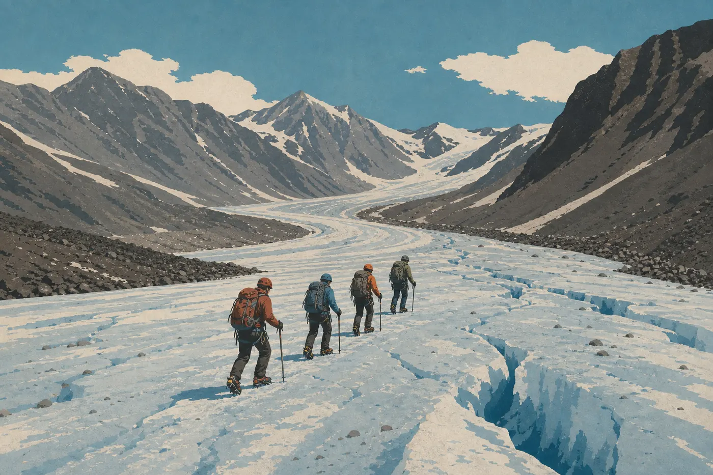
If you only do one hike, make it the Root Glacier Trail, starting in Kennecott. You'll be standing in front of bare ice in less than two hours of hiking. The terrain is flat, access to the glacier is direct, and the scenery is striking. If you're looking for a climb, the Bonanza Mine Trail is the one to choose. It gains 3,000 feet and leads to the ruins of the mine that made Alaska rich at the turn of the 20th century. Families and first-time hikers will find more manageable terrain around the Crystalline Hills, near Chitina.
Our complete guide gives you the park's context before you plan your itinerary.
How to Prepare for a Hike in Wrangell–St. Elias
Bears and wildlife. The park is home to grizzlies and black bears. Carrying bear spray is nonnegotiable, whether you're on a maintained trail or traveling cross-country. Learn how to use it before you leave. That's not a minor detail. Our Wildlife page explains how to respond to each species.
Maintained trails are the exception, not the rule. Official trails cluster around Kennecott and Nabesna Road. Across most of the park, there are no trail markers at all. Any trip beyond the official trails requires a topographic map, a compass, and a GPS with offline maps loaded.
Water. Don't drink untreated water from streams or springs. Bring a filter, iodine tablets, or a UV purifier before you arrive. There are no resupply points on the trails.
Weather. Alaska's weather changes quickly, even in midsummer. Afternoon thunderstorms at elevation regularly catch people off guard. Keep a rain jacket in your pack at all times. Our Weather page breaks down conditions by season.
Permits and registration. You don't need a paid permit for a day hike. Overnight backcountry trips don't require formal registration either, but signing in voluntarily at a visitor center is strongly recommended. If something goes wrong, rangers will know where to look for you.
Dogs. Dogs aren't allowed on official trails in the “National Park” area. They're permitted on leash in the adjacent “National Preserve” areas. Check the official map for your planned area before bringing your dog.
Insects. Mosquitoes are out in force from June through mid-August, especially in wet lowland areas. High-DEET repellent and long sleeves are essential for any stay from June through mid-August.
The Best Hikes, Area by Area
Kennecott and McCarthy: The Essential Trails
Nearly all of the park's maintained trails are here. You can reach Kennecott from McCarthy, which is connected to the rest of the world by about 59 miles of unpaved road from Chitina, the McCarthy Road. This is the area to prioritize on a first visit.
- Distance
- About 5.6 to 6.2 miles round-trip
- Elevation gain
- Minimal elevation gain
- Duration
- Easy
- Difficulty
- Out and back
- Type
- Starts in Kennecott
The trail follows Root Glacier's lateral moraine before bringing you to the edge of the bare ice. The view of the seracs, with the snow-covered Wrangell Mountains in the background, is striking. You can rent crampons in McCarthy to walk directly on the glacier, depending on current conditions and operator availability. The moraine gets slippery in the rain, so check the weather before you leave.
- Distance
- About 9 miles round-trip
- Elevation gain
- About 3,000 feet of elevation gain
- Duration
- Difficult
- Difficulty
- Out and back
- Type
- Starts in Kennecott
The climb is steep and sustained all the way to the impressive ruins of Bonanza Mine, perched above 5,250 feet. From the top, the view of Kennicott and Root Glaciers, the Chitina Valley, and the mountain ranges stretching across the horizon is worth every foot of elevation gain. Allow 5 to 7 hours for the full round trip. Start early. Afternoon clouds build quickly along the ridges.
- Distance
- About 3.7 miles one way
- Elevation gain
- Moderate elevation gain
- Duration
- Moderate
- Difficulty
- Out and back
- Type
- Starts at the junction with Root Glacier Trail
A spur off Root Glacier Trail climbs toward the ruins of Erie Mine through rougher, rockier terrain. It's a good alternative if you want elevation gain without the length and commitment of Bonanza Mine Trail.
Trails Along Nabesna Road
Nabesna Road runs about 40 miles into the park's northern section, starting at the Slana visitor center. The trails along it are short, lightly used, and poorly marked beyond the first mile. Check in with the Slana visitor center before heading out in this area.
Skookum Volcano Trail
This trail starts roughly halfway along Nabesna Road and leads toward an old shield volcano through open tundra. Difficulty ranges from moderate to difficult depending on ground conditions and the season. There are no facilities at the trailhead.
Trail Creek Trail and Lost Creek Trail
These two valley-bottom routes follow waterways through the tundra and are manageable in good weather. They're a good introduction to cross-country travel in this area, with plenty of solitude.
Chitina: A More Accessible Gateway
- Distance
- A few miles round-trip
- Elevation gain
- Moderate elevation gain
- Duration
- Easy to moderate
- Difficulty
- Out and back
- Type
- Starts near the Chitina visitor center
This is a good trail for getting your legs under you when you arrive at the park, before taking on more demanding areas. It offers open views of the Copper River and the surrounding peaks. It's ideal early or late in the day, when the light is best.
Easy Family Hikes
Let's be honest. Wrangell–St. Elias isn't the best-equipped park for families with very young children. The practical options are Root Glacier Trail, which has flat terrain and works for kids around 10 who are used to walking, and the Crystalline Hills near Chitina, which are shorter and have gentler elevation gain.
In both cases, bring plenty of water, a substantial snack, effective insect repellent, and rain gear even in midsummer. Weather changes quickly, and there are no shelters along the trails. Our Family page looks at what makes visiting this extraordinary park with kids different.
Challenging Day Hikes
Bonanza Mine Trail is the park's classic big day hike. With 3,000 feet of elevation gain over 9 miles, it demands good fitness and an early start. It's also the park's showcase hike for anyone looking for a memorable alpine experience without an overnight trip.
If you want to go farther, the park opens onto cross-country day trips through glacial valleys that few hikers ever reach. These outings require strong navigation skills, gear suited to changing conditions, and advance communication with rangers. Our Things to Do page covers other activities that pair well with a day on the trail, including small-plane flights that offer striking views of the glaciers.
Access, Trailheads, and Parking
From McCarthy and Kennecott. The main access to trails in the Kennecott area is via the McCarthy Road, about 59 miles of unpaved road from Chitina. There is no vehicle bridge over the Kennicott River. Leave your car on the west side of the river, cross on the pedestrian footbridge, then walk about 5 miles to Kennecott or take a private shuttle available during the season. The trailheads are in Kennecott itself.
Copper Center administrative center. The park's main visitor center is on the Richardson Highway (Route 4), 8 miles south of the junction with the Glenn Highway. It's the logical place to get current conditions before heading in.
Parking. Private paid lots are available at the Chitina end of the McCarthy Road. The NPS doesn't run an official shuttle between these lots and the Kennecott trailheads. Private operators provide that service during the season.
To reach Wrangell–St. Elias from Anchorage and check seasonal road conditions, see the guide to getting to the park.
When to Hike in Wrangell–St. Elias
The best window runs from mid-June through mid-September. July and August offer the best conditions: long days, with up to 20 hours of daylight in July, passable trails, and less snow at higher elevations. June is wetter and brings the peak mosquito season. By mid-September, the first high-elevation snow closes some routes, and visitor centers cut back their hours before closing completely in October.
Our When to Go page compares the months in detail based on activities and weather conditions.
Which Hike to Choose for Your Trip
You have half a day and want to see ice. Root Glacier Trail. No question.
You're fit and looking for a real full-day challenge. Bonanza Mine Trail. Start at 7 a.m., bring a substantial snack, and pack a rain jacket.
You're traveling with kids. Follow Root Glacier Trail to the glacier's edge. Turn around when little legs start to tire.
You're looking for solitude and a genuinely wild experience. Nabesna Road and its lightly used trails. Check in at the Slana visitor center first.
You're a photographer aiming for late-day light. In July, the sun doesn't set until after 11 p.m. The glaciers are worth seeing in the low angled light. Let the rangers know your route if you'll be returning late.
For lodging, our Where to Stay page lists the few, very real options in McCarthy and Kennecott.
Frequently Asked Questions
Is Wrangell–St. Elias worth visiting for hiking?
Wrangell–St. Elias is worth it if you want genuine contact with active glaciers and uncrowded wilderness. It's not a park with a connected trail network. The maintained options are few but unusually rewarding. Cross-country travel is for experienced, self-sufficient hikers.
Are there bears in Wrangell–St. Elias National Park?
Yes. Both species live in the park: black bears and grizzlies (brown bears). Carrying bear spray and making noise as you walk are basic habits. Our Wildlife page explains what to do for each type of encounter.
Are there wolves in Wrangell–St. Elias?
Yes, wolf packs live in the park. Your chances of seeing one are low but real, especially in the broad open valleys around Nabesna Road. They don't pose any particular danger to hikers.
Do you need a permit to hike in Wrangell–St. Elias?
Day hikes don't require a paid permit. Overnight backcountry trips don't require formal registration either, but signing in voluntarily at a visitor center is strongly recommended. If there's an incident, rangers will know where to look.
Can you hike with a dog in Wrangell–St. Elias?
Dogs aren't allowed on official trails in the “National Park” area. They're permitted on leash in the adjacent “National Preserve” areas. Check the official map for the relevant area before bringing your dog.
What's the best time to hike in Wrangell–St. Elias?
July and August offer the best conditions: long days, passable trails, and fewer aggressive insects than in June. By mid-September, the first high-elevation snow may close some routes. Our When to Go page details conditions month by month.
Are the hikes in Wrangell–St. Elias difficult?
Difficulty varies by trail. Root Glacier Trail is accessible to any reasonably fit hiker. Bonanza Mine Trail, with its 3,000 feet of elevation gain, requires good fitness and a full day. Cross-country travel beyond the maintained trails requires navigation skills and experience in remote terrain.
Are there loop hikes in Wrangell–St. Elias?
The main official trails, including Root Glacier Trail and Bonanza Mine Trail, are out-and-back routes. Loops do exist, but they involve cross-country travel and, in most cases, multi-day expeditions. Plan them in coordination with park rangers.