
Wrangell - St Elias National Park: The Complete Visitor Guide
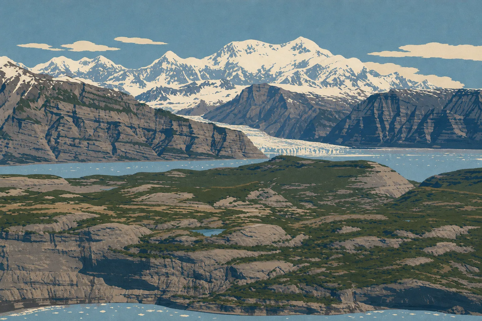
Wrangell–St. Elias is the largest national park in the United States, covering 20,500 square miles of mountains, glaciers, and tundra in southeastern Alaska, roughly the size of Switzerland. People come for the sheer scale, peaks rising above 15,700 feet, glaciers you can walk on, and a ghost town at the end of a dirt road. Plan on at least two days here, ideally three or four, because everything takes effort: distances are long, and the park's only two roads are gravel. This guide gives you the big picture, sector by sector, with detailed guides to each topic linked throughout.
Wrangell–St. Elias at a glance: where the park is and how to get there
The park occupies southeastern Alaska, between the Wrangell Mountains, the Saint Elias Mountains, and the Canadian border. The administrative headquarters and main visitor center are in Copper Center along the Richardson Highway (Highway 4), a paved state highway about 8 miles south of the junction with the Glenn Highway.
From Anchorage, it's about 185 miles and a four-hour drive along the Glenn Highway to Copper Center. This is where your visit really begins. From there, two gravel roads lead into the park, and they don't connect:
- McCarthy Road starts in Chitina and runs about 60 miles to the outskirts of McCarthy and Kennecott, the park's most visited area.
- Nabesna Road starts in Slana to the north and runs about 42 miles into a much wilder, more remote area.
You can't drive all the way into the heart of either McCarthy or Kennecott. Leave your vehicle in a parking area, then cross the Kennicott River on foot via a footbridge. For route details and current road conditions, see Getting to Wrangell–St. Elias. For local shuttles and getting around once you're there, see Getting Around the Park.
Entrance fees, passes, and reservations
Good news for your budget: admission to Wrangell–St. Elias is free. There are no entrance stations, entrance fees, or timed entry reservations like you'll find in parks along the West Coast. You drive in and start exploring.
What costs money are private services, including bush-plane sightseeing flights, shuttles to Kennecott, guided mine tours, and guided glacier trips with crampons. You don't need to buy a park pass here, but if your road trip includes several U.S. national parks, the America the Beautiful pass can still make sense for the rest of your trip. Our Fees and Passes guide explains entrance fees and annual passes. Collectors can get the official cancellation stamp at visitor centers. See our Passport and Stamps page.
Reservations, permits, and rules to follow
Regular visits: You don't need a reservation to enter the park or hike on maintained trails.
Developed campgrounds: The park's few campgrounds operate on a first-come, first-served basis, with no online reservation system. Dry Creek State Recreation Site, near Copper Center, accepts online reservations through the State of Alaska's system.
Backcountry: Camping in the backcountry is free and allowed across almost the entire park. No permit is required, but it's strongly recommended that you leave an itinerary with an NPS visitor center before setting out. Rangers can point you toward areas suited to your experience and tell you where bears have been active recently.
Rules to follow:
- In the backcountry, you must store food in approved bear canisters or food lockers. Black bears and grizzlies live throughout the park.
- Campfires are allowed outside fire-restriction periods, but only on mineral soil, never on vegetation.
- You may not collect plants, minerals, or historic artifacts. Kennecott is a protected historic property.
- Drones are allowed outside designated wilderness areas. Check the restriction map on nps.gov before takeoff.
- Pets are allowed on roads and in parking areas but prohibited on most trails.
Commercial operators, including guides, rafting companies, and sightseeing flight providers, must hold a Commercial Use Authorization issued by the NPS.
Getting around Wrangell–St. Elias
Forget the idea of a paved scenic loop. Here, you travel slowly over gravel or by air.
On McCarthy Road, allow two to three hours for the 60-mile drive and take it slow. The road follows an old railroad grade. Rail spikes still work their way to the surface in places and puncture tires every summer. Check your spare tire before you leave, drive according to conditions, and ask about your rental car's insurance because many companies specifically exclude these roads.
Nabesna Road is shorter but includes several river crossings that can become impassable for low-clearance vehicles after heavy rain. A high-clearance 4WD vehicle is strongly recommended beyond the first few miles.
For the parts of the park beyond the roads, the best way in is still by bush plane. Sightseeing flights and air taxi drop-offs leave from McCarthy, Chitina, and Nabesna. Our Getting Around page covers local shuttles, suitable rental vehicles, and local air services.
How long do you need to visit Wrangell–St. Elias?
Two full days is a realistic minimum, and that's only for the Kennecott–McCarthy area. The drive from Anchorage and McCarthy Road can easily take half a day each way.
Here's how to think about your time:
- Two days: Focus on Kennecott, the mining town, and the Root Glacier hike. That's already a memorable experience.
- Three to four days: Add a glacier sightseeing flight and a second hike, or spend an extra night to break up the long drives.
- Five days or more: Head toward the Nabesna area, which is wilder, or go camping in the backcountry with an air taxi drop-off.
To build a day-by-day plan that fits with the rest of your Alaska road trip, use our Itinerary and Trip Length page.
Plan your visit
What to see and do in Wrangell–St. Elias
The park has no single entrance or marked route. You explore it by area, and each one has its own character. Here's how they break down.
Road trip journal · 4 areas
Kennecott and McCarthy Area (McCarthy Road)
This is the iconic area at the end of McCarthy Road. Kennecott is a former copper-mining town that operated from 1911 to 1938 and is now a National Historic Landmark. Its 14-story red wooden buildings cling to the hillside. You can visit the mill and residential buildings, often on a guided tour. Root Glacier begins just next door. It's one of the few Alaska glaciers you can reach on foot from a trail and then explore with crampons. About 1.2 miles away, McCarthy is a tiny living village with a few bars and lodges, perfect for taking in the frontier atmosphere.
Nabesna Area (Nabesna Road)
To the north, Nabesna Road opens up a quieter side of Wrangell–St. Elias, with tundra, former mining claims, wild trailheads, and almost no one around. It's the choice for people who want Alaska without Kennecott's relative crowds. In return, you need to be comfortable with river crossings and complete self-sufficiency. There are no stores and no cell service.
Copper Center and Richardson Highway Area
This is your gateway. The Copper Center visitor center offers panoramic views of four volcanoes in the Wrangell Mountains, exhibits, an introductory film, and rangers who keep visitors up to date on road conditions. It's where you sort out logistics before heading farther in.
Glaciers, peaks, and sightseeing flights
The park's true character, a frozen landscape on an immense scale, reveals itself from the air. Bagley Icefield is the largest subpolar ice field in North America. Mount Saint Elias rises to about 18,009 feet, making it the second-highest peak in the United States. Nine of the country's sixteen highest peaks stand within this one park. A one-hour flight from McCarthy gives you a spectacular view.
That's only a preview. Our Things to Do page has the full list of activities, organized by season.
Explore the park
The best hikes in Wrangell–St. Elias
Hiking is the best way to get close to the park. Three classics come up again and again: the accessible, spectacular Root Glacier trail, which leads to the glacier's edge and onto the ice; the demanding Bonanza Mine Trail, which climbs from Kennecott toward old mining facilities and wide-open views; and easier walks around McCarthy for tired legs. Along Nabesna Road, several trailheads lead straight into the tundra with little route marking, so they're best left to experienced hikers who can travel independently.
Our Hiking page covers distances, elevation gain, difficulty, and gear. One safety point applies everywhere: never venture onto a glacier alone without crampons and an experienced guide. Crevasses can hide beneath fresh snow.
The detailed guide The Best Hikes in Wrangell–St. Elias for Every Experience Level The best hikes by area, from Root Glacier and Bonanza Mine to bear safety and… Read the guide →Wildlife and plants to look for
Wrangell–St. Elias is home to true far-north wildlife: brown bears (grizzlies) and black bears, moose, caribou, Dall sheep clinging to rocky slopes, wolves, and bald eagles. The golden rule applies everywhere. Keep your distance, at least 300 feet from bears, never feed wildlife, and protect your food from odors when camping. In summer, the tundra bursts into bloom with pink fireweed, while late August brings fall color to the landscape. Our Wildlife page explains where and when to maximize your chances of seeing animals.
The detailed guide Wrangell–St. Elias Wildlife: What to See and Where Dall sheep, grizzlies, caribou, wolves, and moose Read the guide →When to visit Wrangell–St. Elias
The window is short. The high season runs from mid-June through late August, when days are very long, roads are open, visitor centers are operating, and service providers are running. Keep in mind that the facilities at Copper Center and Kennecott close from about mid-September through April, and services become almost nonexistent outside summer. June and early July bring the most daylight. Late August brings fall color, along with already chilly nights and a greater chance of rain.
This is just a summary. Our When to Go page has month-by-month details, including temperatures and crowds, while our Weather page covers conditions by area.
The detailed guide When to Visit Wrangell–St. Elias: Best Seasons, Weather, and Timing Visit Wrangell–St Read the guide →Where to stay in Wrangell–St. Elias
Options are limited, and they fill up early. There are three main choices:
- Lodges in McCarthy and Kennecott, comfortable and well placed for exploring without driving the road again every day.
- Campgrounds and roadside camping areas for travelers on a budget and people who want to be self-sufficient.
- A gateway stay in Copper Center or Glennallen, useful the night before heading in or on the way back.
Our Lodging Guide (Where to Stay) compares all of these in detail, with dedicated pages for Hotels and Lodges, Camping, and RVs, depending on how you travel.
Stay in the park
Things to do around Wrangell–St. Elias
The park fits into a larger Alaska itinerary. To the northwest, the Glenn Highway runs toward Anchorage along the Matanuska Glacier, which is accessible and photogenic. To the south, the road to Valdez descends toward Prince William Sound and its fjords. Many travelers continue north to Denali. Dining options are still rustic and concentrated in McCarthy, Kennecott, and Glennallen, so see our Where to Eat page. To connect the park with the rest of your trip, our Region and Road Trip guides can help you map out your route.
Our take: Is Wrangell–St. Elias worth the trip?
Yes, as long as you're willing to follow its pace. This isn't a park you can check off in three hours from a parking lot. It takes driving, gravel roads, some logistics, and a willingness to get out of the vehicle. In return, it offers something few places in the world still can: walking on a living glacier, sleeping beneath a mining town frozen in time, and flying over an ocean of ice without seeing another person. On our visit, what stayed with us was the silence of Root Glacier early in the morning, the deep rumble of the ice with no other human sound. If you're looking for raw, wide-open Alaska, this detour is well worth it.
Frequently asked questions
Is Wrangell–St. Elias worth the trip?
Wrangell–St. Elias is worth the trip if you're willing to follow its pace and cover its distances. It's the largest national park in the United States, with glaciers you can walk on and a preserved mining town. Plan on at least two or three days here to really enjoy it.
How long does it take to visit Wrangell–St. Elias?
Allow at least two full days for the Kennecott–McCarthy area alone, not including the drive from Anchorage. Three to four days gives you time to add a sightseeing flight and a second hike. See our Itinerary and Trip Length page for a detailed plan.
How much does it cost to enter Wrangell–St. Elias?
Admission to Wrangell–St. Elias is free, with no entrance station or reservation required. You pay only for private services such as sightseeing flights, shuttles, and guided tours. Our Fees and Passes page has the complete rundown.
Can you visit Wrangell–St. Elias by car?
You can visit Wrangell–St. Elias by car, but only via two gravel roads, McCarthy Road and Nabesna Road. No paved road reaches the heart of the park, and you cover the final miles to Kennecott on foot or by shuttle. Our Access and Transportation page explains road conditions and the gear we recommend.
What is the best time to visit Wrangell–St. Elias?
The best time to visit Wrangell–St. Elias is from mid-June through late August, when the roads and services are open. Facilities close from mid-September through April. Our When to Go page has the month-by-month details.
The American Parks shop
Bring Wrangell - St Elias home
Our park-inspired creations, made to order and shipped to your door.
Latest park news
- Wrangell-St. Elias: A New Way to Reach Root GlacierThe old access to Root Glacier is closed because of unstable ground. A new alternate route now runs past Amazon Creek.