
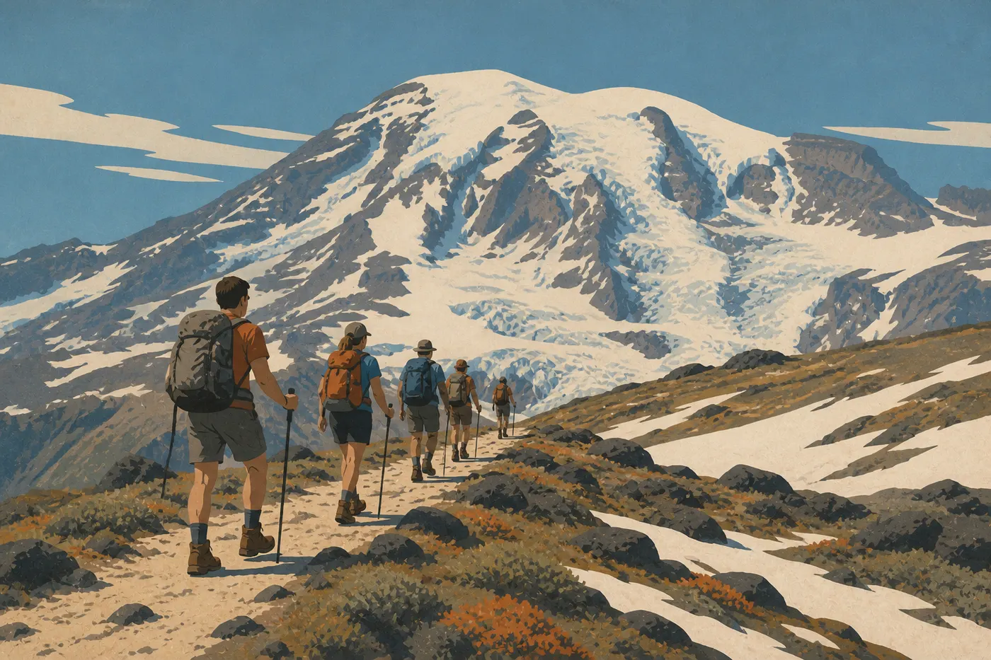
Hiking at Mount Rainier: The Best Trails for Every Skill Level
Mount Rainier is a 14,410-foot stratovolcano crowned with active glaciers, rising in the heart of a 367-square-mile park in Washington State. More than 150 miles of trails cross the mountain, from 90-minute loops through temperate rainforest to multi-day alpine traverses. Each area has a completely different feel, so choosing the right trail can make or break your experience.
Our go-to trail is the Skyline Trail in Paradise (8.1-mile loop, 1,540 feet of elevation gain, 4 to 5 hours). It packs the best of the park into one manageable day, with direct views of Nisqually Glacier, lupine meadows in July, and sweeping views of the Cascades. If you want less exertion, the Naches Peak Loop (4.3 miles, Chinook Pass) offers the same kind of scenery in a more family-friendly format. And if you only have time for one short trail, the Grove of the Patriarchs Trail in Ohanapecosh (1.5 miles round-trip, nearly flat) is the clear choice, with trees nearly 1,000 years old on a trail accessible to everyone.
How to Prepare for a Hike at Mount Rainier
Permits. Day hikes don't require an additional permit. The park charges an entrance fee: $30 per vehicle, $15 per person on foot or by bike, and $25 per motorcycle. The annual pass costs $55 and pays for itself after two visits. You must reserve a camping permit online through Recreation.gov for the Wonderland Trail, the multi-day route around the mountain.
Water. You'll find potable water at the visitor centers in Paradise, Sunrise, Ohanapecosh, and Longmire. Streams along the trail may look clear, but you still need to filter the water. Bring at least 2 liters per person on a hot day.
Wildlife. Black bears roam throughout the park. Keep snacks in an airtight bag or bear canister, and don't leave anything visible in your car. Elk frequent the meadows early and late in the day. Cascade marmots often settle along high-elevation trails. They're charming, but they're still wild animals. For a full list of species in the park, see our Wildlife page.
Dogs. Dogs aren't allowed on any park trails, with no exceptions. They're permitted only on paved roads, in parking areas, and at certain designated campgrounds.
Safety. Above 5,000 feet, weather can change in 20 minutes. Fog, rain, or sudden snow can arrive even in August. Check conditions before you leave at the visitor center or on the NPS website. Hiking boots with ankle support are required on trails with significant elevation gain. Microspikes are recommended outside July and August on any trail above 5,900 feet. For current alerts, rely on the NPS website and the visitor center.
Season. Most high-elevation trails remain snow-covered until mid-July. Sunrise Road opens only in summer, generally from mid-July through October. July and August offer the best window. September works for experienced hikers who are comfortable with more changeable weather.
The Best Hikes, Area by Area
Paradise: The Volcanic Heart of the Park
Paradise (5,400 feet) is the park's most visited area. Its alpine meadows are thick with wildflowers, the volcano rises unobstructed to the north, and the glaciers seem close enough to touch. Two trails stand out.
Skyline Trail, 8.1-mile loop · 1,540 feet of elevation gain · 4 to 5 hours · moderate to strenuous · trailhead: Henry M. Jackson Visitor Center
The trail climbs through phlox and lupine meadows to Panorama Point (6,500 feet), with a straight-on view of Nisqually Glacier. The loop descends through the moraines, passing lingering snowfields even in summer. Plan to arrive before 9 a.m. The parking lot fills by 10 a.m. in July and August.
Alta Vista Trail, 1.5-mile loop · 390 feet of elevation gain · 1 hour · easy · trailhead: same parking lot
A short loop along a grassy ridge with direct views of the volcano. It's ideal for families, as a warm-up, or as an end-of-day add-on after the Skyline Trail.
Sunrise: Panoramas from the North Side
Sunrise reaches 6,400 feet, the highest point in the park accessible by car. The plateau is drier and almost lunar, with open views of the summit and Emmons Glacier.
Burroughs Mountain, 7.5-mile loop · 1,410 feet of elevation gain · 4 to 5 hours · moderate · trailhead: Sunrise parking lot
The trail crosses alpine tundra to Second Burroughs Mountain (7,936 feet). The views of the glaciers on the north side are among the most complete in the park. The trail often stays snow-covered before August, so microspikes are strongly recommended.
Sourdough Ridge Trail, 3.1 miles round-trip · 525 feet of elevation gain · 1.5 hours · easy · trailhead: Sunrise parking lot
For a warm-up or a late sunset, this ridge offers 360-degree views of the Cascades with a very manageable climb. It gets less crowded than Burroughs Mountain.
Ohanapecosh: The Forest of Giants
Ohanapecosh, in the southeast, protects a temperate rainforest where Douglas firs and Sitka spruce reach extraordinary sizes. You won't see the volcano here. The appeal is entirely botanical and atmospheric.
Grove of the Patriarchs Trail, 1.5 miles round-trip · nearly flat · 1 hour · very easy · trailhead: parking lot on SR-123
Trees stand 165 feet tall and can be up to 1,000 years old. A suspension bridge crosses the Ohanapecosh River to the central island, where the largest specimens are concentrated. Strollers can cover most of the trail.
Silver Falls Loop, 3.1-mile loop · 390 feet of elevation gain · 1.5 hours · easy · trailhead: Ohanapecosh Campground
The loop follows the Ohanapecosh River to a 65-foot waterfall framed by moss and ferns. It's a cool trail, ideal on days when the rest of the park gets hot.
Carbon River: The Inland Rainforest
Carbon River, in the northwest corner of the park, protects the only temperate rainforest in the interior of Washington State. Constant moisture, moss draped over every trunk, and dense vegetation create a world of their own.
Carbon Glacier Trail, 4.3 miles round-trip · 295 feet of elevation gain · 2 hours · easy · trailhead: Carbon River Entrance
The trail follows a gray river full of glacial sediment to the terminus of Carbon Glacier, the lowest-elevation glacier in the contiguous United States, at about 1,970 feet. The road may close during high water, so check conditions before you leave.
Twin Firs Loop, 1-mile loop · flat · 30 minutes · very easy · trailhead: Carbon River Road
The park's shortest loop passes beneath century-old Douglas firs. It's perfect for young children or for soaking up the rainforest atmosphere without much effort.
Easy, Family-Friendly Hikes
Mount Rainier isn't all serious high-mountain hiking. These four trails work for kids as young as 5 or 6 and don't require specialized gear:
- Twin Firs Loop (Carbon River): 1 mile, flat, 30 minutes.
- Trail of the Shadows (Longmire): 1-mile loop, very flat, with mineral springs and old 19th-century pioneer cabins.
- Alta Vista Trail (Paradise): 1.5 miles, 390 feet of elevation gain, with guaranteed volcano views.
- Grove of the Patriarchs Trail (Ohanapecosh): 1.5 miles, nearly flat. Even reluctant teenagers are impressed by the giant trees.
To plan a family stay around these trails, our Family guide lays out a two-day itinerary with the must-see stops for each age group.
Challenging Day Hikes
For hikers comfortable with 1,300 to 2,000 feet of elevation gain and a 5- to 7-hour outing, two options stand out.
Spray Park (from Mowich Lake), 8.1 miles round-trip · 1,970 feet of elevation gain · 5 to 6 hours · difficult · trailhead: Mowich Lake
In July and August, Spray Park's meadows rank among the park's most spectacular sights, with a carpet of blue lupines in front of Rainier's north face. The Mowich Lake area is much less crowded than Paradise. The access road is partly unpaved, and the area opens only in summer.
Burroughs Mountain (from Sunrise) is the other option. You can drive on a paved road all the way to the parking lot, and the summit offers a different, more head-on view (see the trail description above).
The Wonderland Trail (93 miles, 7 to 10 days) is the park's signature adventure, reserved for experienced hikers with a camping permit. You can also hike its sections as day hikes from Paradise or Mowich Lake.
Access, Trailheads, and Parking
Nisqually Entrance (southwest, open year-round): access to Paradise and Longmire via SR-706. This is the default entrance from Seattle, Tacoma, or Portland. For GPS, use 39,000 State Route 706, Ashford.
Stevens Canyon Road (east, open in summer): connects Ohanapecosh and Paradise. It lets you combine the Grove of the Patriarchs Trail and the Skyline Trail in one full day.
Sunrise Road (northeast, summer only): from SR-410, access to the Sunrise area. Allow about 2 hours from Seattle.
Carbon River Road (northwest): access may be interrupted by seasonal flooding. Check conditions on the NPS website before you leave.
Paradise and Sunrise parking lots fill between 10 a.m. and 4 p.m. in July and August. Arrive before 8 a.m. or after 4 p.m. to find a spot. A seasonal bus service runs from Ashford to Paradise in summer. See our Getting Around page for current schedules and fares.
When to Hike at Mount Rainier
The best window is July and August. Roads are open, trails are clear, meadows are in bloom, and the weather risk is at its lowest, though it's never zero. Late June and September work for experienced hikers who are comfortable with lingering snow. Outside those months, only lower-elevation trails around Longmire, Carbon River, and lower Ohanapecosh remain reliably accessible year-round.
For month-by-month conditions and climate forecasts, see our When to Go guide and our Weather page.
Which Hike Is Right for You?
| Your profile | Our recommendation |
|---|---|
| First visit, full day | Skyline Trail (Paradise) |
| Family with kids ages 5 to 10 | Grove of the Patriarchs Trail or Twin Firs Loop |
| Quick volcano views (2 hours) | Alta Vista or Sourdough Ridge |
| Fewer crowds, alpine meadows | Spray Park (Mowich Lake) |
| Rainforest and unusual scenery | Carbon Glacier Trail |
| Day-hike challenge, glacier views | Burroughs Mountain |
| Old trees and a waterfall combined | Grove of the Patriarchs Trail + Silver Falls Loop |
To combine these hikes with lodging and logistics over 2 to 4 days, our Mount Rainier Itinerary guide offers programs for 2 to 4 days.
Frequently Asked Questions
What's the best hike at Mount Rainier?
Our team's top choice is the Skyline Trail in Paradise: an 8.1-mile loop with 1,540 feet of elevation gain, direct glacier views, and wildflower meadows in July. For a shorter hike with less climbing, the Naches Peak Loop (4.3 miles, Chinook Pass) offers an excellent effort-to-scenery payoff.
Is hiking at Mount Rainier difficult?
Difficulty ranges from completely flat, as on Twin Firs Loop (1 mile), to demanding mountain trails, such as Burroughs Mountain (1,410 feet of elevation gain). Trails from Paradise and Sunrise always involve a noticeable climb because of their starting elevation, but they remain accessible without specific training if you keep the distance reasonable.
Is it safe to hike at Mount Rainier?
Yes, as long as you respect the weather, which can change in 20 minutes, bring a windbreaker, water, and suitable footwear, and stay on marked trails. Black bears live in the park, but incidents are rare. Outside July and August, some high-elevation trails require microspikes.
Do you need a permit to take a day hike at Mount Rainier?
No. Day hikes don't require a specific permit. The park does charge an entrance fee of $30 per vehicle. A camping permit is required for overnight trips on the Wonderland Trail or in backcountry camping areas.
Are there easy, family-friendly hikes at Mount Rainier?
Yes. Twin Firs Loop (1 mile, Carbon River), Trail of the Shadows (1 mile, Longmire), and the Grove of the Patriarchs Trail (1.5 miles, Ohanapecosh) work for kids as young as 5 or 6. Alta Vista in Paradise is suitable for kids around age 8 and up.
Can you hike with a dog at Mount Rainier?
No. Dogs are strictly prohibited on all trails in Mount Rainier National Park, with no exceptions. They're allowed only on paved roads, in parking areas, and at certain designated campgrounds.
What's the best time of year to hike at Mount Rainier?
The best time to hike at Mount Rainier is July and August, when roads and trails are open, meadows are in bloom, and weather is the most stable of the year. See our When to Go guide for month-by-month details and conditions by area.
Are there loop hikes at Mount Rainier?
Yes. Classic loops include Skyline Trail (8.1 miles, Paradise), Burroughs Mountain (7.5 miles, Sunrise), Naches Peak Loop (4.3 miles, Chinook Pass), Silver Falls Loop (3.1 miles, Ohanapecosh), and Twin Firs Loop (1 mile, Carbon River). The Wonderland Trail is the park's 93-mile loop around the mountain.
How do you reach the trailheads at Mount Rainier?
The main trailheads are at the visitor center parking lots in Paradise, via SR-706 and Nisqually Entrance; Sunrise, via SR-410; Ohanapecosh, via SR-123; and Carbon River Road. In July and August, arrive before 8 a.m. to guarantee a parking spot. Our Getting Around page has details on shuttle and transportation options.
Which trails offer waterfalls, wildlife, or great views?
Waterfalls: Silver Falls Loop in Ohanapecosh. Wildlife, including bears, elk, and marmots: the meadows of Paradise and the Sunrise plateau in the early morning. Volcano views: Skyline Trail at Panorama Point, Burroughs Mountain, and Sourdough Ridge.