
Kobuk Valley Map: Layout, Areas, and the Official Map to Download
Kobuk Valley National Park lies in northwestern Alaska, beyond the Arctic Circle. The park covers about 2,741 square miles of glacial valley, Arctic sand dunes, and untouched tundra, with no roads leading in. The official NPS map is available free at nps.gov/kova/planyourvisit/maps.htm. Download it before you leave. It will be your primary navigation tool for this extraordinary expedition.
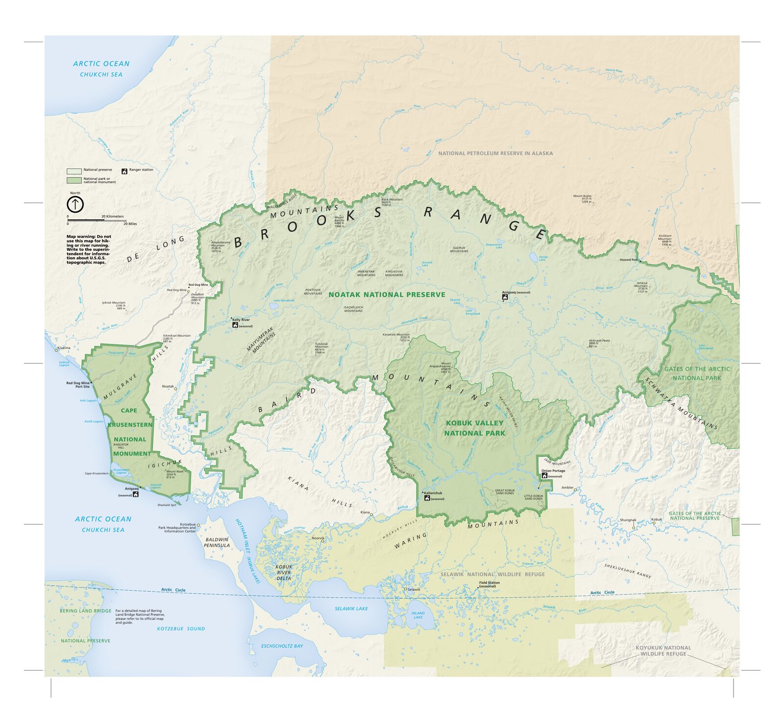
The official park map handed out at entrance stations, with roads, areas, visitor centers and services. View it here or download it for offline use.
Download the map (PDF) Public domain · National Park ServiceWhere Is Kobuk Valley?
Kobuk Valley lies in Alaska's Northwest Arctic region, framed by the Baird Mountains to the north and the Waring Mountains to the south. The Kobuk River flows east to west across the entire length of the park, well above the 66th parallel. On a map of the United States, Alaska usually appears in an inset at the lower left of the continental map. Kobuk Valley sits in the state's northwestern interior, about 37 miles east of Kotzebue.
To place Alaska on a world map, it's a U.S. state separated from the contiguous United States by Canada, bordering Russian Siberia to the west and the Arctic Ocean to the north. Kobuk Valley is one of the northernmost and most isolated American national parks. Our complete Kobuk Valley guide provides geographic context and the park's history for readers who want to go deeper.
Download the Official Kobuk Valley Map (NPS Unigrid)
The National Park Service publishes a Unigrid map for Kobuk Valley. This free PDF covers the entire park, with the river's route, dune areas, terrain, and information about Inupiaq subsistence rights.
Before you put it in your pack, laminate it or store it in a waterproof sleeve. Rain, snow, and humidity can hit any month of the year in the Alaskan Arctic, and an ordinary map can disintegrate within hours in the field. The Northwest Arctic Heritage Center, the park's visitor center in Kotzebue, also hands out free paper copies before the connecting flight to the park.
Areas of Kobuk Valley
Kobuk Valley doesn't have marked administrative areas like those found in other large national parks. You can still identify four distinct natural areas on the map.
The Central Valley and Kobuk River
The river corridor forms the park's backbone. The Kobuk River stretches east to west across the length of the park. Its sandy banks serve as landing areas for small planes and campsites for canoe expeditions. Anglers fish for salmon there under Alaska's subsistence regulations.
The Great Kobuk Sand Dunes
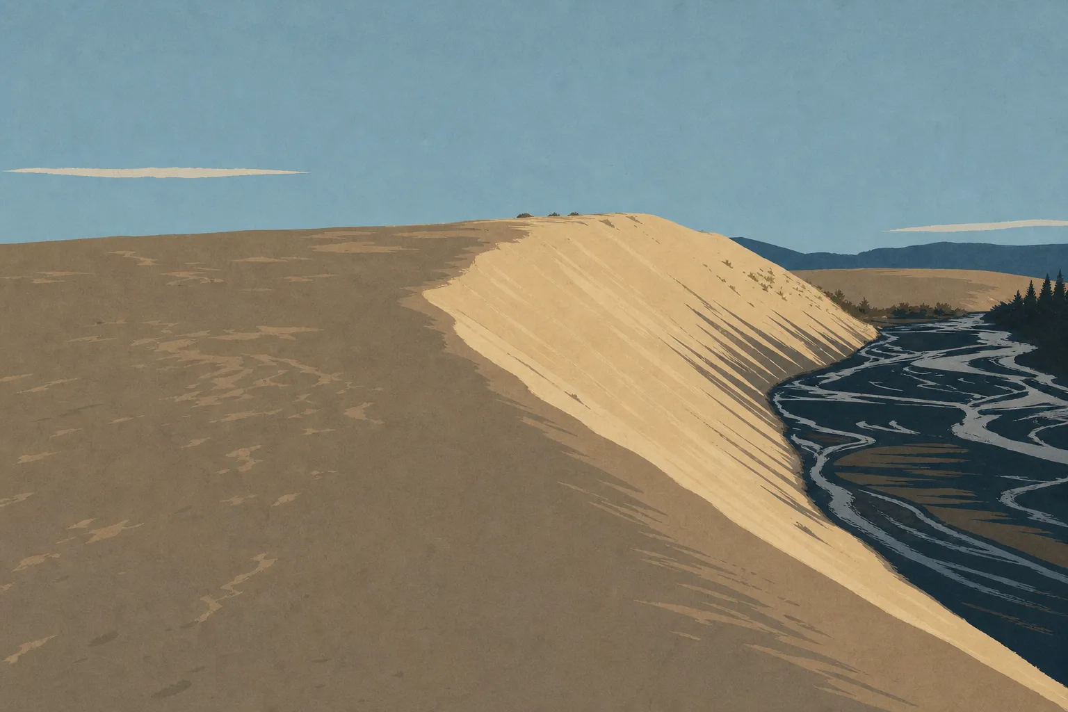
In the park's south-central section, the Great Kobuk Sand Dunes are its most photographed attraction: about 25 square miles of active sand, with ridges reaching roughly 200 feet high in places, surrounded by Arctic tundra. This dune field is a legacy of Quaternary glacial winds. In summer, the sand's surface can exceed 122°F. You can reach it on foot from the riverbanks. For an overview of the dunes and activities in the Arctic sand, see the Kobuk Valley things to do guide, which lays out the options area by area.
The Little Kobuk Sand Dunes and Hunt River
West of the Great Kobuk Sand Dunes, the Little Kobuk Sand Dunes offer a more compact version of the same landscape. The Hunt River area also serves as a migration corridor for caribou herds in spring and fall. The Kobuk Valley wildlife guide covers the species to watch for in this area.
The Baird and Waring Mountains
The Baird Mountains close off the valley to the north, with peaks rising above 4,900 feet. The Waring Mountains form the southern boundary. You can explore these slopes only off-trail and with full expedition gear. There are no marked routes here. The Kobuk Valley hiking guide explains the conditions for heading into these mountain ranges at elevation.
Getting to the Park: No Roads, Only Air and River Travel
No road reaches Kobuk Valley, making it one of the few American national parks that are completely inaccessible by car. Driving across the park simply isn't an option.
There are two ways in: an air taxi from Kotzebue or Bettles, or the Kobuk River by nonmotorized boat. Inside the park, you travel on foot across the tundra or by paddle. Distances between areas are significant, so allow several days to reach the Great Kobuk Sand Dunes from a standard landing site. The guide to getting to Kobuk Valley covers air taxi operators, prices, and drop-off logistics.
Points of Interest to Find on the Map
Here are three landmarks to locate first.
The Great Kobuk Sand Dunes sit in the park's south-central section. They stand out clearly in any satellite or aerial view, their ocher color contrasting with the surrounding green or snow-covered vegetation.
The Hunt River area is a central logistics point for multiday expeditions. Air taxis often use it as a drop-off or pickup area.
The Kobuk River upstream is accessible from Bettles and allows long-distance trips downstream, with pickup in the central valley. Our Things to Do page covers activities specific to each area.
For species to watch for in each zone, see our Wildlife page. Caribou, grizzlies, and beavers range throughout the park.
Nearest Towns and Airports
Kotzebue is the main gateway. The town has regular commercial flights from Anchorage. Ralph Wien Memorial Airport (OTZ) serves Kotzebue from Anchorage in a little over an hour. From Kotzebue, an air taxi can drop visitors in the park in under an hour.
Bettles is the eastern alternative, reached by regional flight from Fairbanks (BTT airport). It provides access to the park's eastern section and works well for expeditions traveling downstream.
Anchorage (Ted Stevens Anchorage International Airport, ANC) remains the main hub for entering Alaska. Fairbanks is the preferred option for reaching Bettles. Either way, plan to spend time in one of these towns before the final flight. Our Access & Transportation page covers connections, schedules, and travel times in detail.
Hiking Maps and Topographic Guides
The NPS Unigrid map remains an overview. To navigate away from the river, especially across the tundra or toward the mountain ranges, you'll need a USGS 1:63,360 topographic map. Several sheets in the USGS Alaska series cover the park, including the “Baird Mountains” and “Shungnak” series. The USGS sells them as PDFs or paper maps.
Offline apps such as Gaia GPS and Avenza Maps let you download these sheets before you leave. In the Arctic, always keep the paper map as a backup. Lithium-ion batteries don't last long at -4°F, and a GPS without a backup map is an unnecessary source of stress.
Frequently Asked Questions
How do you visit Kobuk Valley?
You visit Kobuk Valley by chartering an air taxi from Kotzebue or Bettles, then traveling on foot across the tundra or by canoe on the Kobuk River. No road leads there. Most visitors plan a self-guided expedition lasting several days, while some specialized outfitters offer guided trips combining air travel and a river descent.
How much does a visit to Kobuk Valley National Park cost?
Admission to Kobuk Valley is free. The park charges no entrance fee. Most of the budget goes toward air travel: commercial flights to Kotzebue or Bettles, followed by an air taxi to the park. The park's specific regulations and permit requirements are summarized in the park overview.
Where is Alaska on a world map?
Alaska is a U.S. state in the northwestern part of North America, separated from the contiguous United States by Canada. It borders the Bering Sea to the west and the Arctic Ocean to the north. Kobuk Valley lies in the state's Arctic region, above the 66th parallel.
Can you drive across Kobuk Valley?
No. Kobuk Valley National Park has no roads. You can't cross it by car. You can reach the park only by small plane or by boat on the Kobuk River.
What is the nearest town to Kobuk Valley?
Kotzebue is the nearest town, about 37 miles west of the park by direct flight. Most air taxis bound for the park depart from Kotzebue.
How long does it take to visit Kobuk Valley?
A meaningful visit requires at least three to five days on site. The distances, air logistics, and unpredictable Arctic weather, which can ground an air taxi for several days, call for plenty of flexibility in your planning. Itinerary ideas for different experience levels are detailed in the itinerary guide.