
Great Basin Hiking: The Best Trails for Every Ability
Great Basin is a low-key park. No packed shuttles, no lines at the trailhead, and no crowds along the ridgelines. Nevada's Snake Range draws only those who know where to look: about 130,000 visitors a year, compared with millions at Arches or Zion. The trails climb as high as 13,100 feet, bristlecone pines can be 4,000 years old, and silence is the rule. That's exactly why we keep coming back.
The must-do hike: Wheeler Peak Summit Trail (about 8.6 miles round-trip and 2,900 feet of elevation gain) leads to Nevada's second-highest peak, with 360-degree views across the Great Basin. If you're looking for a more manageable effort, Bristlecone Pine Trail (about 2.8 miles round-trip) and Alpine Lakes Loop (about 2.8 miles round-trip) are two excellent alternatives for intermediate hikers.
How to Prepare for a Hike in Great Basin
Permits and entry. The park is free, and you don't need a reservation. No permit is required for day hikes, regardless of distance.
Dogs. Dogs are allowed on all trails but must be kept on a leash no longer than 6 feet. They're not allowed in Lehman Caves.
Water. Water sources are scarce at elevation. Bring at least 2 liters per person for a half day, and more in hot weather. Filter or treat stream water before drinking it.
Wildlife. Rattlesnakes, especially below 8,200 feet, cougars, mule deer, and marmots live in the park. Keep your distance from all wildlife, and don't feed any of it.
Elevation and acclimatization. The trailheads around Wheeler Peak sit at about 9,800 feet. If you're coming from sea level, give yourself 24 hours before tackling strenuous hikes. Persistent headaches, nausea, and unusual fatigue are the first signs of acute mountain sickness. Descend right away.
Thunderstorms. In July and August, storms roll in during the afternoon without warning. Start before 7 a.m. for major climbs and be off the ridges before 1 p.m. At elevation, lightning strikes the high points first.
Temperatures. The park spans nearly 7,900 feet of elevation between the valley and Wheeler Peak. This is a mountain desert, with low humidity and temperatures that drop sharply after sunset. Even in August, you'll need an insulating layer at higher elevations.
The Best Hikes, Area by Area
Great Basin's trails fall into three distinct areas: Wheeler Peak, home to nearly all of the marked hikes; Baker Creek Valley, quieter and wilder; and Lexington Arch at the park's southern end.
Wheeler Peak Area: High-Elevation Trails
Wheeler Peak Summit Trail Round-trip | ~8.6 miles | ~2,900 feet of elevation gain | 5 to 7 hours | Difficult
This is the park's signature hike. It starts at Wheeler Peak Campground (9,800 feet) and ends at the summit of Wheeler Peak (13,100 feet), Nevada's second-highest point. The trail first crosses a conifer forest, then climbs through switchbacks and talus before tackling a rocky ridge for the final 1.2 miles. From the summit, the view stretches across dozens of mountain ranges layered to the horizon. On a clear day, you can see Utah's mountains to the east. Start and finish at the Wheeler Peak Campground parking area. No shuttle.
Tip: The first 1.2 miles are the steepest. Set your pace from the start and drink before you're thirsty, especially if you haven't acclimatized yet.
Bristlecone Pine Trail (+ Glacier Extension) Round-trip | ~2.8 miles (trail only) or ~4.7 miles (with the extension) | 600 to 900 feet of elevation gain | 1.5 to 3 hours | Easy to moderate
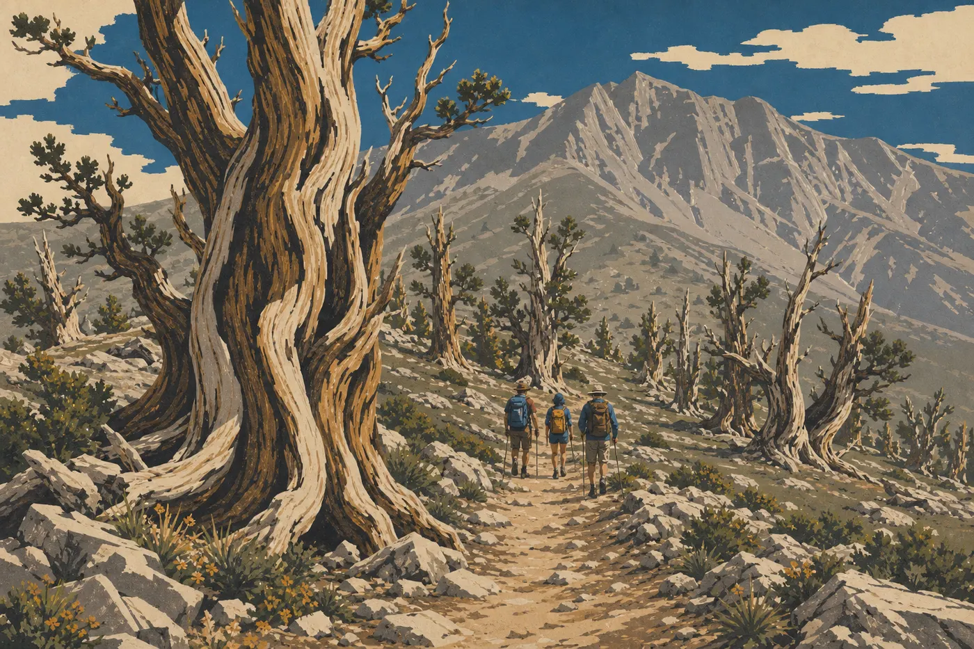
Bristlecone Pine Trail leads to a forest of long-needled bristlecone pines (Pinus longaeva), some more than 4,000 years old. These trees don't look impressive at first glance. Twisted and bleached by wind and frost, they look like sculpted wreckage. That's exactly why we linger in front of them.
From the same trailhead, Glacier Trail extends the hike to a rock glacier, a mass of blocks carried and frozen in place by ice. It's one of the few landforms of its kind in the contiguous 48 states. Start at Bristlecone-Glacier Trailhead on Wheeler Peak Scenic Drive. Parking is limited to about 20 spaces.
Alpine Lakes Loop Loop | ~2.8 miles | ~400 feet of elevation gain | 1.5 hours | Easy
This loop connects the park's two alpine lakes, Stella Lake and Teresa Lake, at about 9,800 feet. The water takes on a striking blue-green color in a glacial cirque. The elevation gain is minimal, and the trail is well established. It's the hike to recommend to families and anyone who wants a beautiful destination without pushing too hard. Start at the Stella Lake parking area on Wheeler Peak Scenic Drive.
Baker Creek Area: Glacial Valley
Baker Creek Loop Loop | ~7.5 miles | ~1,100 feet of elevation gain | 3.5 to 4.5 hours | Moderate
The loop follows Baker Creek Valley, runs alongside the stream through a forest of pines and spruces, then climbs through switchbacks toward Baker Lake and Johnson Lake, two tucked-away glacial lakes. This is the least visited area of the park and one of the prettiest in early fall, when the trees' warm colors contrast with the gray-white ridges. The loop's high point is just above 9,800 feet.
Start at the end of Baker Creek Road, reached by 3.7 miles of unpaved road from Nevada State Route 488. An ordinary car can make it in dry weather.
Tip: In June, the creek may run high after the snowmelt. Check conditions on the park's website before setting out.
Lexington Arch: An Arch at the End of the World
Lexington Arch Trail Round-trip | ~6.8 miles | ~1,100 feet of elevation gain | 3 to 4 hours | Moderate
Lexington Arch is a geological curiosity: a large natural limestone arch, more than 60 feet high. It's not sandstone like the arches on the Colorado Plateau. The arch sits at the park's southern end, in a wooded canyon that sees few visitors. The hike follows a stream, crosses a dense forest, and climbs steadily to the arch. Even in the middle of August, you'll find few people here.
Start at Lexington Arch Trailhead, reached from Utah State Route 21 via Snake Valley Road. The approach includes about 10 miles of unpaved road on the park's east side.
Access alert: The road becomes impassable after rain. A high-clearance vehicle is recommended, and four-wheel drive is preferable.
Easy and Family-Friendly Hikes
Three trails are made for outings without much physical strain.
Alpine Lakes Loop (about 2.8 miles round-trip) is the most complete option: short, nearly flat, and rewarded with two beautiful alpine lakes. Kids ages 6 or 7 can hike it without difficulty.
Bristlecone Pine Trail (about 2.8 miles round-trip) is a solid choice for families who want a memorable destination without serious elevation gain. The grade is steady, and the surface is firm. Seeing a 4,000-year-old tree makes an impression on kids and adults alike.
Stella Lake Loop (less than 1.2 miles and nearly flat) works for very young children or a 30-minute evening outing after you set up camp.
One thing to keep in mind: even these “easy” trails start at about 9,800 feet. Drink regularly and watch for unusual fatigue, especially in young children and anyone arriving from sea level.
Strenuous Hikes and Big Views
Wheeler Peak Summit Trail is Great Basin's strenuous hike, hands down. It climbs 2,900 feet from a trailhead already at 9,800 feet, crosses talus on the ridge, and takes 5 to 7 hours depending on your pace. You can't wing it. The view from 13,100 feet, however, is unmatched in the park.
For a full day with less elevation to contend with, Baker Creek Loop (7.5 miles and 1,100 feet of elevation gain) offers a beautiful progression through varied terrain, with two lakes as a reward and a pleasant forest to walk through.
Lexington Arch Trail (6.8 miles and 1,100 feet of elevation gain) suits regular hikers who want an unusual destination in a quiet area. The unpaved approach is the only real logistical obstacle.
Access, Trailheads, and Parking
Wheeler Peak area. Wheeler Peak Scenic Drive is a paved 13-mile road that starts at Lehman Caves Visitor Center and climbs to 9,800 feet. The three main trailheads, Wheeler Peak Campground, Bristlecone-Glacier, and Stella Lake, are accessible by standard car. The road closes from October through late May, depending on snowfall.
Baker Creek area. Baker Creek Road, a 3.7-mile unpaved road, branches off Nevada State Route 488 before the park entrance near Baker. It's passable in dry weather in an ordinary car and strongly discouraged after rain.
Lexington Arch. From Utah State Route 21 on the east side, take Snake Valley Road, including 10 miles of unpaved road. Allow 2 to 2.5 hours from Lehman Caves. A high-clearance vehicle is recommended.
Shuttle. The park doesn't have a shuttle. Every trail requires you to return to the same trailhead or arrange a private ride with your group.
To reach Great Basin from Las Vegas or Salt Lake City, see the park access guide for driving options and travel times.
When to Hike in Great Basin
The high-elevation trails generally open in June, once the snow melts, and remain accessible through mid-October. September is often the best window: cool temperatures, almost no thunderstorms, and no crowds.
For a month-by-month breakdown of valley and high-elevation temperatures, freeze periods, and average snowfall, Great Basin weather provides the key details. When to visit Great Basin offers a complete overview of the visiting calendar.
Which Hike Is Right for You?
| Hiker profile | Recommended trail |
|---|---|
| Family with children | Alpine Lakes Loop, Bristlecone Pine Trail |
| Easy outing | Stella Lake Loop, Bristlecone Pine Trail |
| Summit views | Wheeler Peak Summit Trail |
| Geology and photography | Lexington Arch Trail, Glacier Trail |
| Full day, intermediate level | Baker Creek Loop |
| Major climb | Wheeler Peak Summit Trail |
The Great Basin guide provides an overview of all the park's activities, including hiking.
Frequently Asked Questions
What's the best hike in Great Basin?
The best hike in Great Basin depends on your ability. Wheeler Peak Summit Trail (8.6 miles round-trip and 2,900 feet of elevation gain) is the benchmark for experienced hikers. At an intermediate level, Bristlecone Pine Trail and Alpine Lakes Loop offer an excellent effort-to-reward ratio.
Is hiking in Great Basin difficult?
Difficulty varies by trail. Alpine Lakes Loop (2.8 miles) is accessible to almost everyone. Wheeler Peak Summit Trail is rated difficult, mainly because of the elevation: it starts at 9,800 feet and crosses talus during the final 1.2 miles.
Is it safe to hike in Great Basin?
Hiking in Great Basin is safe if you follow three practical rules: start early to avoid afternoon thunderstorms, bring warm layers even in summer, and watch for signs of acute mountain sickness at elevation. Rattlesnakes live below 8,200 feet. Stay on marked trails and watch where you step.
Do you need a permit to hike in Great Basin?
No permit is required for day hikes. Entry to the park is completely free.
Are there easy hikes in Great Basin?
Yes. Alpine Lakes Loop (2.8 miles), Bristlecone Pine Trail (2.8 miles round-trip), and Stella Lake Loop (less than 1.2 miles) work well for families and casual hikers.
Can you hike with your dog in Great Basin?
Yes. Dogs are allowed on the park's trails but must be kept on a leash no longer than 6 feet. They're not allowed in Lehman Caves.
What's the best time to hike in Great Basin?
The best time to hike in Great Basin runs from late June through mid-October, with September being the top choice: few people, comfortable temperatures, and a low risk of thunderstorms. See the When to Visit Great Basin guide for the complete calendar.
Are there loop hikes in Great Basin?
Yes. Alpine Lakes Loop (2.8 miles) and Baker Creek Loop (7.5 miles) are the park's two main loops.
How do you reach the trailheads?
The Wheeler Peak area is accessible via Wheeler Peak Scenic Drive, a paved 13-mile road. The Baker Creek area requires 3.7 miles of unpaved road. Lexington Arch requires 10 miles of unpaved road from Utah State Route 21. The Great Basin access guide details all the routes.
Which trails are best for wildlife or views?
For wildlife, including mule deer, marmots, and mountain birds, Baker Creek Loop is your best bet. For views, nothing in this park matches Wheeler Peak Summit Trail.