
Joshua Tree Itinerary: What to See in 1, 2, or 3 Days
Joshua Tree National Park isn't a park you experience through a car window. Two deserts meet here, granite boulders rise from the ground like abstract sculptures, and the joshua trees themselves look like something a child might have sketched on a Sunday morning. Ideal length: 2 to 3 days. In two days, you'll cover the essentials of the northwest section, the park's historic heart, and make a brief foray into the drier, less crowded east. A third day lets you either take on more hikes or explore the surrounding area. One day is doable from Palm Springs or Los Angeles. You just need to choose your stops ahead of time.
How Much Time Do You Need to Visit Joshua Tree?
One day is enough for an overview. The northwest section's highlights, including Skull Rock, Hidden Valley, and Keys View, follow one another along the drive, with a few short walks along the way. This is the option for a quick visit.
Two days is the minimum for a comfortable visit. The first covers the northern section from Twentynine Palms westward. The second gives you time for a serious hike and a drive through the east, including Cholla Cactus Garden and Cottonwood Springs.
Three days is our recommendation if you're climbers, astronomy enthusiasts, or traveling with family. The park has some of the darkest night skies in Southern California. Spending a night here completely changes the experience.
After three days, our Joshua Tree hiking guide covers the less crowded trails in the remote areas. For multi-park extensions, our Roadtrips guides offer well-planned routes. To choose the right season, our Joshua Tree seasonal guide compares conditions month by month. March and April, along with October and November, remain the most pleasant periods by far, with daytime temperatures around 84 °F.
Access, Entrances, and Getting Around the Park
The park is in Southern California, about two hours east of Los Angeles via I-10. There are three main entrances:
- West Entrance: from the town of Joshua Tree via CA-62, Exit 117 off I-10. This is the most-used access point for the northwest section.
- North Entrance: from Twentynine Palms, also via CA-62. It's ideal if you're staying in Twentynine Palms and want to start with the rock formations in the park's east.
- South Entrance, Cottonwood: Exit 168 off I-10, from Indio or the direction of Phoenix. It serves the Colorado section, which is hotter and less crowded.
Park Boulevard crosses the park from west to east, running from the West Entrance to Twentynine Palms. This 26-mile paved road is suitable for any vehicle and forms the backbone of any driving itinerary.
Getting around: there are no shuttles or public transportation. A car is essential. A few dirt roads, where 4WD is recommended, lead to the most isolated areas. The general speed limit in the park is 45 mph, dropping to 25 mph near campgrounds.
Fees: $30 per vehicle, valid for 7 days. Motorcyclists pay $25, while pedestrians and bicyclists pay $15. The America the Beautiful Pass, at $80, pays for itself as soon as you visit a second national park that year. You'll find all the details on our Fees & passes page.
For detailed logistics covering parking, accessibility, and marked routes, the Joshua Tree access guide has you covered.
Joshua Tree's Sections
Understanding the park's geography before opening the map will save you unnecessary backtracking. Joshua Tree is crossed by the natural boundary between two desert ecosystems, and you can see this contrast directly from the main road.
The Mojave Section (North and Northwest): Where Joshua Trees Grow
The northwest concentrates the vegetation that gives the park its name. At this elevation, between 3,000 and 5,900 feet, temperatures are milder, and joshua trees cover every hill alongside yuccas and cholla. Granite formations reach spectacular proportions here, which explains the concentration of climbing routes in this section.
The main anchor points are Skull Rock, an iconic rock formation accessible from the parking area on Pinto Basin Road; Hidden Valley, a natural bowl surrounded by boulders, with a 1-mile loop; Barker Dam, a historic artificial reservoir with petroglyphs on the walls halfway around; and Keys View, a viewpoint at 5,180 feet with views of the Coachella Valley on clear days. This is where you'll find most of the traffic between 9 a.m. and 4 p.m.
Our Joshua Tree activities guide covers each site, including visit times and difficulty levels.
The Colorado Section (East and Southeast): The Other Desert
As you head east along Park Boulevard, the landscape gradually shifts. The elevation drops, the joshua trees disappear, and golden-stemmed cholla cacti take over. The setting feels more otherworldly and sees fewer visitors. It's also often 9 to 14 °F warmer.
Two stops not to miss are Cholla Cactus Garden, a natural cactus garden with formidable spines and a short quarter-mile loop. Don't touch the stems under any circumstances. The spines instantly catch on skin and clothing. The other is Cottonwood Springs, a natural oasis visited by abundant birdlife, 5 miles from the South Entrance. Our Joshua Tree wildlife guide lists the species you can see by season.
Day-by-Day Itinerary
Day 1: Skull Rock to Keys View
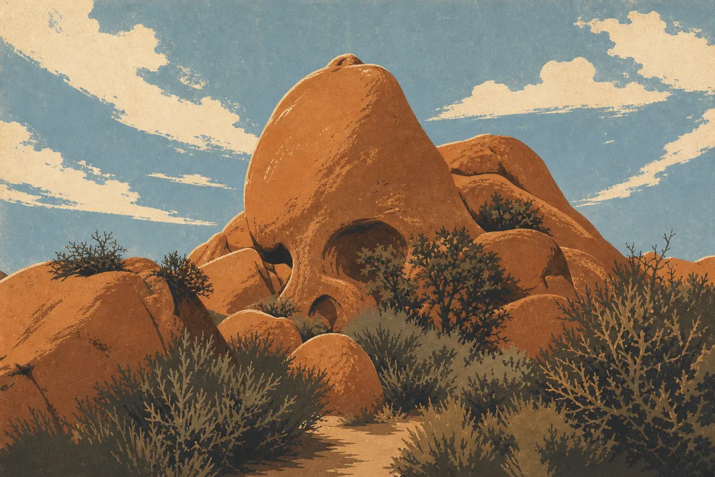
Enter through the North Entrance at Twentynine Palms and take Pinto Basin Road west. First stop: Skull Rock, right beside the parking area. The formation really does look like a skull viewed head-on. The Interpretive Trail starts here, a 1.7-mile loop with signs about the geology and wildlife of the Mojave Desert. Allow 45 minutes.
Continue to Barker Dam. Park at the Barker Dam Trailhead and walk 1.3 miles round-trip to the reservoir. In March and April, the vegetation around this water source is surprisingly lush for a desert. The petroglyphs on the rock walls halfway around are subtle but authentic.
Next, head to Hidden Valley for an easy 1-mile loop among 33-foot granite boulders. According to local tradition, unscrupulous ranchers used this natural bowl to hide stolen cattle. Today, it's one of California's busiest granite climbing areas.
Late in the afternoon, drive up to Keys View for sunset. On a clear day, you can make out the Salton Sea, the outline of Palm Springs, and the snow-covered ridges of San Jacinto in winter. Be careful. The wind can be fierce up there, even in summer, so an extra layer comes in handy.
Day 2: Hiking and a Night Under the Stars
Spend the morning on Ryan Mountain: 3 miles round-trip, about 1,200 feet of elevation gain, and a 360-degree panorama of all four sections of the park from the 5,456-foot summit. Set out before 8 a.m. in summer to avoid the heat and encounter fewer people at the top.
In the afternoon, head toward the east for Cholla Cactus Garden. Even if desert botany isn't your thing, the late-afternoon light on the golden stems makes the stop worthwhile.
If you're camping in the park, stay outside after 10 p.m. Joshua Tree is recognized by the International Dark-Sky Association, and the Milky Way is visible to the naked eye for several months of the year. Our Joshua Tree camping guide lists the sites with the best open-sky views and tells you which ones require advance reservations.
Day 3: Cottonwood Springs and the South Section (Optional)
Day three takes you down to the South Entrance and Cottonwood Springs, often overlooked by visitors in a hurry. The Cottonwood Spring Oasis hike, 1 mile round-trip, crosses an unexpected wetland in the middle of the desert. Washingtonia filifera palms signal a permanent underground water source. Migratory birds stop here in large numbers in spring and fall.
If you still have energy, the Lost Horse Mine Trail, 4 miles round-trip, leads to the ruins of a late-nineteenth-century gold mine. The site's history is well documented on the signs in place, and the views over the Keys section make this a good final stop before leaving the park.
Variations Based on Your Time
Quick 1-day trip from Palm Springs or Los Angeles: enter through the West Entrance, visit Skull Rock, Hidden Valley, and Keys View in succession, then leave through the North Entrance toward Twentynine Palms or retrace your route. Plan on 6 to 7 hours in the park, including about an hour of walking overall.
Classic 2- to 3-day trip: the day-by-day itinerary above is designed for this format. Add Ryan Mountain on day two if you enjoy hiking. If you're traveling with children or people with limited mobility, swap it for Cap Rock, a short, accessible loop that works with a stroller.
Regional road trip: Joshua Tree fits easily into a desert California itinerary. To the west, Palm Springs, 45 minutes away, offers design hotels, a scenic tramway up Mount San Jacinto, at 8,517 feet, and notable restaurants. To the north, Pioneertown is a 1940s Western movie set turned inhabited town. Pappy & Harriet's hosts live concerts there on weekends. To the southeast, the Salton Sea, an inland lake 230 feet below sea level, fascinates with its run-down landscapes and remaining birdlife. Our Regions guides connect these stops into a coherent route with driving times.
Itinerary Map
The NPS publishes an official Unigrid map available at every park entrance. This folded paper map is enough to navigate the main roads and locate campgrounds, the few water sources, and day-use-only areas where overnight parking is prohibited.
The Joshua Tree itinerary map overlays points of interest with estimated driving times between each section. Check it and download it before entering the park. Cell coverage is very limited inside, and some areas have no signal.
Where to Stay Along the Itinerary
The park has nine NPS campgrounds spread across the entire area. Some are available without reservations on a first-come, first-served basis. The most popular ones fill up several weeks in advance on recreation.gov, especially in March and April. Our Camping page sorts them by section, comfort, and accessibility.
Outside the park, the towns of Joshua Tree, Twentynine Palms, and Yucca Valley have motels, bed-and-breakfasts, and a few boutique properties. From Palm Springs, 45 minutes away, you'll find a much wider selection and livelier evenings. Our Where to Stay page compares options by location and budget.
Extend Your Trip: What to See Around Joshua Tree
Within a day's drive from the West Entrance:
- Palm Springs (45 min): modernist architecture from the 1950s through the 1970s, Palm Canyon Drive, and the Mount San Jacinto tramway, at 8,517 feet.
- Pioneertown (30 min): an authentic 1940s Western movie set turned town, with quality live concerts at Pappy & Harriet's on weekends.
- Salton Sea (1 hr 15 min): an inland lake gradually shrinking, abundant birdlife, and deliberately post-industrial landscapes.
- Death Valley (about 3 hours north): the national park where summer temperatures regularly exceed 122 °F. Save it for the shoulder seasons.
Our Roadtrips guides connect these destinations into a coherent desert California itinerary, with recommended overnight stops and driving times for each leg.
The Ideal Itinerary for Your Time
| Length | What you'll see | What you'll skip |
|---|---|---|
| 1 day | Skull Rock · Hidden Valley · Keys View | East section, longer hikes |
| 2 days | + Ryan Mountain · Cholla Cactus Garden · a night under the stars | Cottonwood Springs, secondary roads |
| 3 days | + Cottonwood Springs · Lost Horse Mine · surrounding area | The most demanding trails |
Our complete Joshua Tree guide brings together all the park guides, including hiking, lodging, practical information, and family travel, if you're planning a trip from start to finish.
Frequently Asked Questions
Is Joshua Tree worth visiting?
Joshua Tree is definitely worth the trip if you're drawn to desert landscapes, granite climbing, astronomy, or nature photography. The park has no spectacular waterfalls or geysers, but it has a strong visual identity: two deserts meeting, unique rock formations, and night skies that are hard to match in Southern California.
How long do you need to visit Joshua Tree National Park?
Two days let you cover the essentials of both main sections, the Mojave in the northwest and the Colorado in the east. One day is enough for an overview of the northwest from Palm Springs or Los Angeles. Three days are recommended if you want to take serious hikes or stargaze in the park.
Is there an entrance fee for Joshua Tree National Park?
Yes, there is an entrance fee: $30 per vehicle, valid for 7 days. Motorcyclists pay $25, and pedestrians and bicyclists pay $15. The park's annual pass costs $55. The America the Beautiful Pass, at $80, is a good deal as soon as you visit two national parks in a year. Our Fees & passes page compares all the options.
What's the best itinerary for visiting national parks in the American West?
Joshua Tree fits into several routes depending on where you're starting: a desert California road trip through Palm Springs, Joshua Tree, and Death Valley, or an Arizona-California route through Grand Canyon, Zion, Las Vegas, and Joshua Tree. Our Roadtrips guides detail these options, including driving times and recommended overnight stops.
When is the best time to visit Joshua Tree?
Spring, from March through April, and fall, from October through November, offer the most pleasant conditions, with daytime temperatures between 59 and 84 °F. Summer temperatures regularly exceed 100 °F, making long hikes dangerous outside the first and last hours of the day. Winter days are mild, around 59 °F, but temperatures can drop below freezing at higher elevations. Our When to Go page details conditions month by month.