
Yellowstone Hiking Guide: Best Trails for Every Level
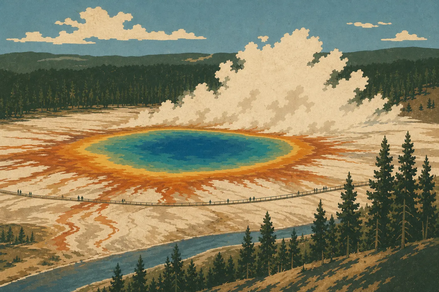
Yellowstone is more than a roadside view of Old Faithful. The park has more than 900 miles of marked trails, from a few-hundred-foot geothermal boardwalk to multi-day alpine traverses. If you only do one hike on your first visit, make it Fairy Falls Trail. It combines an elevated view of Grand Prismatic Spring with a waterfall in an easy outing that takes less than three hours. Have a full day and solid hiking experience? Climb to the top of Mount Washburn for 360-degree views across the plateau. Traveling with kids? The Geyser Hill Loop around Old Faithful takes about an hour at an easy pace and follows a completely flat boardwalk.
This guide helps you choose. It is not meant to cover every trail.
How to Prepare for a Yellowstone Hike
Permits and Park Entry
Day hikes don't require any permit in Yellowstone. Your park entry fee is enough ($35 per vehicle, valid for 7 days, or a $70 annual pass). Backcountry camping requires a wilderness permit, issued at visitor centers.
Wildlife: Keep Your Distance
Yellowstone is home to abundant wildlife. The park enforces strict minimum distances: 25 yards from bison, elk, and other hoofed animals, and 100 yards from bears and wolves. Nearly every reported incident involves hikers who got too close. Carry bear spray and know how to use it. A bear bell attached to your pack lets wildlife know you're coming on wooded trails.
Geothermal Features: The Hidden Risk
Leaving marked boardwalks is prohibited and can be fatal. The ground around geothermal basins can collapse without warning, and hot-spring accidents have killed visitors in Yellowstone. Never leave children unattended near active areas.
Dogs
Dogs are not allowed on any trails in the park. They're permitted in parking lots and on roads, but must be leashed. Boarding facilities are available in West Yellowstone and Gardiner.
Water, Weather, and Basic Gear
The park's streams and lakes may contain Giardia, so never drink untreated water. Bring at least 2 liters per person for a half-day hike. Weather changes quickly. Afternoon thunderstorms can roll in even in July, and snow can fall in any month. Summer daytime temperatures sometimes climb above 70°F before dropping 18°F or more when a front moves through. Always pack a waterproof layer, and check the Yellowstone weather forecast before every outing.
The Best Hikes, Area by Area
Old Faithful and the Geyser Basins (Southwest)
This area has the park's most photographed geothermal features. The trails are short and well developed, making them ideal for a first day.
- Distance
- 5 miles round-trip
- Elevation gain
- 100 feet of elevation gain
- Duration
- Easy
- Difficulty
- Out and back
- Type
- Trailhead: Fairy Falls Trailhead, Grand Loop Road south of Midway Geyser Basin
Fairy Falls drops 200 feet into a rocky amphitheater. The trail first follows a geothermal basin, then climbs briefly to an elevated viewpoint over Grand Prismatic Spring, whose turquoise water is ringed with orange. It's the only accessible day-hike overlook of the spring, and well worth the outing. Set out before 8 a.m. if you don't want to share the parking lot with half of West Yellowstone.
- Distance
- 2.2 miles round-trip
- Elevation gain
- 375 feet of elevation gain
- Duration
- Moderate
- Difficulty
- Out and back
- Type
- Trailhead: Old Faithful Visitor Center
This is one of the few trails that puts you above Old Faithful instead of at its base. The climb takes about 20 minutes. At the top, you see the geyser in context, surrounded by the basin and forest. Add the Geyser Hill Loop (0.9 miles, flat) on the way back to see about a dozen active geysers.
- Distance
- 2.5 miles round-trip
- Elevation gain
- 300 feet of elevation gain
- Duration
- Easy to moderate
- Difficulty
- Out and back
- Type
- Trailhead: Biscuit Basin, 1.9 miles north of Old Faithful
A 85-foot waterfall in lodgepole pine forest, with far fewer visitors than Fairy Falls. The loop variation via Lava Creek Trail adds 1.2 miles and a few dozen more feet of elevation gain.
Grand Canyon of the Yellowstone (Central)
The canyon is about 22 miles long and 1,000 to 1,500 feet deep. Its yellow and orange walls gave Wyoming its name.
- Distance
- Sections from 0.6 to 5 miles, depending on the route
- Elevation gain
- Flat to 165 feet of elevation gain
- Duration
- Easy
- Difficulty
- Out and back
- Type
- Trailhead: South Rim parking area, 3.1 miles from Canyon Village
The South Rim offers the classic views of Upper and Lower Falls. Artist Point, reached by a 0.6-mile walk from the parking area, provides a head-on view of Lower Falls, which drops 308 feet. Continue to Point Sublime if you want a 5-mile outing with hardly another person in sight.
- Distance
- 0.5 miles round-trip
- Elevation gain
- 500-foot descent
- Duration
- Difficult
- Difficulty
- Out and back
- Type
- Trailhead: South Rim parking area
It's short but strenuous. The trail drops down the canyon wall via 328 metal steps and steep paved sections. At the bottom, the close-up view of Lower Falls is dramatic. The climb back up works your knees and calves, so bring trekking poles if you have them.
- Distance
- 12 miles round-trip
- Elevation gain
- 1,200 feet of elevation gain
- Duration
- Difficult
- Difficulty
- Out and back
- Type
- Trailhead: Glacial Boulder Trailhead, North Rim, about 3.1 miles east of Canyon Junction
The trail descends to the bottom of the canyon and the Yellowstone River, with active geothermal features below. This is a serious commitment. Allow a full day, carry plenty of water, and tell someone your plans before you leave.
Mammoth Hot Springs and the North of the Park
The northern area stays open year-round. It's cooler and less crowded than the geothermal areas to the south.
- Distance
- 5 miles loop
- Elevation gain
- 525 feet of elevation gain
- Duration
- Moderate
- Difficulty
- Loop
- Type
- Trailhead: Sepulcher Mountain Trailhead, Mammoth
A low-key classic through conifer forests, meadows, and five beaver ponds. Elk and deer often appear in the morning. The trail starts behind the historic buildings of Fort Yellowstone. Few hikers know about it because most people stop at the travertine terraces just across the road.
- Distance
- About 12 miles loop
- Elevation gain
- 2,900 feet of elevation gain
- Duration
- Difficult
- Difficulty
- Loop
- Type
- Trailhead: Sepulcher Mountain Trailhead, Mammoth
A true alpine hike that climbs above Mammoth and opens up views of the Gardiner Valley and the Absaroka Range. It's for experienced hikers who are comfortable with elevation gain and properly equipped. Start at dawn.
Mount Washburn (North-Central)
Mount Washburn rises to 10,243 feet. On a clear day, the view takes in much of the Yellowstone plateau, the Tetons to the south, and the Absaroka Range to the east.
- Distance
- 6.2 miles round-trip
- Elevation gain
- 1,280 feet of elevation gain
- Duration
- Moderate to strenuous
- Difficulty
- Out and back
- Type
- Trailhead: Dunraven Pass Trailhead, Grand Loop Road between Tower-Roosevelt and Canyon Village
The trail climbs steadily on a ranger road without any technical sections. At the summit, a historic fire lookout has fixed binoculars and a shelter. Bighorn sheep are regularly spotted on the upper slopes. Winds can be strong even on a sunny day, so a windbreaker is essential. This is our recommendation for any moderately fit hiker who wants Yellowstone's signature panorama.
Yellowstone Lake and the East Side
Yellowstone Lake stretches across more than 7,700 feet of elevation and covers 132 square miles. The surrounding trails see fewer visitors and feel more remote.
- Distance
- 4 miles round-trip
- Elevation gain
- 2,130 feet of elevation gain
- Duration
- Difficult
- Difficulty
- Out and back
- Type
- Trailhead: East Entrance Road, about 21 miles from Fishing Bridge Junction
One of the park's most strenuous climbs, it ends on a panoramic ridge at 9,849 feet. The view takes in the lake and the Absaroka Range. The trail becomes unmarked near the top, so route-finding skills help. Snow is possible into July. Check conditions before setting out.
Easy and Family-Friendly Hikes
Yellowstone offers several options for young children and visitors with limited mobility.
- Geyser Hill Loop (0.9 miles, flat, boardwalk; starts at Old Faithful Visitor Center): about a dozen active geysers around Old Faithful, with most of the route accessible to strollers.
- Grand Prismatic Spring Overlook (about 1.9 miles round-trip from the dedicated parking area on Grand Loop Road): a short climb up a grassy slope to an aerial view of the multicolored spring. It may be the park's most-shared photo.
- Mammoth Hot Springs terraces (0.6 to 1.9 miles, depending on the route, boardwalk, minimal elevation gain): the travertine terraces change from one season to the next. Some sections are stroller accessible.
- Lamar Valley: less a trail than a series of roadside stops with short marked walks. It's the best area in the park for seeing wolves, bison, and bears without much physical exertion.
The Yellowstone family guide covers age-appropriate activities in detail.
Challenging Hikes and Big Views
For hikers looking for serious elevation gain and wide-open views:
- Mount Washburn: the park's best effort-to-view ratio.
- Avalanche Peak: for those who want real mountain terrain and don't mind losing the trail markers.
- Seven Mile Hole: a descent to the bottom of the Grand Canyon of the Yellowstone and the river.
- Sepulcher Mountain: the North Country's big alpine loop.
One useful detail: Yellowstone sits at an average elevation of 7,900 feet. If you're coming from low country or the coast, allow a day to acclimate before tackling trails with major elevation gain.
Trailhead Access and Parking
You can reach every trailhead by car via the park's internal roads. For parking logistics and timing advice during peak season, see the getting around Yellowstone guide.
A few things to know:
- Old Faithful: the large central parking lot is often full by 10 a.m. in July and August. Biscuit Basin parking, 1.9 miles north, is a less crowded alternative for reaching Mystic Falls.
- Canyon Village: South Rim and North Rim parking areas are separate, with clear signs from Canyon Junction.
- Dunraven Pass: a small lot with about 15 spaces that fills quickly. The alternative access from Chittenden Road, another Mount Washburn trailhead, usually has more room, but adds 1.2 miles round-trip.
- Fairy Falls: dedicated parking on Grand Loop Road south of Midway Geyser Basin. Coordinates are available in the official NPS app.
For the park's five entrances and access details by area, see the Yellowstone entrances and roads guide and the park overview.
When to Hike in Yellowstone
The main season runs from mid-June to mid-September. Trails are mostly clear, all trailheads are accessible, and visitor centers are open. July and August bring most of the visitors.
September is our favorite time. Crowds thin out, fall colors begin in the meadows, and elk enter the rut. Wildlife viewing is often better than in the height of summer.
Before June, snow can block high-elevation passes and trailheads, especially Dunraven Pass and the route to Avalanche Peak. Check opening and closing alerts on the NPS website before making plans.
For monthly climate data and road opening dates, the Yellowstone month-by-month calendar has the full overview.
Which Hike Is Right for You?
| Hiker profile | Recommendation |
|---|---|
| First visit, any skill level | Fairy Falls Trail + Observation Point |
| Family with kids | Geyser Hill Loop + Grand Prismatic Overlook |
| Panorama, moderate level | Mount Washburn |
| Wildlife viewing | Lamar Valley + Beaver Ponds Loop |
| Waterfalls | Mystic Falls + Uncle Tom's Trail |
| Challenging hike | Avalanche Peak or Seven Mile Hole |
To build your trip around these outings, our 3-, 5-, or 7-day Yellowstone itineraries give you a ready-made structure.
Frequently Asked Questions
What's the best hike in Yellowstone National Park?
For a first visit, the best hike is Fairy Falls Trail (5 miles round-trip, easy). It combines an elevated view of Grand Prismatic Spring with a beautiful waterfall and no technical difficulty. For hikers looking for a panorama, Mount Washburn (6.2 miles, 1,280 feet of elevation gain) is our top choice.
Are Yellowstone hikes difficult?
Yellowstone hiking isn't difficult overall. Most popular trails are easy to moderate, with limited elevation gain. High-elevation trails such as Avalanche Peak (2,130 feet of elevation gain) and Sepulcher Mountain (2,900 feet) are genuinely strenuous and require good fitness.
Is it safe to hike in Yellowstone National Park?
Hiking in Yellowstone is safe when you follow wildlife-distance rules, keeping 25 yards from bison and 100 yards from bears, carry bear spray, and stay on boardwalks near geothermal areas. Also pack a waterproof layer and enough water. Weather can change dramatically within a few hours.
Can you hike in Yellowstone National Park?
Yes. Yellowstone has more than 900 miles of trails open to the public. Day hikes don't require a special permit. You only need to pay the park entry fee.
Are there easy family-friendly hikes in Yellowstone?
Yes. Geyser Hill Loop (0.9 miles, flat), the Mammoth Hot Springs terraces, where some boardwalk sections are stroller accessible, and Grand Prismatic Overlook (about 1.9 miles) work well for kids as young as 5 or 6. Park entry is all you need, and no special gear is required.
Can you hike with your dog in Yellowstone?
No. Dogs aren't allowed on any trails in Yellowstone National Park. They're permitted in parking lots and on roads, but must be leashed. Boarding facilities are available in towns near the park.
When is the best time to hike in Yellowstone?
The best time to hike in Yellowstone is from mid-June to mid-September, with the heaviest crowds in July and August. September offers an excellent balance: fewer people, fall colors, and active wildlife.
Are there loop hikes in Yellowstone?
Yes. Beaver Ponds Loop (5 miles, moderate), Sepulcher Mountain (about 12 miles, difficult), and Geyser Hill Loop (0.9 miles, easy) are the most popular examples. Most other popular trails are out-and-back hikes.
How do you get to Yellowstone trailheads?
You can reach the trailheads by private vehicle through the park's five entrances. Yellowstone doesn't have an official internal shuttle comparable to Zion's. Arrive before 8 a.m. or after 4 p.m. during peak season to avoid full parking lots. The Trailhead Access and Parking section above summarizes the essentials for each trailhead.
Which trails are best for wildlife viewing in Yellowstone?
For wildlife, prioritize Lamar Valley, where wolves, bison, and grizzly bears are often visible from the road and nearby short walks; Hayden Valley, for bison and sandhill cranes; and Beaver Ponds Loop at Mammoth, for elk and beavers. Mount Washburn is known for bighorn sheep on its upper slopes.