
White Sands Map: Layout, Areas, and the Official Map to Download
White Sands National Park lies in New Mexico, between Las Cruces and Alamogordo along US Highway 70. The park covers the world's largest expanse of white gypsum dunes, about 274 square miles of sand as fine as powdered sugar. The official NPS map, a free PDF, can be downloaded directly from nps.gov/whsa. Print it before you leave. It's the map you'll want as your reference.
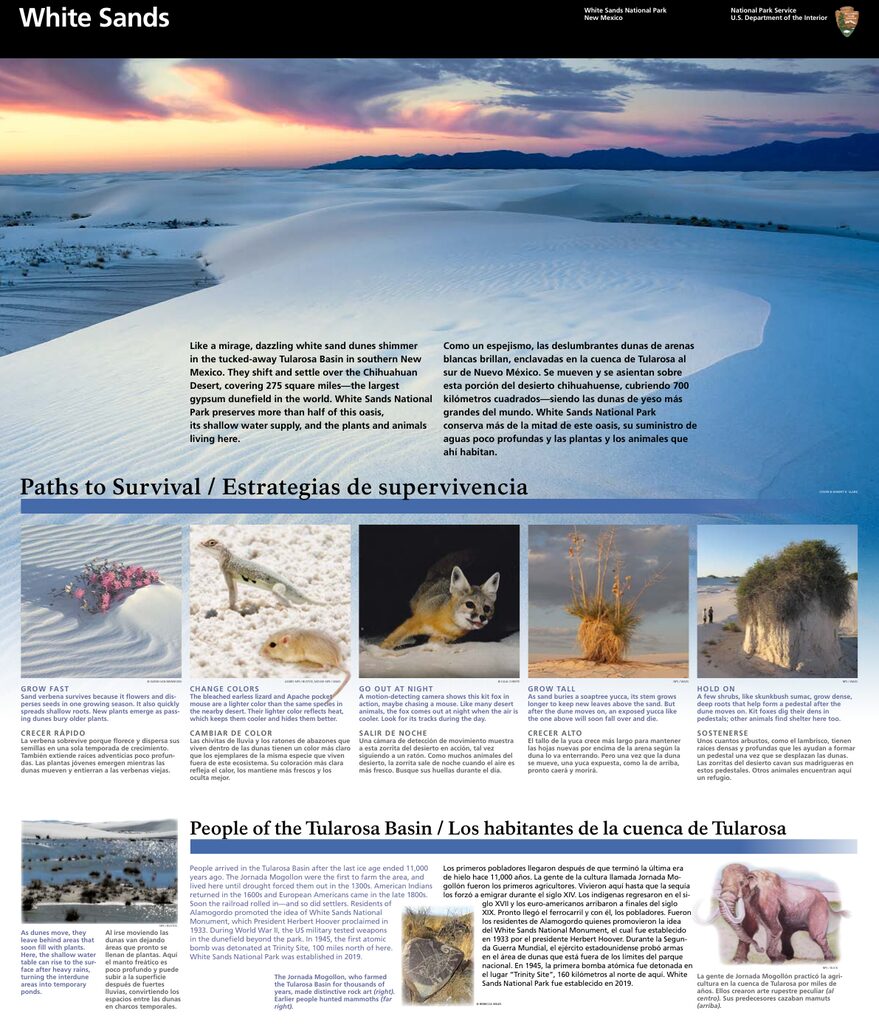
The official park map handed out at entrance stations, with roads, areas, visitor centers and services. View it here or download it for offline use.
Download the map (PDF) Public domain · National Park ServiceWhere Is White Sands Located?
White Sands sits in southern New Mexico, in the heart of the Tularosa Basin. The park lies about 15 miles west of Alamogordo and 52 miles east of Las Cruces. On a map of the United States, it's halfway between El Paso, Texas, to the south and Albuquerque to the north, in a desert region bordered by two mountain ranges: the San Andres Mountains to the west and the Sacramento Mountains to the east.
Keep this location in mind. The area also includes White Sands Missile Range. US Highway 70, the main access road, is regularly closed for ballistic tests, sometimes without notice or with very little warning. Check current alerts before you hit the road. Our guide to getting to White Sands covers routes from El Paso and Albuquerque, including distances and drive times.
Download the Official White Sands Map (NPS Unigrid)
The National Park Service publishes the White Sands Unigrid map. It's the same paper map handed out at the park entrance, and you can download a free PDF from the NPS website.
It includes:
- The full route of Dunes Drive, the main road, which runs for 8 miles
- Picnic areas, sand sledding areas, and restrooms
- Marked trails and their trailheads
- A satellite view of the Tularosa Basin showing the park in its surroundings
Practical tip: Download the map before you leave and save it for offline use. Cell service is almost nonexistent inside the dunes.
Areas of White Sands
White Sands is a linear park. Everything is organized along Dunes Drive, the only road that enters the dunes from the main entrance to its western terminus.
The Entrance and Visitor Center Area
The Visitor Center sits on the east side, just past the entrance station. This is where you'll pick up the paper map, pay your entrance fee, and get the day's closing time. The park closes 30 minutes after local sunset. A shop rents and sells plastic sand sleds. Buying one on-site is a better deal than renting one.
The Dunes Area (Middle of Dunes Drive)
As you head west on Dunes Drive, the dunes quickly get taller. This is the central area and the most photogenic one, where the dunes rise above 39 feet. Numbered picnic areas, including Roadrunner Picnic Area and Lake Lucero Overlook, line the road every 0.6 to 1.2 miles. Stop wherever you feel like it.
The Terminus and Back-Dune Area
At the end of Dunes Drive, the Alkali Flat Trailhead parking area marks the limit of where you can drive. This is the trailhead for the park's most demanding trail, which crosses the most remote part of the dunes. There are no other facilities here: beyond the official trails, you'll find unmarked tracks, no cell service, and no drinking water.
Park Entrances and Driving Through the Park
White Sands has just one vehicle entrance, on US Highway 70. Dunes Drive, the interior road, is an 8-mile dead-end road, or about 16 miles round-trip. You can't drive across the park from east to west. You enter and leave by the same road.
Entrance fees (2025):
| Vehicle type | Fee |
|---|---|
| Private vehicle (up to 7 people) | $25.00 |
| Motorcycle | $20.00 |
| Pedestrian or cyclist | $15.00 |
| White Sands annual pass | $45.00 |
The America the Beautiful pass ($80.00 per year, valid at all federal parks) is accepted.
Hours: The entrance gates open at 7:00 a.m. every day. The park closes 30 minutes after local sunset. As a rough guide, sunset at White Sands is about 8 minutes earlier than in Alamogordo. Check sunrise-sunset.org for the exact time on the evening of your visit.
Map Highlights and Viewpoints
Here are the stops to mark on your map before you enter:
Interdune Boardwalk: This short, 0.25-mile boardwalk is accessible to visitors with limited mobility. It winds between two dunes and explains the vegetation that survives in the sand. The trailhead is clearly marked at about mile 3 on Dunes Drive.
Lake Lucero: This dry lake on the park's western edge is the original source of the gypsum that formed the dunes. It's accessible only on NPS-guided tours, which require reservations and have limited space. Its location on the map is outside the usual sledding area.
Alkali Flat: This viewpoint looks out over the tallest dunes, at the end of Dunes Drive. It's also the trailhead for the trail of the same name, a 4.7-mile round-trip hike with no shade and no permanent markers beneath the shifting sand. Don't head out without enough water, at least 2 liters per person, and either a GPS or compass. The markers regularly disappear beneath the sand.
For details on the activities at each stop, Things to do at White Sands and our hiking guide cover every trail.
Nearest Towns and Airports
Alamogordo (15 miles east) is the park's gateway town. You'll find lodging, gas stations, and supermarkets there. It's the logical place to spend a night before or after your visit.
Las Cruces (52 miles west) is a larger city with more lodging and dining options. I-25 connects it to the rest of New Mexico.
El Paso, Texas, has the closest airport with direct flights from Europe. Figure on about 56 miles from the park entrance. El Paso International Airport (ELP) is the main gateway for travelers coming from far away.
Albuquerque International Sunport (ABQ) is another option, about 224 miles north. It offers more domestic connections and could work for a road trip that includes Santa Fe or Carlsbad Caverns National Park.
Our lodging guide and our Access & Transportation page cover places to stay in Alamogordo and routes from El Paso in detail.
Hiking Maps and Printed Trail Guides
The NPS Unigrid map covers the main trails, but if you're planning to hike Alkali Flat or head out at sunrise or sunset, a detailed topographic map is useful. Here are a few options:
NatGeo Trails Illustrated Map No. 945 (White Sands National Park): A go-to resource for hikers, with contour lines and detailed geographic markers. You can find it at specialty travel bookstores or order it online.
CalTopo or Gaia GPS trail guide: The digital version is handy for tracking your position, even without cell service, as long as you download the map before entering the park. It's essential on Alkali Flat, where the physical markers disappear.
Ask a specialist travel bookstore whether it stocks NatGeo 945 or can order it.
Frequently Asked Questions
How much time do you need to visit White Sands?
Plan on 2.5 to 4 hours to drive Dunes Drive in both directions, stop at the picnic areas, and hike a short trail. A full day is enough to cover longer trails such as Alkali Flat. Our White Sands itinerary suggests sample days based on how much time you have.
Where is White Sands located?
White Sands is in southern New Mexico, on US Highway 70, 15 miles west of Alamogordo and 52 miles east of Las Cruces.
What is White Sands known for?
White Sands is home to the world's largest expanse of gypsum dunes. The nearly pure white mineral gives the sand its bright color and especially fine texture. The area has been a national monument since 1933 and a national park since 2019.
Can the access road close temporarily?
Yes. US Highway 70 may close without notice during tests at the nearby White Sands Missile Range. Check current alerts at nps.gov/whsa before you hit the road.