
Bryce Canyon Hiking: The Best Trails for Every Ability
If you only do one hike at Bryce Canyon, make it the combination of Queen's Garden + Navajo Loop (about 3.5 miles, moderate, 2.5 to 3 hours). In half a day, you'll descend into the heart of the hoodoos from Sunrise Point, pass through Wall Street's sandstone corridor, and climb back up to Sunset Point. This is Bryce Canyon at its most distinctive, at a pace most visitors can handle.
Here are two alternatives depending on what you're looking for:
- Short on time and traveling with kids? The Mossy Cave Trail (2 miles round-trip) is short, surprising, and easy.
- Looking for serious elevation gain and solitude? The Fairyland Loop (8.1 miles, 2,100 feet of elevation gain) delivers.
Bryce Canyon offers one of the most distinctive hiking experiences on the Colorado Plateau. The park works differently from what you might expect: you start at the edge of the cliff, descend among the formations, and climb back out on the way back. The elevation (between 7,900 and 8,900 feet) makes the effort harder. Here are a few things to consider before you start.
Prepare for Your Bryce Canyon Hike
Permits and Entrance Fees
You don't need a permit for a day hike. Park admission costs $35 per vehicle and is valid for 7 days. If you're visiting several national parks on a road trip, the America the Beautiful pass ($80 per year) covers all federal recreation sites. For an overnight trip in the backcountry, a wilderness permit is required. Pick one up at the Visitor Center before you leave.
Altitude and Physical Effort
At elevations above 7,900 feet, you'll get short of breath faster than you would at sea level, even if you're an experienced hiker. Drink more than usual, at least 0.5 liters of water per hour of hiking. There are no water sources on the trails, so bring everything you'll need from the Visitor Center or your lodging.
The trails are exposed, with little shade. A wide-brimmed hat, SPF 50 sunscreen, and sunglasses are essential, even on overcast days. In July and August, severe thunderstorms often develop between 1 and 5 p.m. The simple rule is to start early so you'll be back up before noon.
In winter, the trails that descend below the rim, including Navajo Loop and Queen's Garden, become icy. Microspikes or light crampons are strongly recommended from November through March.
Wildlife
Mule deer cross the trails without warning, while prairie dogs fill the meadows along the rim. They're adorable, but feeding them is prohibited. California condors regularly soar above the cliffs. Rattlesnakes are present on rocky trails in summer, so watch where you put your hands and feet.
Black bears do live in the park, but they're rarely seen on the main trails. If you encounter one, don't run. Speak calmly and back away slowly.
Dogs
Dogs aren't allowed on the park's trails, with one exception. The Rim Trail allows leashed dogs, with leashes no longer than 6 feet. All other trails, including Queen's Garden and Navajo Loop, are closed to pets.
The Best Hikes, Area by Area
Bryce Canyon's hiking is organized around four areas: the central amphitheater, the heart of the park; Fairyland to the north; Mossy Cave to the east; and the backcountry around Rainbow Point to the south.
Bryce Amphitheater: The Classics
This is where you'll find the densest concentration of hoodoos and most of the visitors.
Queen's Garden Trail Distance: 1.8 miles round-trip · Elevation gain: 300 feet · Duration: 1 to 1.5 hours · Difficulty: easy · Type: out-and-back · Trailhead: Sunrise Point
This is the most accessible trail that descends below the rim. It winds among the orange formations to a rock shape that resembles Queen Victoria, if you use your imagination. The climb back up is short. It's our top choice for kids and beginners. Tip: The early morning light from Sunrise Point gives the hoodoos a golden glow. If you're into photography, arrive when the parking lot opens.
Navajo Loop Distance: 1.4 miles · Elevation gain: 540 feet · Duration: 1 to 1.5 hours · Difficulty: moderate · Type: loop · Trailhead: Sunset Point
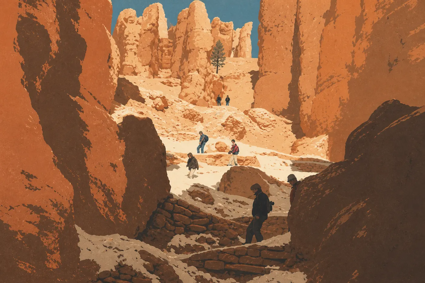
The park's iconic loop. It descends steeply from Sunset Point, passes through Wall Street, a corridor between vertical sandstone walls more than 65 feet high where Douglas firs grow in the cracks, and climbs back up. It's short, but the slopes are steep. Seasonal alert: Wall Street is often closed in winter and early spring because of ice. Check trail conditions at the Visitor Center or on the NPS website before you leave.
Queen's Garden + Navajo Loop (combined) Distance: 3.5 miles · Elevation gain: 720 feet · Duration: 2.5 to 3 hours · Difficulty: moderate · Type: partial loop · Trailhead: Sunrise Point or Sunset Point
This is our top recommendation for a first visit. Descend through Queen's Garden from Sunrise Point, cross the floor of the amphitheater, and climb back up via Navajo Loop to Sunset Point. The Rim Trail, or the free seasonal shuttle, gets you back to your starting point in a few minutes. This route shows you the best of Bryce Canyon in half a day.
Peekaboo Loop Distance: 5 miles · Elevation gain: 1,600 feet · Duration: 3 to 4 hours · Difficulty: moderate to strenuous · Type: loop · Trailhead: Bryce Point or Sunset Point
The most demanding loop in the amphitheater. It passes through areas packed with hoodoos, goes beneath natural arches, and follows cliffs with colorful layers. You'll feel the elevation gain, especially on the climb back toward Bryce Point. Be aware that horseback rides also use this trail. From Bryce Point, the view across the entire amphitheater at the start of the loop is worth the trip by itself.
- Distance
- Distance: up to 10 miles in sections
- Elevation gain
- Elevation gain: negligible
- Duration
- Difficulty: easy
- Difficulty
- Type: linear
- Type
- Trailheads: Fairyland Point, Sunrise Point, Sunset Point, Inspiration Point, or Bryce Point
This is the only trail in the park where dogs are allowed. It follows the cliff edge from north to south and offers sweeping views over the amphitheater without descending into the formations. It's ideal for a low-commitment walk, connecting two overlooks, or an evening outing.
Fairyland: Hoodoos and Solitude
Fairyland Loop Distance: 8.1 miles · Elevation gain: 2,100 feet · Duration: 4 to 6 hours · Difficulty: strenuous · Type: loop · Trailhead: Fairyland Point
This is the least crowded of the park's major hikes. The formations differ from those in the main amphitheater. They're more slender and come in a wider range of colors. California condors often fly over this area. If you want solitude without a wilderness permit, this is your best option. Plan on a full day, plenty of food, and at least 2 liters of water.
Mossy Cave: An Out-of-the-Way Curiosity
Mossy Cave Trail Distance: 2 miles round-trip · Elevation gain: 300 feet · Duration: 1 hour · Difficulty: easy · Type: out-and-back · Trailhead: along UT-12, about 3.7 miles east of the park's main entrance
This trail is geographically separate from the rest of the park. It follows a historic irrigation ditch built by the first Mormon settlers to supply the town of Tropic. At the end, you'll find a moss-covered cave that's cool and unusual, plus a small waterfall depending on the season. It's a good option if you're short on time or have already done the amphitheater classics. One thing to know: Reaching this trail from UT-12 doesn't require driving through the park, which may affect whether you need to pay the entrance fee.
Easy Hikes for Families
Bryce Canyon isn't flat. Even trails rated easy include a descent followed by a climb back up, since every trail drops below the rim. That said, several options work for healthy kids as young as 7 or 8.
Queen's Garden Trail: Our top family pick. The elevation gain is short, the hoodoos are spectacular right away, and kids love looking for the queen's silhouette at the end of the trail.
Rim Trail (Sunrise Point to Sunset Point section): About 0.9 miles of gentle walking between two overlooks, mostly paved. This section is accessible to all-terrain strollers and people with limited mobility.
Mossy Cave Trail: Relatively flat for most of the way, with a visual reward at the end. It works for younger children if you avoid the hottest days.
For park activities designed especially for kids, including ranger programs and the Hoodoo Hike challenge, the Bryce Canyon Family Guide has everything you need to know.
Strenuous Day Hikes
For hikers looking for elevation gain, distance, and fewer people on the trail.
Fairyland Loop (see trail details above): 2,100 feet of elevation gain over 8.1 miles through a protected area. No permit is required, making it the park's classic strenuous day hike.
Peekaboo Loop from Bryce Point (see trail details above): 1,600 feet of elevation gain on a 5-mile loop through the area with the densest hoodoos. It's shorter than Fairyland Loop, but the exposure and elevation gain make it considerably harder than Navajo Loop.
Riggs Spring Loop (trailhead at Rainbow Point, at the end of the Scenic Drive): 9 miles, with about 1,600 feet of elevation gain, through the ponderosa pine forest in the southern area. It's less visually spectacular than the amphitheater, but the solitude is complete and the views from Rainbow Point (8,900 feet) reach all the way to Arizona on clear days.
If you're planning a long day or want to combine several areas, the Bryce Canyon itineraries can help you organize your time in the park.
Access, Trailheads, and Parking
The main trailheads are clustered around the amphitheater and accessible via UT-63, the park's main road:
Sunrise Point: Trailhead for Queen's Garden Trail and the Rim Trail. The parking lot fills quickly in peak season, by 8 or 9 a.m. in July and August.
Sunset Point: Trailhead for Navajo Loop. The same applies here. The lot is often full in the morning as early as June.
Bryce Point: Trailhead for Peekaboo Loop and an overlook across the amphitheater from the highest point on the rim. The parking lot is smaller, but because the trail is harder, it fills more slowly.
Fairyland Point: Trailhead for Fairyland Loop. The parking lot is quiet, in keeping with the trail's low traffic.
Mossy Cave: Dedicated parking along UT-12, outside the park's main road. It's convenient if you're coming from Tropic or want to avoid the traffic heading toward the amphitheater.
Free Seasonal Shuttle
From roughly May through October, a free shuttle serves the main overlooks and trailheads in the amphitheater. In July and August, it's the simplest option. Parking lots fill by 8 a.m., and driving from one end to the other adds unnecessary stress to an already full day. The shuttle also makes point-to-point hikes easier, so you can start at one trailhead and finish at another.
Bryce Canyon shuttles and getting around the park and ways to reach the park cover the routes, schedules, and stops in detail.
When to Hike in Bryce Canyon
Bryce Canyon is open 365 days a year, 24 hours a day. But some seasons are better for hiking than others.
Spring (April to mid-June): Amphitheater trails may still be snow-covered at higher elevations in early April, then clear in May. The light is soft, and the contrast between leftover snow and the hoodoos' ochre tones is striking. Crowds remain manageable.
Summer (mid-June to mid-September): Peak season. Daytime temperatures are pleasant, from 68 to 81 °F, but severe thunderstorms regularly hit in July and August between 1 and 5 p.m. Start every hike before 7 or 8 a.m.
Fall (mid-September to October): Our favorite time of year. Crowds thin out, the light turns warm, and daytime temperatures are mild. Keep in mind that nights drop below 32 °F starting in October, and mornings can be cold.
Winter (November to March): The hoodoos beneath the snow are spectacular, and the park is nearly empty. Amphitheater trails require crampons or microspikes. Temperatures fall below 32 °F every night from December through March, and significant snowfall is common.
For a month-by-month look at temperatures and precipitation, see our guide to the best times to visit Bryce Canyon. Bryce Canyon weather covers expected conditions and seasonal alerts to watch for.
Which Hike Is Right for You?
| Profile | Recommended trail | Duration |
|---|---|---|
| First visit, moderate ability | Queen's Garden + Navajo Loop | 2.5 to 3 hours |
| Family with kids | Queen's Garden or Rim Trail (Sunrise to Sunset) | 1 to 2 hours |
| Short on time, looking for something unusual | Mossy Cave Trail | 1 hour |
| Fit hiker, elevation gain, solitude | Fairyland Loop | Full day |
| Photography (close-up hoodoos) | Navajo Loop / Wall Street | 1 to 1.5 hours |
| With a dog | Rim Trail only | Variable |
| High-point overlook | Riggs Spring Loop (Rainbow Point) | 4 to 5 hours |
| Multi-day, backcountry | Under-the-Rim Trail | 2 to 3 days |
To plan your full visit and make sure you don't miss anything, our complete Bryce Canyon guide covers all the essentials, from overlooks to wildlife.
Frequently Asked Questions
What's the best hike in Bryce Canyon?
For a first visit, the best hike in Bryce Canyon is the Queen's Garden + Navajo Loop combination. It's about 3.5 miles, moderately difficult, and takes 2.5 to 3 hours. It takes you into the heart of the hoodoos and through Wall Street, the park's most photographed sandstone corridor.
What's the best Bryce Canyon trail for beginners?
The best trail for beginners at Bryce Canyon is Queen's Garden Trail: 1.8 miles round-trip, 300 feet of elevation gain, and spectacular rock formations accessible to most ability levels. Even if you're not in great shape, most hikers can complete it.
Is hiking in Bryce Canyon difficult?
Hiking in Bryce Canyon isn't uniformly difficult. There are options for every ability level. Still, even the trails rated easy require a descent and climb below the rim, and the elevation, from 7,900 to 8,900 feet, adds to the fatigue. Bring water and allow more time than you normally would.
Is it safe to hike in Bryce Canyon?
Yes, hiking in Bryce Canyon is safe as long as you follow a few practical rules. Bring at least 1.5 liters of water per person, since there are no water sources on the trails. Start early to avoid summer afternoon thunderstorms, wear light crampons in winter, and stay on marked trails.
Do you need a permit to hike in Bryce Canyon?
You don't need a permit for a day hike at Bryce Canyon. The park entrance fee, $35 per vehicle and valid for 7 days, is the only requirement. A wilderness permit is required for any overnight trip in the backcountry.
Are there easy family-friendly hikes at Bryce Canyon?
Yes. The best family options are Queen's Garden Trail (1.8 miles), Mossy Cave Trail (2 miles), and the paved section of the Rim Trail between Sunrise Point and Sunset Point.
Can you hike with your dog at Bryce Canyon?
You can hike with your dog at Bryce Canyon only on the Rim Trail, with a leash no longer than 6 feet. Pets aren't allowed on any other trail, including popular routes such as Navajo Loop and Queen's Garden.
When is the best time to hike in Bryce Canyon?
The best times to hike in Bryce Canyon are spring, from May through June, and fall, from September through October. Expect pleasant daytime temperatures, smaller crowds, and clear trails. For a complete month-by-month analysis, see our When to Visit page.
Are there loop hikes in Bryce Canyon?
Yes, Bryce Canyon has several loop hikes: Navajo Loop (1.4 miles), Peekaboo Loop (5 miles), Fairyland Loop (8.1 miles), and Riggs Spring Loop (9 miles). The Queen's Garden + Navajo Loop combination forms a partial loop between Sunrise Point and Sunset Point.
How do you get to Bryce Canyon trailheads?
You can reach Bryce Canyon trailheads by car via UT-63, with parking at Sunrise Point, Sunset Point, Bryce Point, and Fairyland Point. In peak season, from June through September, these lots often fill by 8 or 9 a.m. The park's free shuttle is strongly recommended. Our Access & Transportation page has route and schedule details.