
Bryce Canyon National Park: The Complete Visitor Guide
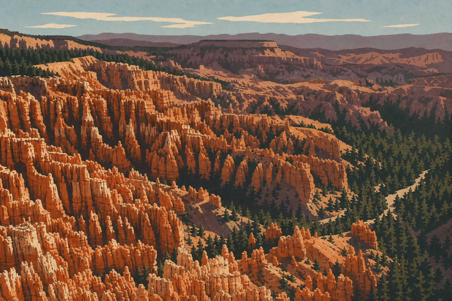
Bryce Canyon is the kind of place where you reach the edge of an ordinary, forested plateau and the ground suddenly opens onto an army of orange limestone spires. The park protects a series of amphitheaters carved into the edge of Paunsaugunt Plateau in southern Utah. People come for the hoodoos, those fairy chimneys sculpted by frost and rain over thousands of years, and for the contrast between pink rock, green pines, and blue sky. According to the National Park Service (NPS), the park has the highest concentration of hoodoos on Earth.
The short answer: plan on a full day to see the highlights, including the amphitheater viewpoints and a short hike among the hoodoos, or two days if you want to explore without rushing. The park is about a 2-hour drive from Zion, so it fits naturally into a Western road trip. It's open 24 hours a day, 365 days a year, but the high elevation, with the rim rising above 7,900 feet, changes everything: snow in winter, afternoon thunderstorms in summer, and cool nights year-round.
Bryce Canyon at a Glance: Where the Park Is and How to Get There
Bryce Canyon lies in southern Utah, away from the major highways, which partly explains why it gets fewer visitors than Zion or the Grand Canyon. The park entrance is near the small community of Bryce Canyon City, on UT-63.
Here are some useful distances for planning your road trip: allow about 4 hours from Las Vegas, just under 2 hours from Zion, and about 4.5 hours from the Grand Canyon's South Rim. Las Vegas remains the most convenient airport for an international flight. Salt Lake City is an alternative if you're coming down from the north. The complete logistics, including airports, car rentals, and parking inside the park, are covered on our Access & Transportation page.
Entrance Fees, Passes, and Reservations
Admission to Bryce Canyon costs $35 per private vehicle and is valid for 7 consecutive days. Other current rates include:
- $30 for a motorcycle, valid for 7 days;
- $20 per person if you arrive on foot or by bicycle, valid for 7 days;
- $70 for the Bryce Canyon-specific annual pass.
If your trip includes several national parks, the America the Beautiful interagency annual pass ($80) quickly pays for itself. Two or three parks are enough to make it worthwhile. One piece of good news for planning is that Bryce Canyon doesn't require a timed entry reservation, unlike Arches and certain seasons at Zion. You can arrive whenever you want. Our National Park Entrance Fees & Passes guide explains entrance fees and passes, including free-entry days. And if you collect park stamps, visit our Passport & Stamps page to find out where to get yours stamped.
Reservations, Permits, and Rules to Follow
Reservations
You don't need a reservation to enter the park. The in-park campgrounds, however, including North Campground and Sunset Campground, should be reserved through Recreation.gov months ahead for the busy season from June through September. Bryce Canyon Lodge, the only lodging inside the park, often fills up six to eight months before summer dates. Book early if you're aiming for summer.
Permits
The standard day hikes, including Queen's Garden, Navajo Loop, Rim Trail, and Fairyland Loop, don't require a permit.
Multi-day backcountry trips on the Under-the-Rim Trail and Riggs Spring Loop require a specific permit. You can pick it up at the Visitor Center the same day or up to 48 hours in advance, subject to availability.
Rules to Follow
The park's rules are straightforward:
- Stay on marked trails at all times. Limestone and sandstone hoodoos are fragile. One step off the trail can destroy formations that took thousands of years to develop.
- Pets are allowed only on roads, in parking lots, and in campgrounds, never on trails.
- Drones are prohibited throughout the park.
- Fires are allowed only in designated fire rings at the campgrounds.
- Pack out all your trash, including food scraps and packaging.
If you're unsure about a specific situation, the Visitor Center, which is open every day with hours that vary by season, is your best on-site resource.
Getting Around Bryce Canyon (Shuttle, Scenic Road, and Areas)
The park revolves around two distinct areas: the compact main amphitheater, served by a shuttle, and Scenic Drive, which heads south toward the high-elevation viewpoints.
The free shuttle runs roughly from April through October, with dates varying from year to year. It connects Bryce Canyon City, the visitor center, the campgrounds, and the amphitheater's main viewpoints as far as Bryce Point. It's the most relaxing option during the busy season, when the lots at Sunset Point and Sunrise Point fill before midmorning. Keep in mind that the shuttle doesn't serve the southern section of Scenic Drive.
Scenic Drive is best explored in your own vehicle. It runs about 18 miles to Rainbow Point, at the park's southern end, which reaches 9,114 feet. A practical tip is to drive straight to the end, then head back down, stopping at the overlooks on your left as you travel downhill. That way, you won't have to cross the road against traffic.
We cover shuttle schedules, parking, and ways to avoid the crowds in our guide to getting around the park.
How Long Do You Need to Visit Bryce Canyon?
Bryce Canyon is a compact park, and that's one of its strengths. In a full, busy day, you can see the amphitheater's four main viewpoints, hike down among the hoodoos, and continue to Rainbow Point. It's a full pace, but a realistic one.
Our recommendation is one full day for the highlights and two days to take your time. With a night in the area, you'll catch sunrise and sunset, the two best times for light on the rock, and add a longer hike or a trip to Mossy Cave. If you're just passing between two parks, half a day is enough to get a feel for the place from the rim, but you'll leave wanting more. Our Itinerary & Length of Stay page breaks down the hours according to your season and travel style.
Plan your visit
What to See and Do in Bryce Canyon
The heart of the visit breaks down into three easy-to-remember geographic areas. Here's an overview. Trail details are on our Hiking page, and the complete list of activities is on our What to Do page.
Road trip journal · 3 areas
The Main Amphitheater and Its Viewpoints
This is the Bryce Canyon from the postcards. Four overlooks follow the rim, each offering a different angle on the sea of hoodoos:
- Sunrise Point: direct access to Queen's Garden, with a bird's-eye view of the thinnest spires.
- Sunset Point: the starting point for Navajo Loop and its steep switchbacks through the famous Wall Street corridor.
- Inspiration Point: the broadest view of the amphitheater, spread across three stepped levels.
- Bryce Point: the highest panorama, ideal at sunrise.
One thing to keep in mind is that, despite their names, all four viewpoints offer beautiful light in the morning and at dusk. Don't rely too heavily on the Sunrise or Sunset label. Look at the orientation and the day's weather instead.
The Rim Trail connects these overlooks and follows the rim on mostly level ground. It's the quintessential accessible walk, with no descent into the canyon and uninterrupted views.
Down Among the Hoodoos: The Signature Loop
Seeing Bryce from above is one thing. Walking among the hoodoos is another. The loop combining Queen's Garden, descending from Sunrise Point, with Navajo Loop, climbing back toward Sunset Point, is the park's signature route. It's about 3.1 miles, with several hundred feet of elevation gain, and takes two to three hours with photo stops. Along the way, you'll pass under arches, between orange walls, and beside formations that look like a queen, a camel, or whatever your imagination sees.
Here's a practical reminder that matters: at this elevation, the descent is easy, but the climb back up is much harder. Save water and energy for the return. The other loops, including Peekaboo Loop and Fairyland, plus the backcountry trails, are compared on our Hiking page.
Scenic Drive and Mossy Cave
South of the amphitheater, Scenic Drive strings together high-elevation overlooks: Natural Bridge, a photogenic red-rock arch, then Agua Canyon, Ponderosa Canyon, Rainbow Point, and finally Yovimpa Point. On a clear day, the view reaches across the plateaus all the way to Arizona.
Away from the main area, northeast of the park, Mossy Cave offers a short, easy walk, about 0.9 miles round-trip, to a small moss-covered grotto and a waterfall along a stream. It's a great option if you're short on time or traveling with young children.
Explore the park
The Best Hikes in Bryce Canyon
Bryce hikes are mostly vertical. Most trails descend from the rim toward the bottom of the amphitheaters, then climb back up. The essentials are the Queen's Garden / Navajo Loop for a first visit, Peekaboo Loop for more elevation gain and solitude, and Fairyland Loop for a long day away from the crowds. Each trail profile, including distance, elevation gain, duration, actual difficulty, and recommended season, is covered on our Hiking page.
One practical safety note: summer afternoon thunderstorms move in quickly, so avoid being exposed on the rim or at high elevations after midday. In winter and spring, icy trails call for light traction devices.
The detailed guide Bryce Canyon Hiking: The Best Trails for Every Ability Bryce Canyon's best hikes by area, with safety tips, trailhead access, and… Read the guide →Wildlife and Plants to Look For
The forested plateau bordering the amphitheaters is home to wildlife that's often visible early in the morning. Utah prairie dogs, a protected species, have colonies in the meadows near the entrance. You'll regularly see deer, chipmunks, squirrels, and sometimes pronghorn in open areas. In the sky, ravens and raptors circle above the hoodoos, while swifts and swallows dart along the cliffs.
The forest includes ponderosa pines at lower elevations and bristlecone pines on the heights around Rainbow Point. Some are among the oldest trees on Earth. To learn where and when to observe each species without disturbing it, see our Wildlife page.
The detailed guide Bryce Canyon Wildlife: Prairie Dogs, Condors & Where to Look Utah prairie dogs at your feet, California condors overhead Read the guide →When to Visit Bryce Canyon
Elevation dictates the seasons. From June through September, days are mild and nights are cool, with highs generally between 70 and 90°F, but afternoon thunderstorms are common in July and August. It's the busy season, with beautiful light, the most visitors, and the shuttle in service.
From October through May, temperatures dip below freezing almost every night. The coldest and snowiest period runs from December through February, and spring storms in March and April can still dump significant snow on the region. The upside is that Bryce under snow, with orange hoodoos capped in white, is a rare sight that few visitors see. Our When to Visit page provides month-by-month temperatures, snowfall, and crowd levels, while our Weather page has detailed forecasts.
The detailed guide When to Visit Bryce Canyon: The Best Time, Month by Month May-June and September-October offer the best Bryce Canyon conditions Read the guide →Where to Stay in Bryce Canyon (Hotels and Campgrounds)
You have three main options. Inside the park, the historic lodge offers the luxury of being there at sunrise, but it books up months in advance. Just outside the entrance, Bryce Canyon City has hotels, restaurants, and services. Finally, the park's two campgrounds, North and Sunset, let you sleep under the pines just a few minutes' walk from the rim. RV travelers will also find several suitable sites and services in the area.
The full comparison, including rates, operating seasons, and reservations, is covered in our Where to Stay guide and its dedicated Hotels & Lodges, Camping, and RV Camping pages.
Stay in the park
Around Bryce Canyon: Things to Do Nearby
Bryce Canyon makes the most sense as part of a larger circuit. Nearby, Red Canyon is lined with red-rock arches that the road passes through for free, even before you reach the park entrance. Farther east, UT-12, one of the West's most scenic roads, leads toward Grand Staircase-Escalante and Capitol Reef. To the west, Zion is less than 2 hours away. To the south, the Grand Canyon's North Rim and Page, with Antelope Canyon and Horseshoe Bend, make natural extensions to the trip.
To build a multi-day itinerary, keep an eye on our upcoming regional guides and Road Trip guide.
Our Take: Is Bryce Canyon Worth the Trip?
Yes, without a doubt, for one simple reason: Bryce doesn't look like any other park in the West. Where Zion overwhelms you with its cliffs and the Grand Canyon with its vastness, Bryce focuses on detail, color, and strangeness. During our visit, the dawn descent through Wall Street, alone between two orange walls still cold from the night, left the strongest impression. The park also has the advantage of being compact. You can see a lot in a short time, which makes it an ideal stop even on a tight road trip. The only real trap is the elevation, which visitors often underestimate. Bring warm layers even in summer, and take it easy on the climbs.
Frequently Asked Questions
How Long Do You Need to Visit Bryce Canyon?
Plan on a full day to see the highlights of Bryce Canyon: the amphitheater's four main viewpoints, a short hike among the hoodoos, and Scenic Drive to Rainbow Point. Two days give you time to add sunrise and sunset as well as a longer hike.
How Do You Visit Bryce Canyon?
Visit Bryce Canyon by combining the rim overlooks, accessible by car or the free shuttle from April through October, with at least one hike down among the hoodoos. The Queen's Garden / Navajo Loop is the standard route. Explore the park's southern section in your own vehicle along Scenic Drive.
What Are the Best Viewpoints in Bryce Canyon?
Bryce Canyon's best viewpoints are Sunrise Point, Sunset Point, Inspiration Point, and Bryce Point, all along the main amphitheater. Farther south, Natural Bridge and Rainbow Point offer different high-elevation views of the surrounding plateaus.
How Much Does It Cost to Enter Bryce Canyon?
Admission to Bryce Canyon costs $35 per private vehicle and is valid for 7 days. It's $30 for a motorcycle and $20 per person on foot or by bicycle. A park-specific annual pass costs $70, while the America the Beautiful interagency pass ($80) is worthwhile once you're visiting two or three parks.
The American Parks shop
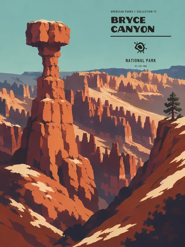
Bring Bryce Canyon home
Our park-inspired creations, made to order and shipped to your door.
Latest park news
- Bryce Canyon: Two Trails Closed After Rain, the Rest Stay MuddyWall Street and the Bryce Connector are closed until further notice after heavy rain; the park's other trails stay open but slippery.
- Bryce Canyon: Campfires Only Allowed in Established Fire PitsAt Bryce Canyon, you can only light a fire in an existing fire pit. Here's what that rule means for your visit.
- Bryce Canyon: Several Trails Closed After a Weather EventAt Bryce Canyon, four trails including Wall Street and the Peekaboo Loop are closed until further notice after a recent bout of weather.