
Bryce Canyon Itinerary: What to See in 1, 2, or 3 Days
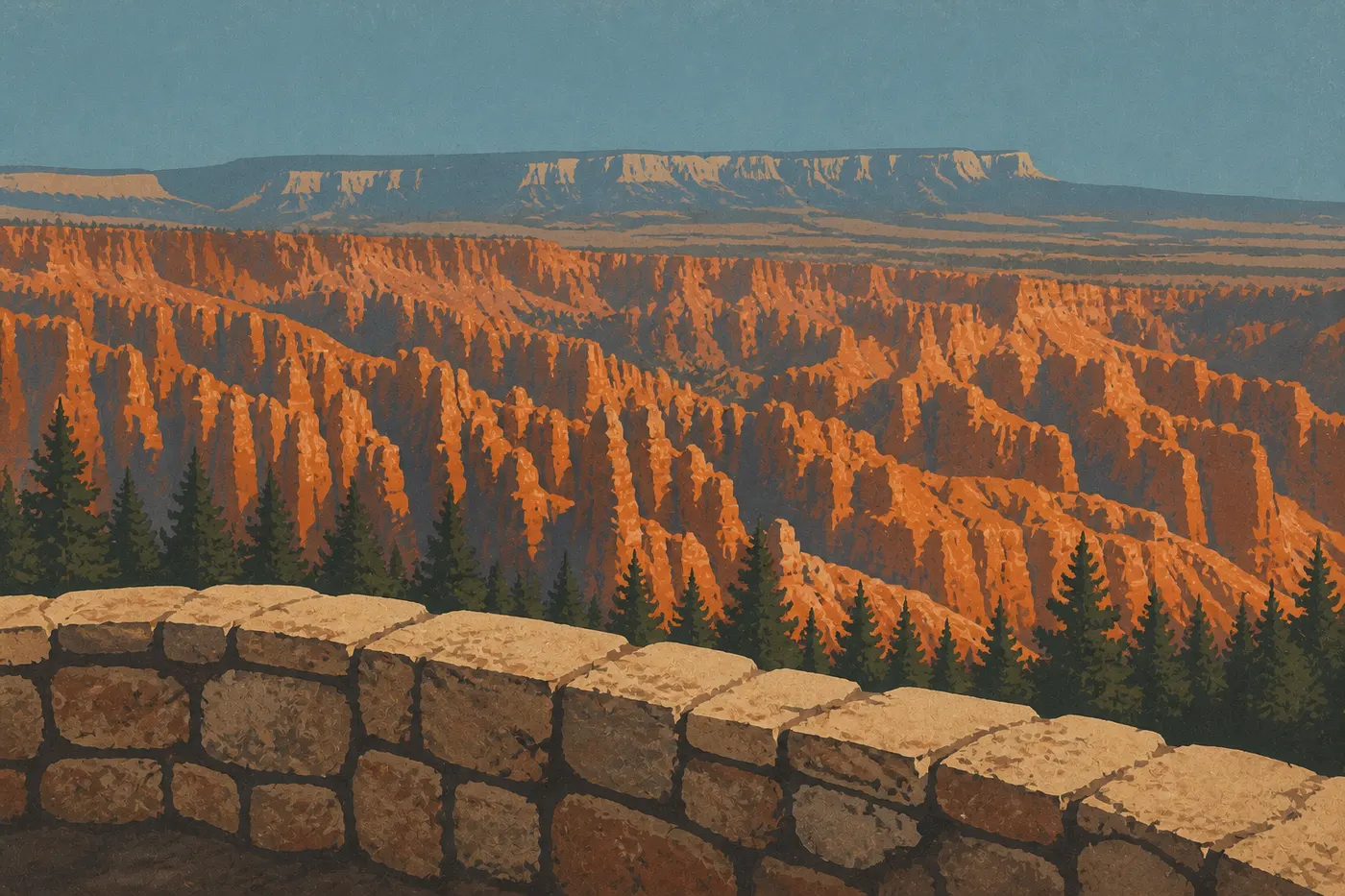
Bryce Canyon isn't a canyon. It's an amphitheater carved into a high limestone plateau in Utah, filled with thousands of hoodoos, the red, orange, and white rock spires that have made the park famous around the world. Two days is ideal. Spend the first day hiking down into the Amphitheater to see the hoodoos from within, then drive the Scenic Drive to Rainbow Point on the second. Three days give you time for less crowded trails and stargazing programs. The route is straightforward: the park road, UT-63, climbs south from the entrance to its terminus at 9,120 feet, and you return on the same road.
You'll find entrance fees, available passes, and park rules in our complete Bryce Canyon guide.
How Much Time Do You Need to Visit Bryce Canyon?
One day: the minimum for seeing the highlights without rushing. Walk through the Bryce Amphitheater, descend among the hoodoos on the Navajo Loop Trail and Queen's Garden Trail (3.1 miles, 525 feet of elevation gain), and watch the sunset from Sunset Point. It's a full day, but doable.
Two days: the comfortable pace. Spend the first day in the Amphitheater and the second on the full Scenic Drive. You'll leave without feeling like you only skimmed the park.
Three days: for hikers who want to tackle Fairyland Loop (10 miles, 1,970 feet of elevation gain), spend a night under the stars with the ranger program, and visit Mossy Cave or Red Canyon before hitting the road again.
One thing to keep in mind is the altitude. Bryce Canyon sits between 7,900 feet at the Visitor Center and 9,120 feet at Rainbow Point. If you're coming from Las Vegas or a coastal city, give yourself some time to acclimate when you arrive. Headaches and shortness of breath are common during the first few hours, especially on the trails.
Getting There and Getting Around
To reach Bryce Canyon and get between the viewpoints, see our Bryce Canyon access guide, with routes from Salt Lake City, Las Vegas, or Zion, free shuttles, and parking tips.
Bryce Canyon's Areas
The park breaks down into three areas, which you'll visit in order from north to south.
The Bryce Amphitheater
This is the heart of the park. Between Fairyland Point to the north and Bryce Point to the southeast, the Amphitheater has the highest concentration of hoodoos, all the iconic trails, and four main viewpoints accessible by car or shuttle.
Sunrise Point is the go-to spot for sunrise. Low-angle light illuminates the hoodoos from the front, creating an entirely different experience from visiting in the middle of the day. Sunset Point is a 1,640-foot walk along the Rim Trail. Inspiration Point looks down over the Silent City, a dense forest of hoodoos that resembles a miniature city from the plateau rim. Bryce Point, the highest point in the Amphitheater at 8,304 feet, takes in the entire basin at a glance.
The Scenic Drive
From Bryce Point to Rainbow Point and Yovimpa Point, the road climbs higher and the crowds thin out noticeably. This section is accessible only by car.
Natural Bridge is a must-stop for photos, with a natural arch framed by ponderosa pines. Agua Canyon is the park's most underrated viewpoint. Two giant hoodoos known as The Hunter and The Rabbit rise above a compact amphitheater with especially vivid colors. Farview Point looks more than 100 miles toward Grand Staircase-Escalante on a clear day. Rainbow Point and Yovimpa Point at 9,120 feet mark the road's terminus. Rainbow Point looks north across the entire park, while Yovimpa Point faces south toward the cliffs of Grand Staircase. Bring an extra layer. It's often 18°F cooler than at the park entrance.
Mossy Cave
On UT-12, before the park's official entrance, the Mossy Cave Trail (0.9 miles round-trip, easy) follows a historic irrigation ditch built by the first Mormon settlers, then climbs toward a cool, moss-covered grotto and a small waterfall. Access is free, and you don't need an entrance pass. It's a good option when you're arriving at or leaving the park, and a pleasant break if you want to avoid the crowds in the Amphitheater.
Day-by-Day Itinerary
Day 1: The Heart of the Amphitheater
Get up early. Really early. Arrive at Sunrise Point before dawn to watch the light settle over the hoodoos while the parking lot is still empty. It's a completely different experience from what you'll see two hours later, when the tour buses arrive.
Around 8 a.m., start the Navajo Loop Trail + Queen's Garden Trail from Sunset Point (3.1 miles, 525 feet of elevation gain; allow 2 to 2.5 hours). This is the park's signature hike. You'll descend into the Amphitheater on tight switchbacks carved into the rock, pass through Wall Street, a corridor so narrow that the sky disappears between the hoodoos on either side, then climb back out through Queen's Garden beneath mushroom-shaped formations. Exit at Sunrise Point and get back to your car at Sunset Point by following the Rim Trail for 1,640 feet.
Have lunch at Bryce Canyon Lodge (make a reservation if you have a set date) or picnic at North Campground.
In the afternoon, head to Inspiration Point for views of the Silent City, then Bryce Point for the broadest panorama. If your legs still have some energy, the Rim Trail between Sunset Point and Bryce Point (5.4 miles one way) gives you continuous views of the Amphitheater from the plateau rim. Otherwise, take the shuttle.
Watch the sunset from Sunset Point.
Day 2: The Scenic Drive and the Southern Plateau
Set out early by car toward the south. The goal is to reach Rainbow Point in the morning, before the limited parking fills up. Drive all the way to the terminus, then visit the viewpoints in reverse order as you head north: Yovimpa Point, Rainbow Point, Natural Bridge, Agua Canyon, and Farview Point. Allow 3 to 3.5 hours for the drive and the short walks at each stop.
Return to the Amphitheater in the early afternoon. Use the time to walk a section of the Rim Trail you haven't covered yet, or rest before the evening program.
In the evening, the ranger program is well worth your time. Rangers give free talks on geology, wildlife, and astronomy at the Visitor Center amphitheater and the campgrounds. Bryce Canyon is one of the parks least affected by light pollution in the American West. You can see the Milky Way with the naked eye on most clear nights.
Day 3: Beyond the Beaten Path
The third day depends on what you're looking for.
For experienced hikers: Fairyland Loop (10 miles, 1,970 feet of elevation gain, 5 to 6 hours) starts at Fairyland Point in the northern part of the park. The crowds thin out, the rock formations change scale, and Tower Bridge, an arch-shaped formation halfway through, is a surprise that makes the effort worthwhile.
For a more relaxed pace: Visit Mossy Cave early in the morning (UT-12, free), then head to Red Canyon on UT-12, about 6 miles before the park entrance. Vermilion walls line a bike path, with hoodoos that look miniature compared with Bryce. It's photogenic and almost crowd-free.
For stargazing enthusiasts: Ask at the Visitor Center about the ranger-led full-moon hike. The program is seasonal and spaces are limited.
Options for Different Trip Lengths
One-day express: Focus entirely on the Amphitheater. Take the shuttle from Bryce Canyon City to avoid the parking hassle. Your absolute priority is the Navajo Loop Trail + Queen's Garden Trail, followed by sunset at Sunset Point. You won't see the Scenic Drive, and that's the right call with just one day.
Classic two or three days: The day-by-day itinerary above covers the entire park at a comfortable pace.
Utah road trip (Mighty Five): Bryce Canyon fits naturally between Zion National Park, 1.5 hours southwest via US-89 and UT-9, and Capitol Reef, 2.5 hours east via UT-12, one of the most spectacular scenic roads in the West. Our Road Trip guides cover possible routes connecting the other Utah parks.
Itinerary Map
The NPS provides a free Unigrid map at the entrance station. It shows all the viewpoints, trails with distances and elevation gains, and picnic areas. Download the PDF from nps.gov before you leave, too, but keep the paper version with you. It won't run out of battery. The Bryce Canyon areas map provides an overview of the park.
For backcountry hikes, including the Under-the-Rim Trail (23 miles) and Riggs Spring Loop in the southern area, a 1:24,000-scale topographic map is essential. Maps are sold at the Visitor Center.
Where to Stay Along the Route
In-park lodging is limited to Bryce Canyon Lodge, which you should book several months ahead for the high season, and North Campground and Sunset Campground (on Recreation.gov). Bryce Canyon City has most of the hotels and motels. Panguitch, 15.5 miles north, is often less expensive and has more availability.
Our Where to Stay guide and Hotels & Lodges page cover all the options and their price ranges.
Extend Your Trip: What to See Around Bryce Canyon
Red Canyon (UT-12, free access): 10 minutes west of the entrance, with vermilion walls lining a bike path. Often overlooked, but always rewarding.
Grand Staircase-Escalante National Monument: accessible via UT-12 to the east. Hundreds of miles of roads, arches, and nearly untouched canyons await. Bring a vehicle suited to rough roads and plan on spending several days.
Capitol Reef National Park (2.5 hours east via UT-12): one of the least visited parks in the Mighty Five. UT-12 between Escalante and Boulder is one of Utah's most spectacular roads.
Cedar Breaks National Monument (1 hour northwest via US-89 and UT-14): a natural amphitheater with an aesthetic similar to Bryce, at 9,800 feet, with an exceptional alpine bloom in July.
Zion National Park (1.5 hours southwest): the Zion-Bryce pairing is the classic road trip through southern Utah. Our Regional guides cover the nearby parks and sites.
The Ideal Itinerary for Your Available Time
Two days is the right amount of time for Bryce Canyon. You'll see the entire park without rushing. If you only have one day, the Amphitheater is enough, as long as you hike down among the hoodoos. The view from the plateau rim is beautiful, but seeing the formations from within is a different experience. I planned one day on my first visit and ended up spending two. Bryce Canyon is that kind of place.
Frequently Asked Questions
How much time do you need to visit Bryce Canyon?
Plan on at least one day to visit Bryce Canyon, focusing on the Amphitheater and the Navajo Loop Trail. Two days let you cover the entire park, including the Amphitheater and Scenic Drive, at a comfortable pace. Three days are a good fit for hikers who want to explore less crowded trails or enjoy the rangers' evening program.
What is the Bryce Canyon route?
The Bryce Canyon route runs north to south along the Scenic Drive (18 miles round-trip). The Bryce Amphitheater is the first stop, with the Sunrise, Sunset, Inspiration, and Bryce Point viewpoints, along with trails through the hoodoos. The road then continues south, stopping at Natural Bridge, Agua Canyon, and Farview Point before reaching its terminus at Rainbow Point (9,120 feet).
What is the best viewpoint in Bryce Canyon?
The best viewpoint in Bryce Canyon depends on the time of day. Sunrise Point is the go-to spot for sunrise, while Sunset Point is best at the end of the day. Inspiration Point offers the most impressive look down into the Silent City. Bryce Point has the broadest panorama of the entire Amphitheater.
When is the best time to visit Bryce Canyon?
The best times to visit Bryce Canyon are spring (May and June) and fall (September and October), when temperatures are comfortable (50°F to 68°F) and crowds are lighter than in July and August. Winter is visually spectacular, with the hoodoos under snow, but several services are reduced. Our Bryce Canyon seasons guide details conditions month by month.