
Kenai Fjords Map: Areas, Official Map, and What to Download
Kenai Fjords is in Alaska, just outside Seward, about 124 miles south of Anchorage. The park stretches along a coastline deeply carved by glaciers and backed by the Harding Icefield. You can download the official NPS Unigrid PDF map for free from the NPS website. It covers the trails around Exit Glacier and provides an overview of the coastal fjords. For logistics such as flights, distances, and driving times, see the full details in the Kenai Fjords access guide.
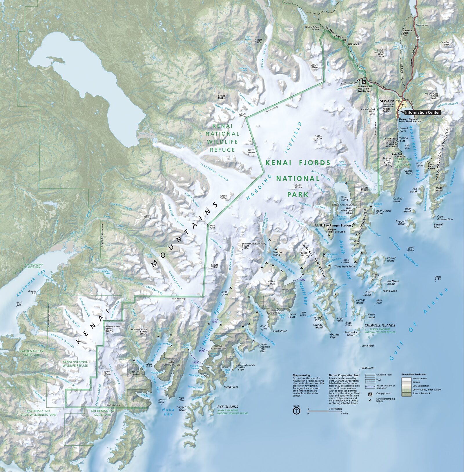
The official park map handed out at entrance stations, with roads, areas, visitor centers and services. View it here or download it for offline use.
Download the map (PDF) Public domain · National Park ServiceWhere Is Kenai Fjords?
Kenai Fjords is in Southcentral Alaska, on the Kenai Peninsula along the Gulf of Alaska. The park borders Seward, which you can reach year-round via the Seward Highway from Anchorage, about 124 miles away. There is no land access from the rest of the continental United States without crossing Alaska. Kenai Fjords is a remote, end-of-the-road park, and that isolation is exactly what shapes its character.
The park is part of the larger Southcentral Alaska region, between the Chugach Range and the gulf. To place Kenai Fjords within Alaska's network of national parks, our Regions guide will soon provide a broader perspective.
Download the Official Kenai Fjords Map (NPS Unigrid)
The NPS provides a free Unigrid map in PDF format on the park's official Maps page. It includes:
- a detailed map of the Exit Glacier area, including marked trails, the visitor center, and parking;
- an overview of the coastline and coastal fjords accessible by boat;
- the park boundaries and areas with strict protection.
Practical tip: print it on A3 paper before you leave. The original format was designed for that, and the Exit Glacier trail details are much easier to read on paper than on a phone screen, especially in Alaska's rain.
Kenai Fjords Areas
The park is divided into two major geographic areas with very different levels of accessibility.
Exit Glacier and the Harding Icefield
This is the only part of the park you can reach by road. A turnoff from the Seward Highway leads to the Exit Glacier Visitor Center, the starting point for all land trails. You can see the glacier from the parking lot. Markers along the route show the glacier's successive terminus positions since the 19th century, and the retreat is striking. The Harding Icefield Trail is more demanding, covering about 8.1 miles round-trip with 3,600 feet of elevation gain. It takes you up to the icefield plateau and offers a sweeping view of one of the largest ice fields in the United States. This is the park's busiest and most accessible area for a family outing or a trip without marine equipment.
The Coastal Fjords
The rest of the park, which accounts for most of its area, is accessible only by boat or floatplane from Seward. The jagged coastline is home to several major fjords: Aialik Bay, with Aialik and Holgate glaciers; Northwestern Fjord, with several active calving fronts; and McCarty Fjord and Harris Bay, where you'll find Bear Glacier. Full-day boat tours from Seward are the most common way to explore this area. Marine wildlife is everywhere. The Kenai Fjords wildlife guide explains which species you can see during each season.
Park Entrances and Road Access
Kenai Fjords doesn't have a traditional entrance station, and there's no entrance fee to access the park. The only paved road leads to Exit Glacier via a turnoff from the Seward Highway a few miles north of Seward. It's about 8.1 miles of well-maintained road during the summer season. The road isn't plowed in winter and closes to motorized traffic once snow and ice settle in, generally from November through April. Beyond this road corridor, no road crosses the park. You don't drive through Kenai Fjords. You reach it by a dead-end road or by sea.
Points of Interest and Map Viewpoints
Here are the landmarks to locate on the map before you leave:
- Exit Glacier: the glacier terminus is accessible on foot from the parking lot, with markers showing its retreat since the 19th century.
- Harding Icefield: from the trail's highest point, you get a panorama of the endless white expanse.
- Aialik Bay: Holgate Glacier, sheer cliffs, puffin colonies, and harbor seals.
- Northwestern Fjord: an active calving area with an unforgettable sound and visual display.
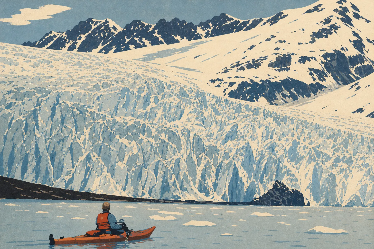
- Bear Glacier: a calving lagoon accessible by sea kayak from Seward.
The Kenai Fjords activities guide explains what each site offers in practical terms.
Nearest Towns and Airports
Seward is the gateway town for the park. It borders the Exit Glacier access road and Resurrection Bay, the departure point for all sea excursions. Lodging, restaurants, and boat tour operators are concentrated there. The Where to Stay in Kenai Fjords guide lists options in Seward and nearby.
Anchorage is the main city for air connections, about 124 miles north via the Seward Highway. Ted Stevens Anchorage International Airport (ANC) is the region's main hub. Some visitors stay in Anchorage and drive to the park for day trips. For all the logistics, including car rentals, shuttles, and driving times, the Kenai Fjords Access guide has everything you need to know about getting there.
Paper Hiking Maps and Trail Guides
For hikers who want a detailed paper trail map, the National Geographic Trails Illustrated series offers a dedicated Kenai Fjords map, No. 231. It covers Exit Glacier and the Harding Icefield with enough detail for an independent outing. You can find it at bookstores specializing in maps and travel, as well as on sites such as Cartovia.
For a coastal trip with a sea-kayak campout, a marine navigation guide is also recommended. Distances on the water and weather conditions can change quickly in the Gulf of Alaska. Our complete Kenai Fjords guide lists useful resources to review before you leave.
Frequently Asked Questions
What is the closest town to Kenai Fjords?
The closest town to Kenai Fjords is Seward, Alaska, which borders the park directly. It's the departure point for all boat trips to the coastal fjords, and the Exit Glacier access road is only a few miles from downtown.
How many days should you plan for Kenai Fjords?
How many days you need depends on what you want to see. One day is enough for Exit Glacier. The coastal fjords require at least one full-day boat tour. Two to three days let you combine both without rushing. One- to three-day itineraries are available in the Kenai Fjords itinerary guide.
How old are the Kenai Fjords?
Glaciers carved the Kenai Fjords during the last major ice age, tens of thousands of years ago, during the Pleistocene. You can see the glaciers' retreat since the 19th century directly at Exit Glacier, where markers date the successive positions of the glacier terminus.
Which country is known for its fjords?
Norway is the country best known for its fjords. Its western coast is home to Europe's deepest and most spectacular fjords. The Kenai Fjords use the same geological term for similar glacier-carved landforms, but in a radically different Alaskan setting.