
Glacier Bay Itinerary: What to See in 1, 2, or 3 Days
You can't tour Glacier Bay by car. There are no roads to the glaciers, no viewpoints a few minutes from a parking lot, and no grand loop drive. Everything happens on the water, aboard a cruise boat or sea kayak. That's what makes the park so fascinating, and why you need to set your priorities before you board.
Ideal length: 2 to 3 days. One day is enough to reach the major glaciers on a cruise. Two days give you time to add kayaking and the trails at Bartlett Cove. Three days let you experience the bay from several angles, watch humpback whales, and settle into the park's rhythm. Our complete Glacier Bay guide gives you the big picture before you get into the logistics.
How Long Do You Need to Visit Glacier Bay?
Glacier Bay National Park covers more than 3.2 million acres, and almost all of it is accessible only by boat. The ideal length of your trip depends above all on how you plan to explore.
On an organized cruise: A full day on the water, or 8 to 9 hours round-trip, takes you up the West Arm to the tidewater glaciers at Margerie and Johns Hopkins, with frequent stops for whales and seals. This is the shortest practical option.
By sea kayak: Plan on 3 to 7 days, depending on your experience and ambitions. A self-guided expedition into the bay's northern inlets is a serious undertaking. You'll need a backcountry camping permit, a water-taxi drop-off in remote areas, and constant awareness of brown bears.
For most visitors: Two to three nights in Gustavus or Bartlett Cove let you combine a full-day cruise, a forest hike, and a half-day of coastal kayaking. That's our recommendation for a first visit.
Getting There, Park Entrances, and Getting Around
Reaching Glacier Bay
No national highway connects to Glacier Bay. You have two ways to get there: by air or by water.
By air: Daily seasonal flights connect Juneau with Gustavus Airport, about a 15-minute flight. It's the fastest and most flexible option. Regional airlines also offer service from Skagway and other towns in Southeast Alaska.
By ferry: The AMHS (Alaska Marine Highway System) connects Juneau and Gustavus several times a week during the summer season. The crossing takes about 4.5 hours. It's slower but often cheaper, and it works well if you're bringing camping gear or a kayak.
Once you're in Gustavus, the area's only road runs 10 miles on flat ground between town and Bartlett Cove, the park headquarters. Shuttles leave the airport after each arrival. Renting a bike is popular for this stretch.
Ferry schedules, regional airlines, and shuttle options are covered in the Glacier Bay access guide.
Getting Around the Park
Beyond Bartlett Cove, there are no roads. You need a boat to travel anywhere in the bay.
The daily cruise: Glacier Bay Lodge operates a boat that leaves every morning from the Bartlett Cove dock, in season from late May through early September. It's the main way to reach the glaciers and the park's essential experience.
Water taxis: Kayakers and campers heading into remote areas can arrange drop-offs and pickups at designated points around the bay.
Sea kayaking: You can rent a kayak in Bartlett Cove and explore the lower bay independently. Reaching the northern inlets, including West Arm and Muir Inlet, requires a water-taxi drop-off unless you're a highly experienced paddler.
Private boats: Yachts and sailboats may enter the bay if their operators register in advance with the Visitor Center. A daily quota limits the number of boats to protect humpback whales.
The Glacier Bay transportation guide covers all your options for getting around the park.
Glacier Bay's Main Areas
Glacier Bay's geography runs from south to north. You enter through the broad, open lower bay, then the bay splits into two main inlets that reach toward active glaciers. Understanding this layout before you board makes the route much easier to follow.
Gustavus: The Gateway Town
Gustavus has fewer than 500 residents, and its shopping options are limited. You'll find most of the lodging outside the park here, including bed-and-breakfasts, small family-run hotels, and kayak rentals, as well as the area's only ATM. It's the logical base for a multiday stay. The Glacier Bay lodging guide lists all your options.
Bartlett Cove: The Only Developed Hub
Bartlett Cove is the park's only developed area. Glacier Bay Lodge offers lodging and a restaurant here, along with the Visitor Center on the second floor. The park campground is right nearby. Two marked trails lead through the surrounding boreal forest: the Forest Trail, about 0.9 miles, and the Bartlett River Trail, about 8.7 miles round-trip.
The forest around Bartlett Cove deserves some time. Ice covered this land less than 300 years ago. The vegetation offers a living demonstration of ecological succession, starting with pioneering alder and progressing to taller and taller Sitka spruce as you move away from the original glacier. The beach is also the easiest place to spot bald eagles.
The Glacier Bay activities guide covers every option with practical advice for each one.
West Arm: Active Glaciers
The West Arm is home to the park's most spectacular tidewater glaciers. Every commercial cruise heads this way.
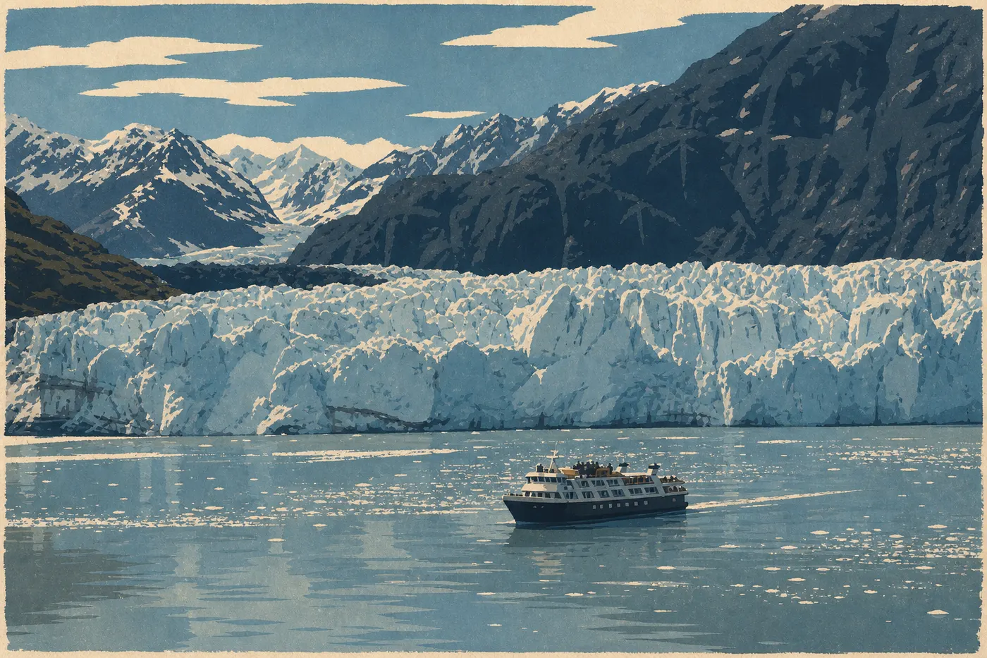
Margerie Glacier is the guides' favorite for close approaches. Its blue-and-white ice face rises about 100 feet and regularly calves with a deep rumble. When we visited, the boat stayed the required 1,300 feet away as a massive slab broke off and plunged into the bay with a cannon-like boom.
Johns Hopkins Glacier is closed to boat traffic from May through mid-July to protect harbor seals pupping on the icebergs at the fjord's entrance. Outside that period, boats may approach more closely. Notably, it's one of the few glaciers in Alaska that is still advancing instead of retreating.
Lamplugh Glacier stands out for its exceptionally deep blue ice, a sign of extreme density and the near-total absence of air in the glacier.
Grand Pacific Glacier reaches all the way to the Canadian border. Its face is less active than Margerie Glacier in terms of calving, but its size makes it the largest glacier in the bay.
Muir Inlet: A Wild Adventure
Less visited than the West Arm, Muir Inlet mainly attracts kayakers and sailors. The glaciers have retreated farther here, leaving behind steep-sided fjords, glacial-clay beaches, and more abundant land wildlife, including brown bears and gray wolves. Commercial cruises don't serve this area. It's territory for experienced paddlers looking for quiet and solitude.
Day-by-Day Itinerary
Day 1: Arrive and Explore Bartlett Cove
Arrive on a morning flight from Juneau. Take the shuttle to Bartlett Cove, or rent a bike, which is a popular choice on the 10-mile flat road. Check in at Glacier Bay Lodge or the campground.
Afternoon: Explore Bartlett Cove on foot. The Forest Trail takes 45 minutes. The view across the bay from the beach is especially striking in late afternoon, when the low light brings out the blue reflections of ice suspended in the water.
The essential stop is the Visitor Center. Pick up the official park map, catch a presentation, and, most importantly, talk with the rangers. Every morning, they update visitors on glacier conditions, the previous day's wildlife sightings, and current weather alerts.
In the evening, attend the interpretive program at 8 p.m. A ranger spends 45 minutes explaining the bay's glacial history. It's a useful introduction to the cruise the next day.
Day 2: Cruise to the West Arm Glaciers
Board at the Bartlett Cove dock at 7:30 a.m. Reservations are required, and you should book well ahead for July. The boat heads north for 2 to 3 hours before entering the West Arm.
Lower Bay: Look for sea otters, Dall's porpoises, and, depending on the season, humpback whales. The boat slows down whenever wildlife appears. An onboard ranger provides a running commentary on the wildlife and geology. A hydrophone hanging beneath the hull broadcasts the whales' songs through speakers on the deck.
Lamplugh and Grand Pacific Glaciers: The upper deck offers narrated views as you approach.
Johns Hopkins Inlet: Access varies depending on the harbor seal pupping season.
Margerie Glacier: Stop for 30 to 45 minutes in front of the glacier face. The silence between calvings is an experience in itself.
Return to Bartlett Cove around 3:30 p.m. Have dinner at the lodge restaurant, which serves a simple menu with local seasonal fish.
Day 3: Kayaking, Hiking, and Departure
Morning: Sea kayak from Bartlett Cove Beach. You don't need previous experience for the coastal area. The water is sheltered, currents are light, and you won't be navigating offshore. Paddle north along the beach and watch for great blue herons and sea otters. Early in the morning, it's not unusual to see a brown bear searching the wrack line.
Afternoon: Hike the Bartlett River Trail. The trail follows the Bartlett River through a forest of spruce and alder. Salmon run from late July through September, and bald eagles perch in the spruces waiting for them. The Glacier Bay hiking guide has exact trail stats and durations.
Return to Gustavus in the evening, then fly back to Juneau the following morning.
Itineraries by Trip Length
Express, one day from Juneau: Some companies offer charter flights from Juneau paired with the day's cruise and an evening return. It's a workable option if you're stopping in Juneau on a cruise. The tradeoff is clear: there's no flexibility if the weather turns, and you won't really have time to settle into the park.
Classic, 2 to 3 days: Follow the itinerary above. This is our recommendation for a first visit. You'll see glaciers, paddle, hike, and have time to adjust to Alaska's distinctive summer light. If you have a third full day, you can add a guided fishing trip or birding outing.
Long stay, 5 to 7 days with a multiday kayak trip: A bay camping permit lets you plan a self-guided expedition in the West Arm or Muir Inlet. The NPS limits the number of campers at one time to preserve quiet areas. Permits go quickly early in the season. Required experience includes at least intermediate kayaking skills, a complete cold-water setup, map-reading ability, and knowledge of Alaska bear-safety rules. The Glacier Bay camping guide explains the permit requirements in detail.
Itinerary Map
The NPS publishes a free official map in Unigrid format. You can pick it up at the Bartlett Cove Visitor Center when you arrive. It shows the bay's two arms, glacier names, backcountry camping areas, and protected zones, including the area around Johns Hopkins during seal pupping season. It's essential for kayakers because distances on the water are much greater than they look, and restricted areas are clearly marked.
Our Map page offers an annotated digital version with the main landmarks, so you can plan your itinerary before you leave.
Where to Stay Along the Itinerary
Glacier Bay deliberately has limited lodging options to protect the park's natural character.
Inside the park: Glacier Bay Lodge at Bartlett Cove is the only hotel inside the park. The Bartlett Cove Campground is free and doesn't require reservations, with a maximum stay of 14 consecutive nights.
In Gustavus: About a dozen B&Bs and small hotels, some with shuttles to Bartlett Cove, make up most of the area's midrange lodging.
Our Where to Stay page and Camping page cover all the options, including prices and reservation policies.
Extend Your Trip: What to See Around Glacier Bay
Nearly all visitors pass through Juneau, the natural gateway for flights to Gustavus. Skagway and Sitka, each less than an hour away by air, let you extend your trip. Skagway offers Gold Rush history, while Sitka is known for Tlingit culture and Russian Orthodox architecture.
The Best Itinerary for Your Time
| Length | Plan | What you'll see |
|---|---|---|
| 1 day | Cruise from Juneau, with flight and boat | West Arm glaciers, whales, seals |
| 2 days | Cruise plus coastal kayaking | Plus Bartlett Cove's boreal forest and coastal wildlife |
| 3 days | Full itinerary | Plus the Bartlett River Trail and Arctic sunsets |
| 5 to 7 days | Multiday kayak expedition | Muir Inlet or the West Arm independently, with backcountry camping |
Glacier Bay is a park of water and silence. It rewards those who stay still long enough to watch a glacier calve, a whale blow, or a bald eagle dive. Leave some room in your schedule. Southeast Alaska weather can upend your plans within hours, and the best moments often don't appear on any original itinerary. Our When to Go page provides month-by-month weather trends to help you adjust your dates.
Frequently Asked Questions
How do you get to Glacier Bay?
You can reach Glacier Bay only by air or by water. No national highway connects to the bay. Seasonal daily flights connect Juneau with Gustavus Airport in about 15 minutes. The AMHS ferry makes several crossings each week from Juneau, with a travel time of about 4.5 hours.
How do you explore Glacier Bay National Park?
Start with the daily cruise from Bartlett Cove, which covers the major glaciers of the West Arm in a single day. Experienced kayakers can get a camping permit for multiday expeditions in the bay. The areas you can explore on foot are limited to Bartlett Cove.
What is the Glacier Road?
“Glacier Road” isn't an official road name in Glacier Bay. There is no road to the bay. The phrase informally refers to the water route toward the West Arm, where the active tidewater glaciers are concentrated: Margerie, Johns Hopkins, Lamplugh, and Grand Pacific. It's the standard route for every park cruise.
What's the best itinerary for visiting the national parks of the American West?
Glacier Bay is in Alaska, so it doesn't fit into a circuit of the national parks in the continental Southwest, such as Utah, Arizona, or California. It works better as a trip of its own or as part of a Southeast Alaska road trip combined with Juneau, Skagway, or Sitka. Several itineraries combining Glacier Bay, Juneau, Skagway, and Sitka are possible in this region.