
National Park of American Samoa Itinerary: What to See in 1, 2, or 3 Days
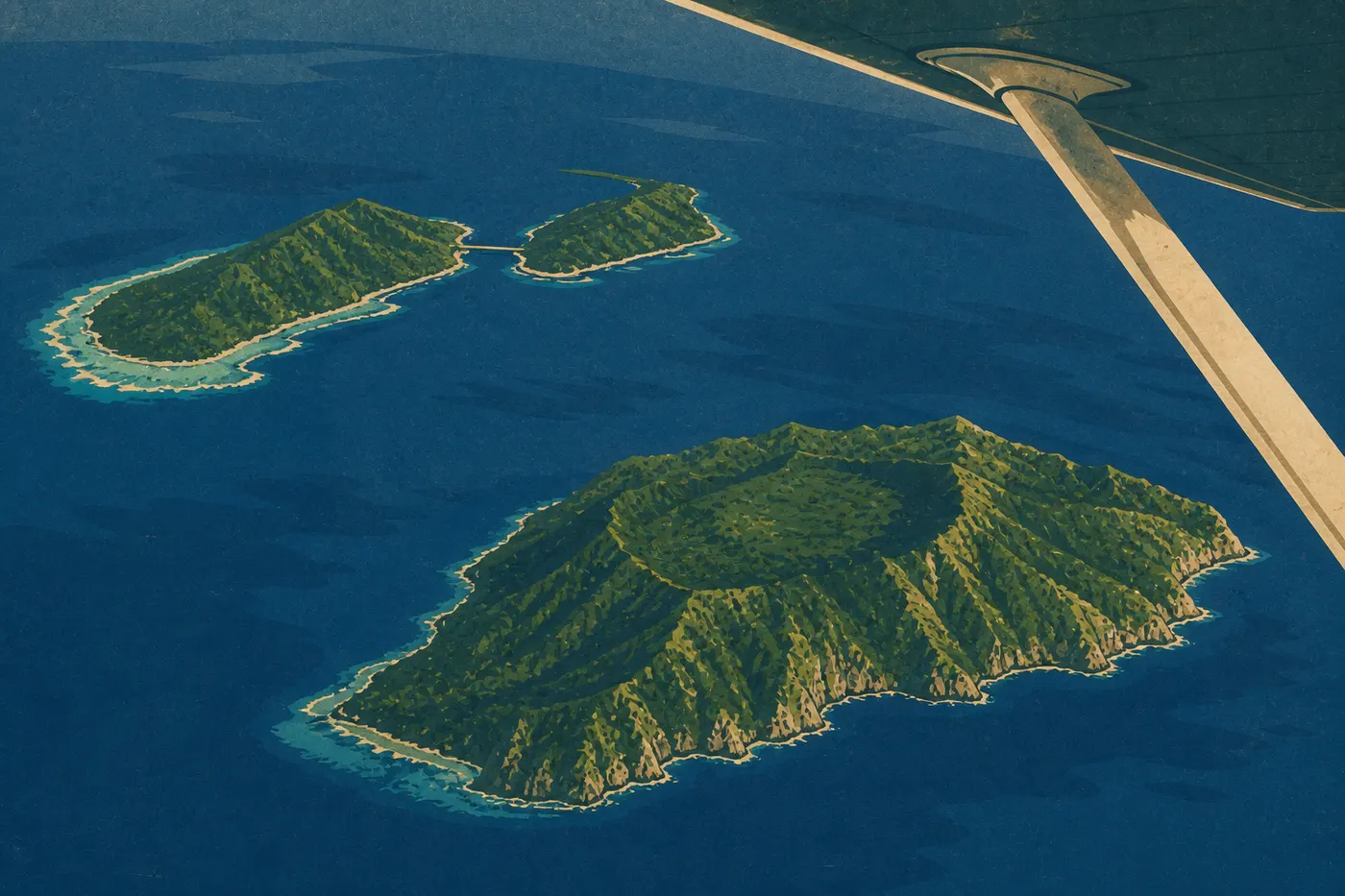
Three islands, one park, and no road connecting them. The National Park of American Samoa is the only U.S. national park in the Southern Hemisphere, and its scattered geography calls for a different approach from anything you may know: start with Tutuila (the main island and the only one served by the international airport), then branch out to Ofu and Taʻu depending on how much time you have. Two days are enough to see the highlights of Tutuila. Add a day for each outlying island to experience landscapes that very few visitors to U.S. national parks ever discover.
How Much Time Do You Need to Visit the National Park of American Samoa?
The right amount of time depends directly on how many islands you want to visit.
One day: Tutuila only. You can cover the visitor center, Pago Pago Harbor, and the Mount ʻAlava Trail. It's a short visit, but a realistic one if you arrive early in the morning.
Two to three days: this works for most visitors. Two days let you cover Tutuila without rushing (the north shore, ridges, and coastal villages). A third day on Ofu gives you access to one of the best-preserved coral reefs in U.S. territory.
Five days or more: essential if you want to combine Ofu and Taʻu. Inter-island flights run only a few times a week, and sometimes less often in the off-season. You'll need to spend at least one night on each island, and booking ahead is essential.
Don't wait until the last minute to plan inter-island flights. The small aircraft fill up weeks in advance in July and August. The American Samoa seasons guide can help you choose the best time to visit.
Getting There, Park Entrances, and Getting Around
Arriving on Tutuila
Pago Pago International Airport (IATA code: PPG) is the only air gateway to American Samoa. Hawaiian Airlines operates regular flights from Honolulu. Some travelers connect through Fiji Airways from Nadi or through the independent Samoan islands (Faleolo Airport, Apia), which lets them combine both archipelagos in a single Pacific itinerary.
The park has no entrance booth, gate, or fee. Its lands are spread across several Tutuila villages (Pago Pago, Vatia, Fagasa, and Afono) and the two outlying islands (Ofu and Taʻu). Access is free and open 24 hours a day, 365 days a year.
The visitor center is in the village of Pago Pago, across from the Pago Way gas station. It's open weekdays from 8 a.m. to 3 p.m. This is the logical place to start. Pick up the official Unigrid map and ask the rangers your questions before heading onto the trails.
Getting Around Tutuila
Renting a car is the most flexible way to reach remote trailheads. Rental agencies operate out of Pago Pago, and people drive on the right, as they do on the U.S. mainland. The “aiga buses,” brightly colored family buses, serve the main villages, but their schedules are irregular. They work well for getting to the market, less so for planning a 7 a.m. hike. Taxis are available downtown. For help getting around the island, see the guide to getting around Tutuila.
Getting to Ofu and Taʻu
Small planes connect Pago Pago Airport with the airstrips on Ofu and at Fitiuta (Taʻu), with a flight time of about 40 minutes. Seats are limited, so book as soon as your itinerary is set. A ferry also connects Pago Pago with the outlying islands, but crossings take several hours and schedules vary by season. Full details are in the guide to getting to American Samoa.
Park Areas
Tutuila: Pago Pago, the Ridges, and the North Shore
Tutuila has nearly all of the park's visitor facilities and its best-marked trails. Pago Pago's natural harbor, ringed by rainforest-covered mountains, sets the tone as soon as you arrive. It's one of the deepest natural harbors in the Pacific. The Vatia area on the north shore has the park's most photographed views. You'll find turquoise waters there and, rising in front of them, Pola Island, a rocky islet shaped like a sugarloaf. The villages of Fagasa and Afono also lie within park lands, reached by a ridge road overlooking both sides of the island.
Ofu: Coral Reef and Beach
Ofu Beach is regularly listed among the best-preserved beaches in the U.S. national park system. The reef runs right along the sand, so a mask and snorkel are all you need to see healthy coral and abundant marine life just a few feet from shore. The island is small and lightly populated, with only basic lodging run by the NPS. Come for the reef, not the comforts.
Taʻu: Old-Growth Forest and Cliffs
Taʻu is the wildest island in the group. It is home to Mount Lata (about 3,170 feet, the highest point in American Samoa) and coastal cliffs that plunge straight into the Pacific. Large areas of rainforest remain virtually untouched. Trails are less maintained than on Tutuila, so expect consistently muddy ground even in the dry season, and bring waterproof shoes.
Day-by-Day Itinerary
Day 1: Pago Pago, the Harbor, and Mount ʻAlava
Start at the Pago Pago visitor center, which opens at 8 a.m. Spend 30 minutes with the exhibits on fa'asamoa culture and park ecology. That cultural context will shape how you experience the rest of your stay.
Late in the morning, hit the Mount ʻAlava Trail from the road overlooking the harbor. The climb is steep, and humidity stays high year-round. Bring at least 2 liters of water, quick-drying clothes, and good trail shoes. From the summit, you'll see Pago Pago Harbor on one side and Vatia Bay on the other. On a clear day, Pola Island stands out on the northern horizon.
In the afternoon, head down into Pago Pago to explore the central market and waterfront. Dinner in town is a good introduction to local Polynesian food. The Pago Pago restaurant guide lists places to eat in the village.
Day 2: The North Shore, Vatia, and the Park Villages
Set out early, before 8 a.m. if possible, for the north shore. Morning light on the bays is clear before tropical haze rolls in around 10 a.m. Take the ridge road above Afono Bay. The turn where the bay opens up is worth a stop. Continue on to Vatia.
In Vatia, a short walk leads to an overlook facing Pola Island. Village lands are part of the park under a co-management agreement between the NPS and Samoan traditional leaders. Respect posted private areas, and always ask permission before photographing residents.
The afternoon can accommodate a second trail outing toward Fagasa, depending on how you feel. The American Samoa hiking guide covers Tutuila's trails, including elevation gain and estimated times. The activities guide covers non-trail outings such as guided diving, cultural visits, and markets.
Day 3: Ofu, Reef, and Beach
Take the morning flight to Ofu (40 minutes). Drop your bags at the NPS shelter and head straight to the beach. Light is best from 9 to 11 a.m., before tropical clouds build over the ridges. You can reach the reef from shore, where water is generally above 81°F year-round. The Tuafanua Trail follows the coast and reaches quieter stretches of reef.
Take an afternoon flight back to Tutuila, or stay one more night on Ofu for another morning in the water. Our Hiking page lists Ofu's trails and reef access points.
Options Based on Your Trip Length
Express version (1 day): Tutuila only. Spend the morning at the visitor center and hike Mount ʻAlava, without detouring to Vatia. You'll leave with a complete picture of the main island, but you won't have reached the outlying islands.
Classic version (2–3 days): two days on Tutuila (Mount ʻAlava on day one, the north shore and Vatia on day two), followed by a flight to Ofu on day three. This is the format we recommend for a first visit. It combines rainforest, Samoan culture, and coral reef without requiring too many nights on the outlying islands.
Immersive version (5 days or more): Tutuila (2 days), Ofu (1 to 2 nights), and Taʻu (1 to 2 nights). You'll need this much time to see Taʻu's cliffs and old-growth forest. Book inter-island flights as soon as you reserve your main ticket. Availability disappears quickly in the high season. To extend your itinerary beyond American Samoa, our Pacific road trips offer routes to the neighboring independent Samoan islands.
Itinerary Map
The NPS publishes an official “Unigrid” map of the park, available free at the Pago Pago visitor center. It shows all three islands to scale, marks official trailheads, and outlines areas that are part of traditional lands. Download it before you leave. Cell service on Ofu and Taʻu is very intermittent. The annotated park map reproduces this map with the park areas and main points of interest.
Where to Stay Along the Itinerary
On Tutuila, several hotels and guesthouses are available in Pago Pago and nearby villages. On Ofu, the NPS shelter offers basic lodging. Bring sheets or a lightweight sleeping bag, along with your food. On Taʻu, options are even more limited. Our Where to Stay page lists options by island with up-to-date contact information.
Extending Your Trip: What to See Around the Park
American Samoa borders the independent Samoan islands of Upolu and Savaiʻi, which you can reach by flying from Pago Pago through Apia. These islands lie outside the national park, but they fit naturally into a Pacific itinerary. Our region guides cover possible extensions from Pago Pago to other South Pacific destinations.
The Ideal Itinerary for Your Time
Two days on Tutuila cover the highlights: rainforest, Samoan culture, Pago Pago Harbor, and panoramic ridges. Three days, with a flight to Ofu, add an exceptional coral reef. Five days let you include Taʻu and its nearly untouched old-growth forest.
Whatever your schedule, the rule stays the same: book inter-island flights as soon as you start planning, leave two to three hours of extra time each day because tropical rain can arrive without warning, and always start with Tutuila. Everything else follows.
Frequently Asked Questions
Is American Samoa worth visiting?
American Samoa is worth the trip for anyone looking for a U.S. national park away from the usual routes. Ofu's reef, Taʻu's old-growth forest, and the warmth of Samoan hospitality make it entirely different from the parks on the mainland. Logistics are more complicated than elsewhere, but that's exactly what protects these places from mass tourism.
How many days do I need in American Samoa?
Plan on at least two days to cover Tutuila properly. Add one or two days for each outlying island (Ofu and Taʻu) if you want to explore them. Five days make a comfortable trip that covers all three islands without rushing.
How do I get to American Samoa?
You can reach American Samoa by flying from Honolulu on Hawaiian Airlines, with several flights each week to Pago Pago International Airport (PPG). If you're flying from abroad, one option is to connect through Los Angeles and then Honolulu. Our Access & Transportation page covers connections and transit times.
How do I get from one island to another (Tutuila, Ofu, and Taʻu)?
Small planes connect Pago Pago with the airstrips on Ofu and at Fitiuta (Taʻu) in about 40 minutes. A ferry is also available, but schedules are very irregular. Seats on the planes are limited, so book well ahead, especially for July and August.
Can I drive through the park?
On Tutuila, a car can take you to the park's main areas, including Vatia, Afono, and Fagasa. There is no single through road like you find in mainland parks. Park lands are interwoven with villages and Samoan traditional lands. Ofu and Taʻu are accessible only by plane or ferry.
How much does it cost to enter the park?
Admission to the National Park of American Samoa is completely free. You don't need an entrance fee or advance reservation to visit the trails. The visitor center is also free and open weekdays from 8 a.m. to 3 p.m. Additional costs such as lodging, inter-island flights, and activities are covered in the relevant sections of this guide.
When is the best time to visit the park?
The dry season, from June through September, is generally more favorable, with less rain and a lower risk of cyclones. The park is open year-round, and trails remain usable during the wet season from October through May, when rain is often brief but intense. Our When to Visit page details conditions month by month.