
Theodore Roosevelt Hiking Guide: The Best Trails for Every Ability
Theodore Roosevelt National Park is one of the least visited national parks in the United States. That's exactly what makes it such an exceptional place to hike: North Dakota's badlands unfold in red scoria ridges sculpted by wind and the Little Missouri River, with Gunnison's prairie dog towns, free-ranging bison, and wild horses appearing from the ravines. The marked trail network is intentionally modest, but every mile is worthwhile.
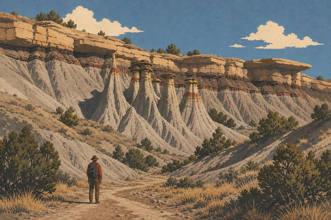
The hike you shouldn't miss: the Caprock Coulee Trail (North Unit, 4.0-mile loop, moderate) offers the park's most complete badlands panorama, with multicolored geological layers rising above the valley like an orange-and-purple layer cake. For a short, spectacular outing, the Wind Canyon Trail (South Unit, 0.5 miles round-trip, easy) takes about 20 minutes and offers a sweeping view of a river bend that photos never quite capture. For a full day and guaranteed solitude, the Achenbach Trail (North Unit, about 17-mile loop) is the answer.
How to Prepare for Your Theodore Roosevelt Hike
Permits and Regulations
You don't need a permit for day hikes in the park. If you want to camp in the backcountry, a free wilderness permit is required. You can get one at the South Unit visitor center in Medora or the North Unit visitor center. Dogs are prohibited on all trails and in the backcountry. They're allowed on paved roads and in campgrounds, but must be kept on a short leash.
Water: An Absolute Rule
Theodore Roosevelt's trails have no water sources. Bring at least 2 liters per person for a short outing, and more in summer, when temperatures in exposed canyons regularly reach 95°F.
Wildlife: Keep Your Distance
Bison roam freely on trails and around trailheads. Park rules require you to stay at least 75 feet from any bison. If an animal blocks your path, wait without trying to pass too closely. Prairie rattlesnakes live in rocky areas and tall grass, especially in summer, so watch where you step. In Gunnison's prairie dog towns, stay on the marked trail to avoid burrows.
Terrain and Safety
The badlands' clay soil, known as bentonite, becomes extremely slippery after rain. Put off any canyon outing if thunderstorms are in the forecast because flash floods can rise quickly. Cell service is almost nonexistent across most of the park. Bring a paper map for any backcountry outing.
The Best Hikes, Unit by Unit
South Unit: Badlands, Prairie Dogs, and Petrified Forest
The South Unit has most of the park's marked trails. The main entrance is in Medora, via Interstate 94 exits 24 and 27. Scenic Loop Drive provides access to all the trailheads from the visitor center.
Wind Canyon Trail (0.5 miles · round-trip · little elevation gain · easy · 20 to 30 min)
Climb for ten minutes to a ridge, then take in a 180-degree view of the Little Missouri River winding through the badlands. The effort-to-panorama ratio is hard to beat anywhere in the park. The trailhead is on the south side of Scenic Loop Drive. Seasonal tip: come in the late afternoon for raking light across the orange formations.
Coal Vein Trail (1.0-mile loop · little elevation gain · easy · 30 to 45 min)
A coal seam burned underground for several decades in the 20th century, baking the surrounding rocks and creating pink and red scoria formations found nowhere else in the park. The interpretive signs are well designed and explain the geology clearly. It's ideal for curious kids. The trailhead is on the northeast side of Scenic Loop Drive.
Ridgeline Trail (1.8-mile loop · moderate elevation gain · moderate · 1 to 1.5 hours)
This trail follows the badlands ridges of the South Unit and opens onto unobstructed views of the prairie. You'll regularly see bison grazing and, in spring, wildflowers contrasting with the gray rock. The loop is well marked and rarely crowded. The trailhead is near Cottonwood Campground.
Jones Creek Trail (4.5 miles · round-trip · moderate elevation gain · moderate · 2 to 2.5 hours)
This trail descends into Jones Creek Canyon, which is much shadier and greener than the exposed ridges. This is where you'll notice the park's greatest variety of birds: songbirds, raptors, and ducks in wet areas. Go early in the morning for a chance to see deer, too. The trailhead is on Scenic Loop Drive.
Petrified Forest Loop (about 16 miles · loop · difficult · full day or backcountry overnight)
This route isn't fully marked and is only for hikers experienced with map reading. It leads to outcrops of petrified, silicified tree trunks dating back millions of years. A wilderness permit is required for an overnight stay. Be sure to check with the visitor center about trail conditions before setting out.
Painted Canyon: A Spectacular Entrance off I-94
Painted Canyon Visitor Center, off I-94 at exit 32, is separate from the main Medora entrance. It has its own trail and is often travelers' first introduction to the park's badlands.
Painted Canyon Trail (about 1.0-mile loop · easy to moderate · 45 min to 1 hour)
Descend from the overlook into the canyon between colorful ridges and layered clay. Morning and late-afternoon light completely transform the palette of ocher, mauve, and steel gray. The trailhead is in the visitor center parking lot, directly accessible from the highway.
North Unit: Caprock Formations and Solitude
The North Unit is about 68 miles north of Medora along Highway 85, near Watford City. Less visited than the South Unit, it offers different scenery: cliffs of compact sandstone, or caprock, overlook a more heavily wooded and quieter valley.
Little Mo Nature Trail (1.5-mile loop · little elevation gain · easy · 45 min to 1 hour)
This interpretive loop follows the Little Missouri River and is shadier than most of the park's trails. It's a good choice for spotting waterfowl, beavers, and deer early in the day. The trailhead is at the North Unit campground.
Caprock Coulee Trail (4.0-mile loop · moderate elevation gain · moderate · 2 to 2.5 hours)
This is our top recommendation for a half-day in the North Unit. The trail climbs onto the caprock plateaus, with views of multicolored geological layers that seem to overlook a science-fiction landscape. Bison herds often graze in the intervening prairies. The trailhead is at Caprock Coulee trailhead on the scenic road.
Achenbach Trail (about 17 miles · loop · difficult · full day or backcountry overnight)
The North Unit's signature trail is reserved for experienced hikers. The route descends to the Little Missouri River, which you'll have to ford twice. Water levels vary with rainfall. The canyon-bottom sections are spectacular and almost deserted. Get a wilderness permit if you're staying overnight. Wear shoes you don't mind getting wet.
Easy, Family-Friendly Hikes
Theodore Roosevelt has several options for hiking with kids or taking a first outing in a desert landscape.
The Wind Canyon Trail (0.5 miles round-trip, South Unit) is the park's best payoff for a short hike. The Coal Vein Trail (1.0-mile loop, South Unit) fascinates kids with its colorful scoria formations and geological explanations. In the North Unit, the Little Mo Nature Trail (1.5-mile loop) is shadier and follows the river, making it a good choice in the heat of summer.
Keep in mind that no trail in the park is suitable for a stroller because the terrain is too rough. For kid-friendly activities off the trails, such as ranger programs and wildlife viewing from the car, the guide to visiting Theodore Roosevelt with kids covers your options.
Challenging Hikes: Panoramas and Technical Terrain
For a full-day outing with elevation gain and true immersion in the landscape, two trails stand out.
The Caprock Coulee Trail (4.0 miles, North Unit) offers panoramic views without any particularly technical sections. It's the hike we recommend first in the North Unit: short enough to finish in the morning and varied enough to keep things interesting.
The Jones Creek Trail (4.5 miles, South Unit) leads to a narrow canyon and beautiful wet areas far from the scenic road. You can easily combine it with the Ridgeline Trail (1.8 miles) on the same day if you want to link canyon and ridges from Medora.
For landscape photographers, late-afternoon light on Wind Canyon and dawn light on Painted Canyon are worth the detour. Check the Theodore Roosevelt weather forecast to anticipate seasonal lighting conditions.
Access, Trailheads, and Parking
South Unit (Medora): The main entrance is in Medora, accessible via I-94 exits 24 and 27. From the visitor center, Scenic Loop Drive leads to all the main trailheads. Trailhead parking along the loop is free. During peak season, from June through August, the Wind Canyon parking area fills up quickly in the late afternoon.
Painted Canyon: I-94 exit 32, east of Medora. Free parking at the visitor center. Open seasonally.
North Unit: About 68 miles north of Medora along Highway 85. Parking is available at the various pullouts along the scenic road.
Elkhorn Ranch Unit: Accessible only via an unpaved road. A high-clearance vehicle is recommended. There are no marked trails or facilities. This is the site of the ruins of Theodore Roosevelt's 1880s ranch, lost in a prairie along the Little Missouri. Check with the visitor center about road conditions before you leave.
The entrance fee is $30 per vehicle, $25 per motorcycle, or $15 per person entering on foot or by bicycle. The America the Beautiful pass ($80 per year) is accepted, as is the park's annual pass ($55). For details on access by unit and transportation options, see the Theodore Roosevelt access guide.
When to Hike in Theodore Roosevelt
The park is open year-round, 24 hours a day. Conditions vary considerably by season.
Spring (April to May) and fall (September to October) are ideal: mild temperatures of 50 to 72°F, beautiful photographic light at sunrise and sunset, and especially active wildlife, including bison calves in spring and fall coats on the prairie animals. Trails can be muddy after spring rains.
Summer (June to August): Heat is intense, especially in July. Hike before 10 a.m. or after 5 p.m. Exposed areas face a risk of severe afternoon thunderstorms.
Winter (November to March): Some roads may close because of snow, including Scenic Loop Drive in the South Unit. Conditions are unpredictable. For a detailed month-by-month calendar, see the season-by-season Theodore Roosevelt guide.
Which Hike Should You Choose?
| Hiker profile | Recommended trail |
|---|---|
| Family with kids | Wind Canyon Trail (South Unit) or Little Mo Nature Trail (North Unit) |
| Panoramic view in 20 minutes | Wind Canyon Trail (South Unit, 0.5 miles) |
| Half-day, beautiful panoramas | Caprock Coulee Trail (North Unit, 4.0 miles) |
| Geological features | Coal Vein Trail + Painted Canyon Trail (South Unit) |
| Wildlife viewing | Jones Creek Trail (South Unit, morning) or Caprock Coulee Trail (North Unit) |
| Challenging full day | Achenbach Trail (North Unit, experienced hikers) |
| Multi-day backcountry trip | Petrified Forest Loop (South Unit) + Achenbach Trail (North Unit) |
To choose between the South Unit and North Unit based on your priorities, including scenery, crowds, and atmosphere, the complete Theodore Roosevelt National Park guide explains the differences between the two units.
Frequently Asked Questions
Can you hike in Theodore Roosevelt National Park?
Yes. Theodore Roosevelt National Park has marked trails in its South and North Units, and you don't need a permit for day hikes. The park is open year-round, 24 hours a day.
Is hiking in Theodore Roosevelt difficult?
Theodore Roosevelt has trails for every ability. Short trails such as Wind Canyon, Coal Vein, and Little Mo are easy and accessible to everyone. Half-day trails such as Caprock Coulee, Jones Creek, and Ridgeline are moderate. Only Petrified Forest Loop, about 16 miles and partly unmarked, and Achenbach Trail, about 17 miles with river fords, are considered difficult.
Is it safe to hike in Theodore Roosevelt?
Hiking is safe if you follow the basic rules: stay at least 75 feet from bison, carry enough water because there are no water sources on the trails, avoid canyon outings during thunderstorms, and watch for prairie rattlesnakes in summer. Tell someone your itinerary before any backcountry outing.
Do you need a permit for a day hike in Theodore Roosevelt?
No. You don't need a permit for day hiking in the park. A free wilderness permit is required only for camping outside developed campgrounds. You can get one at the South Unit visitor center in Medora or the North Unit visitor center.
Are there easy, family-friendly hikes in Theodore Roosevelt?
Yes. Wind Canyon Trail (0.5 miles round-trip), Coal Vein Trail (1.0-mile loop) in the South Unit, and Little Mo Nature Trail (1.5-mile loop) in the North Unit are suitable for kids. No trail is suitable for a stroller.
Can you hike with your dog in Theodore Roosevelt?
No. Dogs are strictly prohibited on all park trails and in the backcountry. They're allowed on paved roads and in campgrounds, but must be leashed.
What's the best time to hike in Theodore Roosevelt?
Spring (April to May) and fall (September to October) offer the best conditions, with mild temperatures and highly active wildlife. Summer is manageable but hot, so choose morning outings. Our When to Go page provides month-by-month conditions.
Are there loop hikes in Theodore Roosevelt?
Yes. Several trails are loops: Coal Vein Trail (1.0 mile), Ridgeline Trail (1.8 miles), Little Mo Nature Trail (1.5 miles), Caprock Coulee Trail (4.0 miles), and Achenbach Trail (about 17 miles). Wind Canyon Trail is an out-and-back.
How do you reach the trailheads in Theodore Roosevelt?
In the South Unit, Scenic Loop Drive, reached from Medora via I-94 exits 24 and 27, leads to all the main trailheads. In the North Unit, Highway 85's scenic road leads to the trailheads. Parking is free at every trailhead. For details on access by unit, see our Access & Transportation page.
Which trails are best for wildlife viewing in Theodore Roosevelt?
Jones Creek Trail in the South Unit is excellent for birds and deer in the morning. Caprock Coulee Trail in the North Unit passes prairies where bison often graze. For wild horses, drive Scenic Loop Drive in the South Unit at dawn or dusk. You're more likely to spot them from the road than on the trails themselves.
Are Theodore Roosevelt National Park and Theodore Roosevelt Island the same place?
No. They're two distinct sites. Theodore Roosevelt Island is a nature preserve in the Potomac River in Washington, D.C. The island loop is about 1.2 miles on foot. Theodore Roosevelt National Park is in the badlands of North Dakota, near Medora. That's the park covered on this page.
Where is Theodore Roosevelt's ranch?
The ruins of Theodore Roosevelt's Elkhorn Ranch, his 1880s “hunting ranch,” are in the Elkhorn Ranch Unit, the park's third unit. It's accessible only via an unpaved road from the South Unit or North Unit. There is no marked trail on site. Check with the visitor center for road conditions before you go.