
Pinnacles Hiking: The Best Trails for Every Skill Level
Pinnacles National Park is one of California's least-visited parks, and that's exactly what makes it special. You'll hike among 23-million-year-old volcanic formations, pass through dark talus caves (a headlamp is mandatory), and, if you're lucky, look up to see a California condor soaring overhead. The park's two separate entrances add a strategic choice that many hikers overlook. The West and East Entrances offer different scenery and trails.
Pinnacles' must-do hike is the High Peaks Trail. It's the park's signature loop, with views across the park, exposed sections carved into the rock, and birdlife overhead. If you've got just one day, make it this one. Two excellent alternatives are the Balconies Cave Trail on the west side, with its spectacular caves, and the Bear Gulch Cave & Reservoir Trail on the east side, an ideal loop for families.
How to Prepare for Your Pinnacles Hike
Permits and Entrance Fees
You don't need a permit for day hikes in Pinnacles. The entrance fee is $30 per vehicle, or $15 for pedestrians and bicyclists. The park's annual pass costs $55, while the America the Beautiful Pass ($80) covers all U.S. federal recreation sites. It pays for itself as soon as you visit a second park. For entrance fees and annual passes, see the National Parks Fees & Passes page.
Dogs
Dogs are not allowed on the trails. They're permitted only on paved roads and in the campground. Arrange for pet care if you're bringing an animal.
Water and Resupply
The park has no restaurants or trail-side stores. Bring at least 2 liters of water per person for any outing longer than an hour, and more in summer. Water fountains are available near the main parking areas at both the East and West Entrances.
Talus Caves: Check Before You Go
Balconies Cave and Bear Gulch Cave sometimes close to protect bat colonies during breeding season, generally from May through July for Bear Gulch. Check the NPS website or call the visitor center before you leave if the caves are central to your plans.
Safety and Seasonal Conditions
Summers at Pinnacles are seriously hot. Temperatures regularly top 100°F from June through September. In midsummer, start before 8 a.m. or after 4 p.m., and stick to shaded areas such as caves and canyons. Spring and fall are the ideal seasons. Winter daytime temperatures stay mild, around 59°F to 64°F, but nights can be chilly. Occasional winter thunderstorms can make some sections slippery.
The Best Hikes, Area by Area
Pinnacles is divided into two distinct areas with no road connecting them inside the park. The mountain separates the two entrances. Choose your base based on your lodging or itinerary.
East Side: High Peaks, Bear Gulch, and Condor Gulch
This is the busier and better-equipped side, with a visitor center, campground, and spacious parking areas.
High Peaks Trail (loop)
Distance: 8.4 miles · Elevation gain: about 1,740 feet · Duration: 4 to 5 hours · Difficulty: strenuous
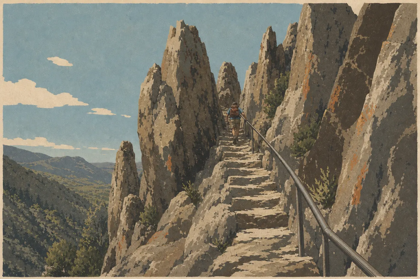
The High Peaks Trail loop strings together the park's most spectacular rock formations. The northern summit section includes exposed passages with handrails carved into the rock. They're exposed but secured, and you won't need climbing equipment. From the high point, the view takes in the entire Pinnacles range and, on a clear day, reaches across central California. Start: Visitor Center Parking Area on the east side. Tip: Hike this section counterclockwise so you tackle the technical descent while the ground is still dry in the morning.
Bear Gulch Cave & Reservoir Trail (loop)
Distance: 2.2 miles · Elevation gain: 400 feet · Duration: 1.5 to 2 hours · Difficulty: moderate
The Bear Gulch loop is the classic family outing on the east side. It passes through Bear Gulch Cave, a talus cave where a headlamp is essential, before emerging at Bear Gulch Reservoir, surrounded by rocks and Mediterranean vegetation. Take time to pause by the water. Rangers often cite it as a good spot for watching condors. Start: Moses Spring Parking Area on the east side.
Condor Gulch Trail (out-and-back)
Distance: 2.7 miles · Elevation gain: 920 feet · Duration: 1.5 to 2 hours · Difficulty: moderate
This trail climbs straight to an overlook above the High Peaks. It offers excellent conditions for watching California condors ride thermals, so arrive early and bring binoculars. It's a good compromise if you want big views without the length of the full loop. Start: Visitor Center Parking Area on the east side.
West Side: Balconies Cave and Juniper Canyon
The West Entrance is reached via Soledad and Highway 146, a narrow, winding road. RVs and large vehicles must enter from the east. The atmosphere is wilder, with fewer visitors.
Balconies Cave Trail (out-and-back or loop via Old Pinnacles Trail)
Distance: 3.3 miles round-trip (long loop: 6.8 miles) · Elevation gain: 430 feet · Duration: 2 to 2.5 hours (loop: 3.5 hours) · Difficulty: easy to moderate
Balconies Cave Trail is the West Entrance's standout hike. The route winds beneath piles of collapsed rocks, passing through complete darkness in places. For anyone comfortable in tight spaces, it's the park's most striking experience. The out-and-back route from Chaparral Trailhead works for hikers of all levels. Adding Old Pinnacles Trail makes a longer loop with commanding views of the rock formation. A headlamp is mandatory for the cave section. Start: Chaparral Trailhead on the west side.
Juniper Canyon Trail (loop)
Distance: 4.3 miles · Elevation gain: 1,700 feet · Duration: 3 to 4 hours · Difficulty: strenuous
Juniper Canyon Trail follows the western ridges of the High Peaks by a different approach than the east-side loop. The climb is sustained, but the trail sees fewer visitors. You'll often encounter less traffic here than on the east-side section. Start: Chaparral Trailhead on the west side.
Easy, Family-Friendly Hikes
The park works very well for families with kids ages 6 or 7 and up, as long as you choose the right trails and avoid July and August, when the heat can be intense.
Moses Spring Trail (loop)
Distance: 2 miles · Elevation gain: 300 feet · Duration: 1 to 1.5 hours · Difficulty: easy
Moses Spring Trail is the ideal introductory hike on the east side. It follows photogenic rock formations without any significant elevation gain. It also pairs naturally with Bear Gulch Cave & Reservoir Trail for a full morning.
Bench Trail (out-and-back)
Distance: 0.9 miles · Elevation gain: minimal · Duration: 30 minutes · Difficulty: very easy
Bench Trail follows the valley floor on the east side. It works for toddlers and people with limited mobility. It's ideal for warming up or taking an end-of-day stroll around camp.
Our Family Guide has more practical advice for visiting Pinnacles with kids, including lodging, off-trail activities, and logistics.
Strenuous and Full-Day Hikes
North Wilderness Trail
Distance: 8.9 miles round-trip · Elevation gain: 2,230 feet · Duration: 5 to 6 hours · Difficulty: strenuous
This trail enters the park's lightly marked northern wilderness area. It's the choice for hikers seeking solitude. You'll see almost no one after the first 2 miles. Serious preparation is required, including water and navigation gear.
High Peaks Trail + Condor Gulch Trail (long loop)
Distance: about 10 miles · Elevation gain: 2,300 feet · Duration: 5 to 6 hours · Difficulty: strenuous
Combining High Peaks Trail and Condor Gulch Trail from the east-side parking area creates Pinnacles' full-day hike. This is the comprehensive option for experienced hikers, with exposed sections, caves if Bear Gulch Cave is open, a condor overlook, and rock formations all around the loop. Start at opening time without fail.
Access, Trailheads, and Parking
Pinnacles has two independent entrances, with no road connecting them inside the park.
East Entrance (Highway 25)
The East Entrance is open 24 hours a day, 7 days a week. It provides access to the main trails, including High Peaks, Bear Gulch, and Condor Gulch, as well as the park's only campground, Pinnacles Campground, where reservations are essential. Visitor Center Parking Area is the starting point for most east-side trails. On spring weekends, it fills by 9 a.m. Arrive before 8 a.m. or consider staying on-site. Our Pinnacles Road Access Guide covers routes and transportation alternatives.
West Entrance (Highway 101 via Soledad, then Highway 146)
Highway 146 is narrow and winding. Vehicles longer than 23 feet, including RVs and trailers, must enter from the east. Chaparral Trailhead serves the Balconies and Juniper Canyon trails. There is no camping on the west side.
There is no official shuttle between the two areas. If you want to hike both sides, plan on two days or use two vehicles, with one positioned at each entrance.
When to Hike in Pinnacles
Spring, from March through May, is the ideal window, with mild temperatures around 64°F to 75°F, wildflowers in bloom, and active condors. Fall, from October through mid-November, offers similar conditions with fewer visitors. Summer is possible if you start very early, before 8 a.m., and avoid exposed trails in the middle of the day. For a month-by-month comparison, see our Guide to the Best Times to Visit Pinnacles.
Which Hike Is Right for You?
| Hiker profile | Recommended trail | Duration |
|---|---|---|
| First visit, general introduction | Bear Gulch Cave & Reservoir Trail | 2 hours |
| Family with kids | Moses Spring Trail + Bear Gulch Cave & Reservoir Trail | half a day |
| Scenic hike | High Peaks Trail (loop) | full day |
| Cave enthusiast | Balconies Cave Trail | 2 to 3 hours |
| Condor watching | Condor Gulch Trail | 2 hours |
| Strenuous hike, solitude | North Wilderness Trail | full day |
| West side without crowds | Juniper Canyon Trail | 4 hours |
To organize your entire stay, including lodging, meals, and a complete itinerary, see our Complete Pinnacles Guide.
Frequently Asked Questions
What's the best hike in Pinnacles?
According to the vast majority of visitors, Pinnacles' best hike is High Peaks Trail, a difficult 8.4-mile loop through the park's most spectacular rock formations, with 360-degree views. For a shorter outing, Bear Gulch Cave & Reservoir Trail is the classic choice.
Is hiking in Pinnacles difficult?
Difficulty varies at Pinnacles. Valley trails such as Moses Spring Trail and Bench Trail are very accessible, while High Peaks Trail and Juniper Canyon Trail require good physical condition and sturdy trail shoes for rocky terrain and exposed sections.
Is it safe to hike in Pinnacles?
Hiking in Pinnacles is safe outside the peak of the summer heat. In summer, heat is the main risk, so hydrate well and start early. Rattlesnakes are present. Stay on the trails, and don't put your hands into rock crevices without checking first. The caves require a headlamp.
Do you need a permit to hike in Pinnacles?
You don't need a permit for day hikes in Pinnacles. The park entrance fee, $30 per vehicle, is all you need. Overnight camping requires a reservation through recreation.gov.
Are there easy, family-friendly hikes in Pinnacles?
Yes. Moses Spring Trail, 2 miles with minimal elevation gain, and Bench Trail, 0.9 miles and flat, work well for kids as young as 5. Bear Gulch Cave & Reservoir Trail is suitable from about age 7 or 8, depending on how comfortable children are in semi-enclosed spaces.
Can you hike with your dog in Pinnacles?
No. Dogs aren't allowed on Pinnacles' trails. They're permitted only on paved roads and in the campground.
What's the best time to hike in Pinnacles?
Spring, from March through May, is the best time to hike in Pinnacles for mild weather and wildflowers. Fall, from October through November, is quieter. See our When to Go page for a month-by-month breakdown.
Are there loop hikes in Pinnacles?
Yes. High Peaks Trail, Bear Gulch Cave & Reservoir Trail, and Juniper Canyon Trail are all loops. Balconies Cave Trail can also become a loop by adding Old Pinnacles Trail.
How do you reach the trailheads?
The main east-side trailheads for High Peaks, Bear Gulch, and Condor Gulch are at Visitor Center Trailhead. On the west side, the Balconies and Juniper Canyon trails start at Chaparral Trailhead. There is no shuttle between the two areas. Our Access & Transportation page has detailed driving directions.
Which trails are best for seeing California condors?
Condor Gulch Trail, with its open overlook, and High Peaks Trail are the best spots for watching condors in flight. Park rangers recommend arriving early in the morning, when thermals begin to form. Binoculars are strongly recommended.