
What to Do in Hawaiʻi Volcanoes: Must-See Sights and Activities
Some national parks draw visitors with landscapes that have stood unchanged for millions of years. Hawaiʻi Volcanoes offers something else: a chance to watch the world being made. Kīlauea is one of the most active volcanoes on the planet. Its caldera saw major eruptions in 2018, then again between 2020 and 2021, and its appearance keeps changing. Add an 11-mile road to the Pacific Ocean, a network of trails crossing solidified lava fields, a lava tube you can walk through, and petroglyphs that are several centuries old. The park packs in far more experiences than its reputation as a “volcano park” suggests.
What to see first: Uēkahuna's overlook above Kīlauea's caldera (the glow from the lava lake after dark is striking), Nāhuku lava tube, Chain of Craters Road to Hōlei Sea Arch, and the Kīlauea Iki hike if you can spare two hours. With a well-planned day, you can check off all four. Two days give you time to slow down, hike, and explore the less-visited areas.
For an overview of the park before you get into the details, our complete guide to Hawaiʻi Volcanoes is the best place to start.
Hawaiʻi Volcanoes at a Glance: Areas, Access, and Getting Around
The park covers the southeastern part of Hawaiʻi's Big Island. It spans about 500 square miles, from the coast to the upper slopes of Mauna Loa at 13,678 feet. You'll find four main areas:
- Kīlauea's caldera and Crater Rim Drive: the central area, accessible from the main entrance. It contains most of the overlooks, sulfur vents, moderate trails, and both visitor centers.
- Chain of Craters Road: an 11-mile descent from the caldera to the ocean, crossing pahoehoe and ʻaʻā lava fields.
- The Mauna Loa area: the slopes of the world's largest shield volcano by volume. This area is for well-prepared hikers.
- Kahuku Unit: a separate southern area that's less visited and open Thursday through Sunday only.
From Hilo: 30 miles southwest on Highway 11, about 45 minutes. From Kailua-Kona: you have two options. Take Highway 11 southeast for 96 miles, which takes 2 to 2.5 hours. Or drive 124 miles via Waimea and Hilo along the northeast coast.
The park is open 24/7, including holidays. Kahuku Unit is the exception. It's open Thursday through Sunday, from 8 a.m. to 4 p.m.
Getting around: you'll need a car. The distances between sites are too great to cover on foot, and there isn't an internal shuttle. You can bike some sections of Crater Rim Drive, but conditions vary with volcanic activity.
Weather is a factor you shouldn't overlook. At the summit of Kīlauea, about 3,940 feet above sea level, temperatures can be 22 to 27°F lower than on the coast, and rain can arrive in any season. By contrast, the coastal plain at the bottom of Chain of Craters Road is hot, dry, and windy. The Hawaiʻi Volcanoes weather forecast and guide to the best times to visit cover seasonal patterns so you can plan your trip.
For driving rules and volcanic safety guidance, the Hawaiʻi Volcanoes access guide has all the practical information.
How Much Time Do You Need to Visit Hawaiʻi Volcanoes?
One full day is the minimum reasonable amount of time to cover the main sights: Crater Rim Drive, Chain of Craters Road, Nāhuku, and the main overlooks. It's doable, but you'll move quickly and won't linger anywhere.
Two days let you add a longer hike, such as Kīlauea Iki Trail or Nāpau Trail, visit Kahuku Unit if it's an open day, and, most importantly, return to the caldera after dark to see the volcanic glow. That nighttime return changes the park experience completely. It's like visiting the park within your visit.
Three days or more make sense if you're considering the Mauna Loa trails, combining the park with beaches and cultural sites in the southern part of the Big Island, or simply want to hike without watching the clock.
For a day-by-day itinerary tailored to your travel style, the Hawaiʻi Volcanoes itinerary lays out each option.
Must-See Sights by Area
Kīlauea's Caldera and Crater Rim Drive
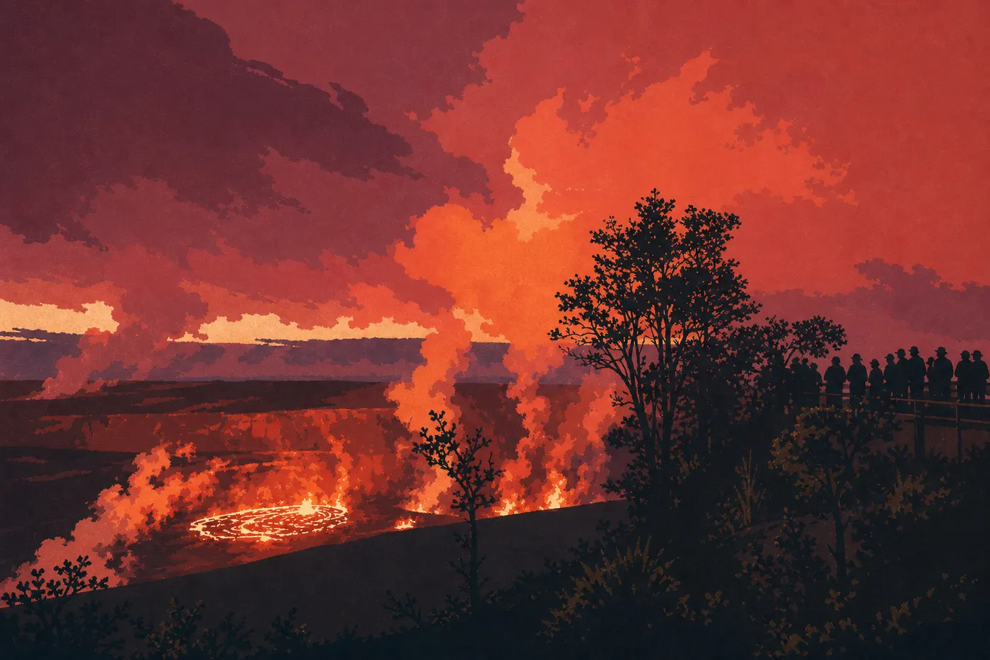
Crater Rim Drive follows the edge of the main caldera. Some sections close periodically depending on volcanic activity, so check conditions with the visitor center when you arrive or on the NPS website before you leave. This area contains most of the park's points of interest and should be your first stop.
Uēkahuna is the highest overlook above the caldera. Once known as Jaggar Museum Overlook, it reopened under its Hawaiian name after renovations in 2022. From here, you can look down into the vast Halemaʻumaʻu Crater, a basin more than 1,000 feet deep where a lava lake appeared during recent eruptions. It's impressive by day. At night, when conditions allow, the orange glow pulsing through the sulfur dioxide plumes is something else entirely. Bring a warm layer. Rain can arrive without warning at the summit of Kīlauea in any season, and the temperature difference from the coast is immediately noticeable.
Steam Vents is a five-minute stop that offers more than you'd expect. Fissures in the rock release columns of steam heated by magma below. On cool days or after rain, the scene is especially photogenic. In the low morning light, the plumes look almost unreal.
Haʻakulamanu (Sulphur Banks) complements Steam Vents. You can reach the site on foot from the visitor center parking lot. Sulfur deposits color the rock bright yellow and ocher. The smell of rotten eggs warns you well before you reach the overlook. Stay on the boardwalks. The surrounding ground is unstable and locally scorching hot.
Kīlauea Iki is a secondary crater next to the main caldera. In 1959, a spectacular eruption filled it to the rim with lava, creating a molten lake more than 1,000 feet deep. Today, that cooled basalt forms a black, cracked plain that you cross on foot along Kīlauea Iki Trail. See the hiking section for details.
Keanakākoʻi Overlook gives you another view of the recent lava fields. The road passes through an area where vegetation is slowly reclaiming the basalt, creating a succession of small, quiet botanical dramas.
Nāhuku, formerly Thurston Lava Tube, is a must-stop. This natural tunnel, several hundred yards long, was carved by a lava flow about 500 years ago. The process is the same throughout volcanology: surface lava cools and hardens into a crust while liquid magma keeps flowing inside, leaving an empty tube behind. The tunnel is lit inside. The ceiling is damp, and the atmosphere falls somewhere between an underground passage and a tropical cave. The loop takes 20 to 30 minutes and passes through a forest of tree ferns and ʻōhiʻa. Practical tip: arrive before 9 a.m. or after 3 p.m. The parking lot fills up midday, and crowds in the tube take away from the experience.
Devastation Trail is often overlooked, and that's a mistake. This 1-mile round-trip trail follows a wooden boardwalk through a field of ash. The bleached trunks of ʻōhiʻa trees scorched in the 1959 eruption stand starkly against the open landscape while vegetation pushes back everywhere with remarkable persistence. It's one of the park's most striking photography spots and one of its least crowded.
Chain of Craters Road

Chain of Craters Road descends from Kīlauea's caldera to the coast for about 11 miles, dropping 3,940 feet. The road itself is a continuous spectacle. It crosses pahoehoe lava fields, with smooth, wrinkled textures like frozen caramel, and ʻaʻā lava areas that are rough, jagged, and sharp. Allow 45 minutes to an hour to drive it without stops, but you'll want to stop.
Kealakomo Overlook is an intermediate overlook with an unobstructed view of the coastal plain and the Pacific Ocean in the background, with black lava fields in the foreground. Simple and effective.
Puʻu Loa Petroglyphs: a 1.6-mile round-trip trail, flat and entirely over lava, leads to Hawaiʻi's largest known petroglyph field. More than 23,000 rock carvings testify to centuries of Hawaiian presence along this coast. The designs depict human forms, concentric circles, and abstract symbols connected to birth rituals. Stay on the observation platforms. Walking on the petroglyphs damages them irreversibly.
Hōlei Sea Arch marks the end of the road beside the ocean. Where lava once reached the water, marine erosion carved an imposing basalt arch into the cliff. Pacific waves crash against it with a deep rumble you can hear from far away. The road ends here. A 1969 flow covered the pavement for several miles to the east. Don't cross the barriers. The cliff edge is unstable, and basalt boulders sometimes break away.
Coastal safety: the plain at the bottom of Chain of Craters Road is the hottest, driest, and windiest part of the park. Carry at least 2 liters of water per person, sun protection, and shoes with stiff soles. Sharp ʻaʻā lava can tear through sandals and flexible soles within minutes.
The Mauna Loa Area

Mauna Loa is the world's largest shield volcano by volume of lava erupted. Its summit reaches 13,678 feet. The park manages its slopes, but this area isn't for rushed or poorly equipped visitors. The altitude, abrupt weather changes, and remoteness demand serious physical and logistical preparation.
Mauna Loa Road climbs to about 6,560 feet and already offers broad views without requiring a summit hike. Kīpukapuaulu Trail, a 1-mile loop that takes 45 minutes, crosses a native forest island spared by lava flows. The diversity of endemic plants in this protected area is remarkable. It's a glimpse of what Hawaiian forests looked like before invasive species, in striking contrast to the basalt fields around them.
Kahuku Unit

Separated from the rest of the park to the south, Kahuku Unit is open Thursday through Sunday only, from 8 a.m. to 4 p.m. It doesn't have the volcanic drama of the Kīlauea area, but it offers something that area can no longer really provide: quiet. On weekdays, you may cross the entire site without seeing another person.
Palm Trail, about 3 miles round-trip, crosses a former ranch where nature is gradually taking back the land: pastures, palm groves, and wooded slopes with views of Mauna Loa's flanks. Puʻu o Lokuana Trail climbs to a volcanic cone with a panorama of the southern coast of the Big Island.
The Best Hikes in Hawaiʻi Volcanoes
The park has more than 125 miles of marked trails, from 20-minute loops to several-day expeditions to the summit of Mauna Loa. Here's an overview of the must-do hikes.
Kīlauea Iki Trail, 4 miles, a loop taking about 2 hours, is our top recommendation if you're doing only one hike in the park. You descend through dense rainforest and emerge onto the solidified lava of Kīlauea Iki crater. You then cross the black basalt plain beneath steam rising from the fissures before climbing back up the other side. The contrast between forest and lava continues throughout the loop. Most hikers in reasonable shape can manage it.
Crater Rim Trail: follow part or all of the caldera rim on foot. It's for people who'd rather take time to notice every detail than see the park from the car.
Nāpau Trail, 9 miles round-trip from the Chain of Craters Road parking area, taking 5 to 7 hours, is a demanding trail across secondary volcanic cones and old lava fields, with open views of the caldera from within. It's for hikers in good physical condition who carry water, sun protection, and closed hiking shoes.
For complete difficulty ratings, elevation gains, trail signage, and gear advice for every route, see the Hawaiʻi Volcanoes hiking guide.
Other Activities for Every Kind of Traveler
Wildlife watching: the Big Island is home to several endemic species found nowhere else on Earth. The nēnē, or Hawaiian goose, is the park's signature bird. You regularly see them around Kīlauea Visitor Center and in the high-elevation meadows. ʻōhiʻa forests shelter native songbirds, some critically endangered, that aren't very shy if you know where to look. Our Wildlife page lists the species found here and the best viewing areas by season.
Night photography and stargazing: the park's low light pollution at higher elevations, combined with volcanic activity, creates a nighttime spectacle that's hard to match. When Kīlauea is active, the orange glow of the lava lake beneath a starry Pacific sky is the kind of image photographers travel thousands of miles to capture. Bring a warm layer for high-elevation evenings and a headlamp for the areas around the overlooks.
Following volcanic activity in real time: the USGS Hawaiian Volcano Observatory publishes activity bulletins several times a week, and sometimes continuously during eruptions. If you're coming specifically to see moving lava, check its alerts the day before and when you arrive.
Visiting with kids: families can enjoy the park with a few itinerary adjustments. Gas emissions around the caldera require extra care for young children and people with respiratory sensitivities. Our Family page offers a selection of suitable activities and trails, along with precautions to take.
Biking: bikes are allowed on the park's paved roads. Chain of Craters Road offers a 3,940-foot descent through scenery few bike rides can match. The climb back, however, requires good physical preparation. It's best done in the morning, before the coastal heat sets in.
Ranger programs: Kīlauea Visitor Center has permanent exhibits on volcanology and Hawaiian culture. Rangers regularly lead free presentations in English. Check the schedule posted at the park entrance.
What to Do Around Hawaiʻi Volcanoes
East toward Hilo, 45 minutes: Hilo is the closest town on the east side. It has a farmers market on Wednesday and Saturday mornings, tropical gardens, museums, and a much more local feel than Kona. It's also the most convenient airport if you're coming straight to the park. Our Where to Eat page covers the dining options in the area.
South, 1 to 1.5 hours by car: the southern tip of the Big Island, Ka Lae, is the southernmost point in the United States. Papakōlea's green olivine-sand beach, reachable on foot from a parking area or by local shuttle, is one of the world's most unusual. Allow an extra half-day for this detour.
Northwest, 2 hours: Puʻuhonua o Hōnaunau National Historical Park (“Place of Refuge”) is an exceptionally well-preserved Hawaiian historic site, with restored carvings (kiʻi), an ancestral refuge enclosure, and a snorkeling bay accessible from shore. Often overshadowed by Volcanoes, it's one of the most important cultural sites in all of Hawaiʻi.
For itineraries combining several Big Island sites or island-hopping routes, see our Region and Road Trip guides.
The Bottom Line: What to See First at Hawaiʻi Volcanoes
Hawaiʻi Volcanoes is worth the trip even when there isn't an eruption underway. Kīlauea's caldera alone justifies the journey. Its scale, recent activity, and constant evolution make it one of the most dynamic geological sites in the United States. You don't come to see a monument. You come to see a process.
One-day quick itinerary: leave Hilo or Kailua-Kona at dawn, stop at the visitor center for current conditions, visit Uēkahuna at sunrise, then see Steam Vents and Haʻakulamanu in the morning. Visit Nāhuku before 9 a.m. if possible. Have lunch in Volcano Village or in the car. Drive down Chain of Craters Road in the afternoon, stopping at Kealakomo, Puʻu Loa, and Hōlei Sea Arch. Return to the caldera at dusk for the nighttime volcanic glow.
Two-day itinerary: add Kīlauea Iki Trail on the morning of day two, when the air is cooler and the light is better. In the afternoon, head to Kahuku Unit if it's an open day, Thursday through Sunday.
One rule to remember: Hawaiʻi Volcanoes is always changing. Roads close, gas emissions rise, and overlooks become temporarily inaccessible. Always check the NPS website before you leave, then stop at the visitor center when you arrive for a five-minute update. Those five minutes can change your entire day's plan.
Frequently Asked Questions
What is there to do at Hawaiʻi Volcanoes?
At Hawaiʻi Volcanoes, you can view Kīlauea's caldera from Uēkahuna Overlook, including the volcanic glow at night, walk through a lava tube at Nāhuku, drive Chain of Craters Road to the ocean, and hike across the solidified lava of Kīlauea Iki crater. The park is open 24/7 year-round, and you don't need an advance reservation for general admission.
What activities are available at Kīlauea volcano?
At Kīlauea, the main activities include viewing the caldera from several overlooks, led by Uēkahuna, visiting Steam Vents and Sulphur Banks, walking through Nāhuku lava tube, hiking across the solidified lava on Kīlauea Iki Trail, and viewing the lava lake's glow at night when the volcano is active. The USGS publishes real-time volcanic conditions.
What are the must-see places in Hawaiʻi?
At Hawaiʻi Volcanoes, don't miss Uēkahuna for its caldera view, Nāhuku for its lava tube, Kīlauea Iki Trail, and Hōlei Sea Arch at the end of Chain of Craters Road. Across the island, the Big Island also offers the south coast's olivine beaches, Puʻuhonua o Hōnaunau National Historical Park, and the Mauna Kea observatories.
Where are Hawaiʻi's volcanoes located?
Hawaiʻi's active volcanoes are on the Big Island. Kīlauea and Mauna Loa are both in Hawaiʻi Volcanoes National Park. Mauna Kea, on the same island, is considered inactive. Haleakalā is on the island of Maui, in its own national park.
What are the world's most dangerous volcanoes?
Kīlauea is regularly ranked among the planet's most active and most closely monitored volcanoes, under continuous observation by the USGS Hawaiian Volcano Observatory. Its danger comes less from the violence of its eruptions, since Hawaiian lava generally flows slowly at a few feet per hour, than from sulfur dioxide emissions, sudden collapses of coastal lava cliffs, and ballistic projectiles during explosive phases. Rankings of the “most dangerous volcanoes” vary according to the criteria used, such as explosivity, proximity to populated areas, and unpredictability, and they have no absolute scientific standing.
Is Hawaiʻi Volcanoes worth visiting?
Hawaiʻi Volcanoes is absolutely worth the trip. Even without a visible eruption, Kīlauea's caldera is a geological spectacle unlike any other in the United States. We recommend at least one full day, and two if you have the time. The park at night is an experience in its own right.
Which hike should you do at Hawaiʻi Volcanoes?
Kīlauea Iki Trail, a 4-mile loop taking about 2 hours, is our top recommendation. Most hikers can manage it, it's visually striking, and it shows you both rainforest and the solidified lava of the crater. For an easy walk, Nāhuku lava tube takes 30 minutes, and Devastation Trail is 1 mile. Both are accessible to everyone. Complete trail information, elevation gains, and gear advice are available on our Hiking page.