
Haleakalā Map: Districts, Roads, and the Official Park Map
Haleakalā National Park stretches along the eastern slope of the island of Maui in Hawaiʻi, from the 10,023-foot volcanic summit to the tropical coast of Kīpahulu. One important thing to know before you even open a map is that the park's two districts aren't connected by an internal road. You can download the official NPS map for free at nps.gov/hale/planyourvisit/maps.htm.
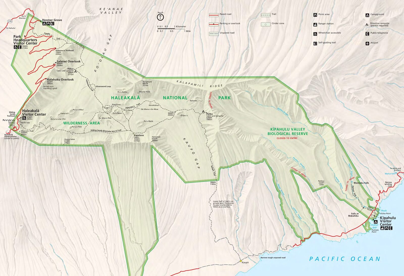
The official park map handed out at entrance stations, with roads, areas, visitor centers and services. View it here or download it for offline use.
Download the map (PDF) Public domain · National Park ServiceWhere Is Haleakalā?
Haleakalā is on the island of Maui, in the state of Hawaiʻi (HI). On a world map, Maui is part of the Hawaiian Islands, set in the middle of the North Pacific about 2,360 miles west of California. It's the only U.S. state made up entirely of islands and located outside the mainland.
On the island itself, the park covers Maui's southeastern third. It includes the Haleakalā volcano and extends all the way to the shoreline at Kīpahulu, near Hana. For a broader look at the park's place in the Hawaiian Islands, our complete Haleakalā guide provides regional context.
Downloading the Official Haleakalā Map (NPS Unigrid)
The NPS publishes a free PDF map known as the “Unigrid.” It covers both park districts, access roads, the main trails, and facilities such as visitor centers, picnic areas, and campgrounds. You can download it without signing up from the Maps page at nps.gov/hale.
Here's a practical tip: save it to your phone before you leave. There's no cell service beyond Kula on the road to the summit, and coverage is very spotty in the Kīpahulu District.
Haleakalā's Districts
The park is divided into two geographically separate districts. To get from one to the other, you'll need to use the island's public roads, which can mean several hours of driving depending on the route you choose.
Summit District (Summit District)
This district includes the volcanic crater, the summit Visitor Center at 10,023 feet, and trails that descend into the wilderness area. This is where you'll watch the sunrise. The access road, Haleakalā Highway (Route 378), climbs from the Pukalani area along roughly 31 miles of switchbacks.
Entry between 3 a.m. and 7 a.m. requires a reservation through recreation.gov.
Kīpahulu District
This very different district runs along the Pacific at the foot of Haleakalā's eastern slope. You get there via the Hana Highway (Route 360), from Hana. The district is home to ʻOheʻo Pools, a dense tropical forest, and the Pīpīwai Trail.
Park Entrances and Driving Around
The park has two separate entrances, one for each district:
- Summit entrance: via Route 378 (Haleakalā Highway), following Route 37 and then Route 377 from Kahului.
- Kīpahulu entrance: via Route 360 (Hana Highway), along the east coast, a few miles south of Hana.
There's no way to drive from one end of the park to the other within the park itself. Each visit is therefore a round trip from the entrance to its district, or it involves driving all the way around the island on public roads. For driving distances between the two districts and transportation advice on Maui, the Getting to Haleakalā guide has all the essential information.
Landmarks and Overlooks on the Map
Here are the landmarks to locate on your map before you leave.
Puʻuʻulaʻula Overlook: the highest point at 10,023 feet, with 360-degree views of Maui and, on clear days, the neighboring islands. This is the meeting point for sunrise.
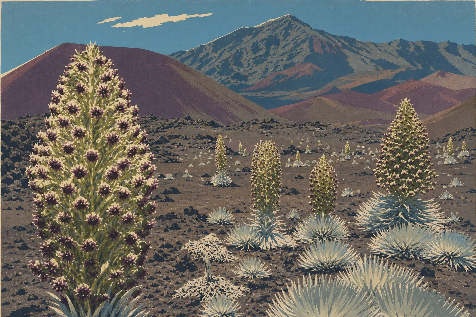
Kalahaku Overlook: at about 9,150 feet along the summit road. It's the only roadside overlook where you can see ʻāhinahina (silversword), the park's signature plant, without heading onto the trails.
ʻOheʻo Pools: in the Kīpahulu District, these are a series of cascading pools. Swimming is sometimes closed after heavy rain upstream, so check conditions on the NPS website that morning.
Hosmer Grove Campground: a low-elevation introduced forest in the Summit District, ideal for acclimating to the altitude before climbing higher.
For detailed activities at each of these sites, the Things to Do at Haleakalā and Hikes at Haleakalā guides describe the trails, including their duration and difficulty.
Nearest Towns and Airports
Kahului (in northern Maui) is the island's main town and the natural starting point for the Summit District. Kahului Airport (OGG) is about 31 miles from the summit by road.
For the Kīpahulu District, plan on about 3 hours of driving from Kahului via the Hana Highway. The village of Hana is the nearest settled place, a few miles north of the entrance.
There isn't another international airport on Maui. For lodging near both entrances, the Where to Stay Near Haleakalā guide compares options in Kahului, Kula, Pāʻia, and Hana.
Hiking Maps and Paper Topographic Guides
The NPS Unigrid map works very well for a standard visit. If you're planning several days of hiking in the wilderness area or in Kīpahulu, a paper topographic map provides additional detail on contour lines and water sources.
The National Geographic Trails Illustrated Map No. 227 covers the entire park at a scale of 1:35,000. Laminated and waterproof, it shows contour lines, springs, and authorized camping locations in the wilderness area. Cartovia offers it for delivery, along with other U.S. national park maps.
Frequently Asked Questions
Is it worth visiting Haleakalā during the day?
Yes. One day is enough to explore the Summit District, as long as you leave early from Kahului. Visiting both districts, the Summit and Kīpahulu, in a single day is possible, but it makes for a tight schedule and several hours of driving.
Where can you watch the sunrise at Haleakalā?
You can watch the sunrise from the overlooks in the Summit District, especially Puʻuʻulaʻula Overlook at 10,023 feet. You must make an online reservation through the NPS website to enter the park between 3 a.m. and 7 a.m.
Can you visit Haleakalā on your own?
Yes. You can drive to both districts in your own vehicle, and the trails don't require a guide. The wilderness area does require a free wilderness camping permit, which you can pick up at the Visitor Center. The Getting to Haleakalā guide summarizes the entry rules and high-altitude safety advice, including the possibility of hypothermia even at the summit in summer.
Where is Hawaiʻi on a world map?
Hawaiʻi is a volcanic island chain in the middle of the North Pacific, about 2,360 miles west of the California coast. It's the only U.S. state made up entirely of islands, with no land border with any other state.
What is the closest town to Haleakalā?
Kahului is the closest town to the Summit District, about 31 miles away by road. For the Kīpahulu District, the village of Hana is the nearest settled place, a few miles north of the entrance on the Hana Highway.
Can you drive across Haleakalā?
No, not from one end to the other within the park. The two districts have separate entrances, with no internal road connecting them. To get from one to the other, you'll need to use the island's public roads, which adds several hours of driving.