
Crater Lake Hiking: The Best Trails for Every Skill Level
Crater Lake has only about 15 marked trails, which isn't much compared with Zion or Arches. But each trail offers a distinct angle on the caldera, perched between 5,900 and 8,900 feet above sea level. The lake's blue color, created by its 1,943-foot depth and exceptionally pure water, appears around every bend with an intensity that never wears off.
If you only do one hike, make it Garfield Peak Trail, which takes in the entire crater from the south slope. Want to get down to the water's edge? Only Cleetwood Cove Trail descends to the shore, making it the park's sole access route to the lake. For a one-hour outing with a rewarding panorama, Watchman Peak Trail is our recommendation when time is short.
Planning Your Crater Lake Hike
Permits. You don't need a permit for day hikes. The park entrance fee ($30 per vehicle in 2025, or an America the Beautiful pass) covers access to all the trails. Overnight backcountry trips do require a free permit, which you can get at the Visitor Center before setting out.
Dogs. Dogs are strictly prohibited on every trail in the park. They're allowed on a leash on paved roads and in parking areas, and that's it. If you're traveling with your pet, plan to stay outside the park.
Altitude. Trailheads start between 6,200 and 6,900 feet. If you've arrived from the Pacific Coast within the past 24 hours, plan an easy first day before tackling significant elevation gain. Headaches and unexpected shortness of breath are common on the first day.
Water. There isn't a single water source along the trails. Carry at least 2 liters per person for each outing. You can technically filter lake water with a pump or tablets, but no trail reaches the shore except Cleetwood Cove Trail.
Wildlife. Black bears live in the park. Store your food in a certified bear canister or in your vehicle's locked trunk, never in an unattended pack at the trailhead. Columbian black-tailed deer on the south slope are used to people, so keep your distance and don't feed them.
Snow outside the main season. Garfield Peak Trail and Mount Scott Trail can remain partly snow-covered into July, sometimes until mid-July after a heavy winter. Check NPS alerts before you head out, and bring trekking poles if you're hiking early in the season.
The Best Hikes, Area by Area
Rim Village and the South Slope
The south slope has the highest concentration of trailheads, all accessible from the Rim Village parking lot. It's also the area that's open year-round via the main road, Highway 62.
Garfield Peak Trail 3.4 miles round-trip · 1,000 feet of elevation gain · 2 to 3 hours · difficult
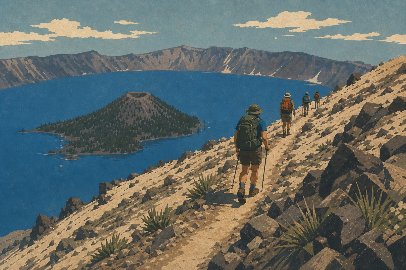
The trail starts at Crater Lake Lodge and climbs to the summit of Garfield Peak (7,800 feet) through a series of exposed switchbacks. Within the first few hundred yards, the lake opens up below with Wizard Island in the foreground. From the summit, you can see the entire caldera, the ridges along Rim Drive, and, on a clear day, Mount Shasta 155 miles to the south. The trail becomes less clearly marked above 7,200 feet, so stay on the main ridge.
Trailhead: Crater Lake Lodge parking lot, Rim Village. Exposed terrain with no shade. Snow is likely before mid-July.
Castle Crest Wildflower Garden Trail 0.8 miles loop · negligible elevation gain · 30 to 45 minutes · very easy
A short loop through a wet meadow covered in wildflowers from July through August. Combine it with a visit to the nearby Steel Visitor Center. It's ideal for starting or ending a day of hiking, or for changing pace with young children.
Trailhead: Castle Crest sign, a few minutes south of Rim Village by car.
Watchman Peak: The Northwest Slope in an Hour
Watchman Peak Trail 1.6 miles round-trip · 360 feet of elevation gain · 45 minutes to 1.5 hours · moderate
The Watchman (8,900 feet) is the quickest viewpoint to reach on the northwest slope. A well-maintained trail climbs to a former fire lookout, with a direct view of Wizard Island and the western part of the lake. It's our favorite trail for sunsets: the northwest slope catches the last light on the water. In August, get to the Overlook parking lot early because it fills up fast.
Trailhead: Watchman Overlook, West Rim Drive. The road opens as soon as Rim Drive opens, usually from late May to early June.
Cleetwood Cove: The Only Access to the Lake
Cleetwood Cove Trail 2.1 miles round-trip · 625 feet of elevation gain · 1 to 2 hours · difficult
A warning is in order. The 1.1-mile descent to the shore, with 625 feet of steady, sustained elevation loss, feels easy on the way down. The climb back in the afternoon sun catches many visitors off guard. Don't underestimate this trail just because it's short. It's still the park's only access route to the lake. The shore offers exceptional swimming and is the only official swimming area. This is also where boats leave for guided tours of Wizard Island. If you want to combine a hike and a cruise, book your boat ticket well in advance. Seats sell out as early as July.
Trailhead: Cleetwood Cove parking lot, North Rim Drive. Bring plenty of water because there are no supplies on site. It's accessible only when North Rim Drive is open, generally from July through November.
East Slope: Mount Scott and The Pinnacles
Mount Scott Trail 4.3 miles round-trip · 1,250 feet of elevation gain · 2.5 to 4 hours · difficult
Mount Scott is the park's highest point at 8,927 feet. The trail starts at 7,700 feet and climbs steadily over exposed terrain to the summit. The panorama opens across the entire lake, the high-elevation forests on the east slope, and the peaks of the Cascade Range on the horizon. Bring an extra layer. Winds at the summit can bite even in mid-August. Skip this trail if storms are building, since lightning on exposed ridges is a serious risk.
Trailhead: Mount Scott parking lot, East Rim Drive. The trail usually opens by mid-July, depending on the year's snowpack.
Pinnacles Trail 2.0 miles round-trip · minimal elevation gain · 1 hour · easy
The Pinnacles are hoodoos formed thousands of years ago from compacted volcanic ash deposits. The trail follows the canyon rim without ever descending, making it perfect for viewing the spires from above. It's the only hike in the park without lake views, but the volcanic landscape is well worth the detour.
Trailhead: Pinnacles Overlook, at the eastern end of East Rim Drive, about 25 minutes from Rim Village. The road is partly open depending on snow conditions.
Easy, Family-Friendly Hikes
Three trails stand out for families, beginners, or days when you want to enjoy the scenery without a sustained effort.
Castle Crest Wildflower Garden Trail (0.8-mile loop): this is the park's shortest outing. In July and August, wildflowers cover the meadow and kids love it. It's an easy choice if you're visiting the Steel Visitor Center.
Discovery Point Trail (about 3.1 miles round-trip, little elevation gain): from Rim Village, the trail follows the crater rim west, with continuous views of the lake. You can turn around at any point, making this hike easy to adjust to the group's ages and energy levels. The terrain is stable and the trail is well marked.
Pinnacles Trail (2.0 miles round-trip, nearly flat): the trail runs along the rim without descending into the canyon. This area is much less crowded than Rim Village, which adds a welcome sense of peace when you're with children.
If you're hiking with young children, avoid Cleetwood Cove Trail. The climb back, 625 feet over 1.1 miles in the sun, wears out even experienced adults. For more activities suitable for children under 10, see the Crater Lake family guide.
Challenging Hikes and Full-Day Outings
For fit hikers who want a real workout and wide-open views, these are the three options to keep in mind.
Garfield Peak Trail (3.4 miles, 1,000 feet of elevation gain): the panorama-to-effort ratio is excellent. It's our default choice for a day built around a signature hike from Rim Village.
Mount Scott Trail (4.3 miles, 1,250 feet of elevation gain): the longest and most remote outing. The east slope sees far fewer visitors than the south slope, and the view from the park's highest point offers a different perspective on the lake. It's more distant and almost aerial. Check conditions in the Crater Lake weather guide before setting out.
Cleetwood Cove + Wizard Island combo: this is the classic full-day itinerary. Descend to the lake on Cleetwood Cove Trail, take the boat to Wizard Island, climb to the island's summit crater on Wizard Island Summit Trail, about 2.3 miles round-trip from the dock with 755 feet of elevation gain, and swim in the lake before taking the boat back. Set aside a full day, and book your boat spot well in advance. Departures sell out as early as spring for July and August dates.
Access, Trailheads, and Parking
Crater Lake doesn't have a shuttle, unlike Zion. Every trailhead requires a personal vehicle or a carpool.
Rim Village (south slope): the park's main parking lot, open year-round via West Entrance and Highway 62. Trailheads for Garfield Peak, Discovery Point, and Castle Crest are here. The lot fills up by late morning from July through August, so arrive before 9 a.m. or after 4 p.m.
Watchman Overlook (West Rim Drive): a small parking area beside the road. It opens as soon as Rim Drive is cleared, usually from late May to early June.
Cleetwood Cove (North Rim Drive): a dedicated parking area on the north road, accessible only when North Rim Drive is open, around July onward depending on the winter snowpack.
East Rim Drive (Mount Scott, Pinnacles Overlook): it follows the same opening schedule as North Rim Drive. Allow about 25 minutes from Rim Village to Pinnacles Overlook.
For access routes from Medford, Klamath Falls, or Interstate 5, you'll find full details in the Crater Lake access guide.
When to Hike at Crater Lake
July, August, and September are the go-to months. Ridge trails are clear, daytime temperatures are pleasant at 59 to 77°F, and skies are clear most of the time. The lake is fully visible and easy to photograph.
In May, June, and October, rain and snow can alternate and close ridge trails from one day to the next. North Rim Drive and East Rim Drive remain closed until the snow melts. In winter, from November through April, several roads close on November 1 or earlier, depending on snowfall. Clouds hide the lake about 50% of the time.
The Crater Lake seasons guide breaks down conditions month by month, including average opening dates for roads and trails.
Which Hike Fits Your Hiking Style
You have 2 hours and want the best viewpoint for the effort: Watchman Peak Trail. Short, accessible, with a direct view of Wizard Island.
You want the park's signature hike: Garfield Peak Trail. Solid elevation gain and a full panorama of the caldera.
You want to get down to the lake: Cleetwood Cove Trail. The only trail that reaches the shore, and a must if you're planning to swim or take the boat to Wizard Island.
You're hiking with children: Discovery Point Trail or Castle Crest. Minimal elevation gain, immediate views, and stable terrain.
You're looking for solitude and the highest summit: Mount Scott Trail. The east slope sees far fewer visitors, and the panorama is unmatched.
You like volcanic landscapes without lake views: Pinnacles Trail. Striking and little known.
Find all the other activities, including cruises, biking, and wildlife viewing, in our complete Crater Lake guide.
Frequently Asked Questions
What's the best hike at Crater Lake?
For the best panorama, choose Garfield Peak Trail, a 3.4-mile round-trip hike with 1,000 feet of elevation gain that takes in the entire caldera from the south slope. For a short, spectacular outing, Watchman Peak Trail, 1.6 miles, is our alternative recommendation.
Is hiking at Crater Lake difficult?
Hiking at Crater Lake ranges from moderate to difficult, mainly because of the altitude. Trailheads start at 6,200 to 6,900 feet. Cleetwood Cove Trail and Mount Scott Trail are physically demanding. Watchman Peak and Discovery Point are manageable for most healthy hikers.
Is it safe to hike at Crater Lake?
Yes, marked trails are generally safe. The main risks are altitude, intense sun on exposed ridges, lightning during storms, and leftover snow early in the season. Start early, carry water, and check NPS alerts before heading onto ridge trails.
Do you need a permit to hike at Crater Lake?
No, day hikes at Crater Lake don't require a permit. The park entrance fee, $30 per vehicle, is enough. A free permit is required for overnight backcountry trips.
Are there easy, family-friendly hikes at Crater Lake?
Yes. Castle Crest Wildflower Garden Trail, a 0.8-mile loop, Discovery Point Trail, with minimal elevation gain, and Pinnacles Trail, a 2.0-mile, nearly flat hike, are the three most accessible trails. Avoid Cleetwood Cove Trail with young children.
Can you hike with a dog at Crater Lake?
No, dogs are prohibited on every trail at Crater Lake. They're allowed on a leash on paved roads and in parking areas only.
When is the best time to hike at Crater Lake?
The best time to hike at Crater Lake is from July through September, when all the trails are clear and the weather is stable. Our When to Go guide covers conditions month by month, along with average opening dates.
Are there loop hikes at Crater Lake?
Nearly all Crater Lake trails are out-and-back. Castle Crest Wildflower Garden Trail is the exception, with its short 0.8-mile loop. Discovery Point Trail can be extended to the Watchman Overlook, but you'll need two cars or have to retrace your steps.
How do you reach the trailheads and parking areas at Crater Lake?
Every trailhead has a dedicated parking area along Rim Drive or East Rim Drive. Crater Lake has no shuttle. The Rim Village parking lot on the south slope fills up between 9 a.m. and 3 p.m. during the busy season. Full traffic and access details are on our Access & Transportation page.