
Crater Lake Itinerary: What to See in 1, 2, or 3 Days
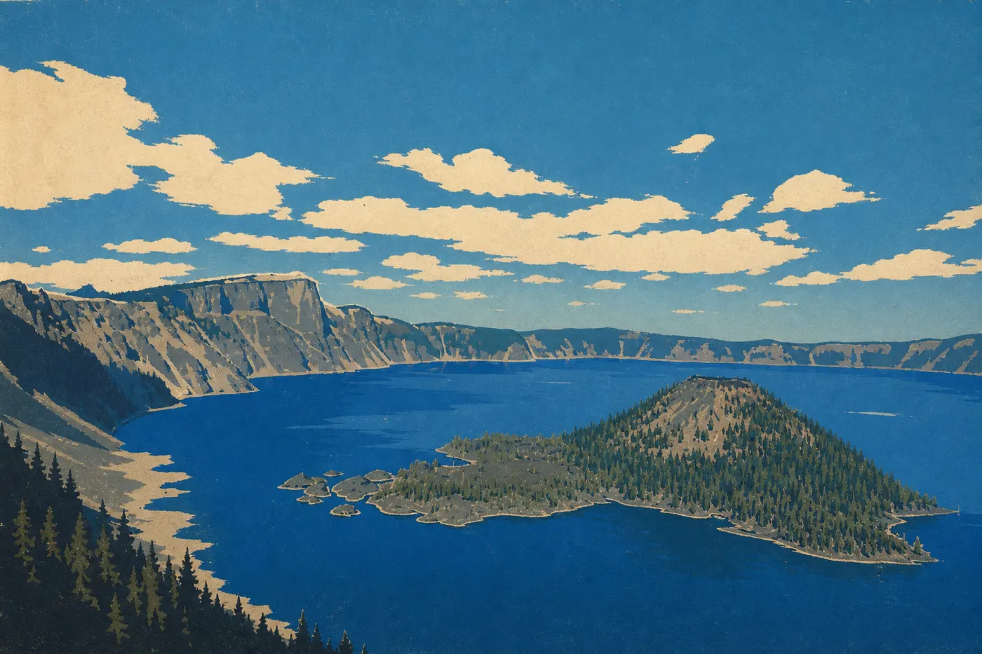
Crater Lake is a park you have to earn. Its lake sits 6,175 feet above sea level in the collapsed crater of Mount Mazama, with such an intense blue that you might suspect someone edited the photo. They didn't. It's simply the purest and deepest lake in the United States (1,932 feet), with no rivers or streams flowing into it, fed only by rain and snow. To see it, you'll drive around the rim (53 miles of Rim Drive), descend to the water on a single trail, and climb to the ridgeline. Two days cover the essentials without cutting anything out. Three days give you time to slow down, choose the best light, and fit in several hikes. One day is doable if you arrive at dawn; you'll leave satisfied, but with a few regrets.
How Much Time Do You Need to Visit Crater Lake?
Crater Lake is one of the most compact national parks in the NPS system: one lake, one main loop road, and short distances between points of interest. That makes planning easier, and it's a real advantage.
1 day: doable if you're there before 9 a.m. Allow 4 to 5 hours for Rim Drive with photo stops, plus 1.5 to 2 hours to descend to Cleetwood Cove and climb back up. The climb is strenuous. It's a tight schedule, but it works.
2 days: the format we recommend for a first visit. Spend the first day driving around the lake and the second on a high-elevation hike. You'll also have time to see Rim Village in the evening light, which changes the experience.
3 days: ideal for hiking more than once, exploring The Pinnacles without rushing, and waking up to the lake at sunrise. This is the pace that lets you really take in the place.
More than 3 days: worthwhile only as part of an Oregon or California-Oregon road trip. Our Road Trip guides lay out the most logical combinations.
The season also affects how much flexibility you'll have. Rim Drive closes November 1 and doesn't reopen until June, depending on snowfall. Outside the July-to-October period, your options narrow considerably. Our Crater Lake seasonal guide breaks down the constraints month by month.
Access, Entrances, and Getting Around the Park
Three Entrances, Two Open Year-Round
Most visitors reach the park through West Entrance from Medford via Highway 62 or through South Entrance from Klamath Falls or California. Both are open year-round. North Entrance closes in winter. For distances and seasonal conditions, our guide to getting to Crater Lake has all the details.
Admission is $30 per vehicle and valid for 7 days. The America the Beautiful pass ($80) covers all national parks if you plan to visit several during the year. The National Parks fees and passes page explains admission fees and the passes available.
Getting Around the Park
You'll need a car to drive Rim Drive. No shuttle connects the overlooks along the road. If you're traveling by RV, our Crater Lake RV guide explains the size restrictions on certain sections.
Crater Lake's Areas
The park's geography is simple: a ring of cliffs surrounding the lake, crossed by Rim Drive. Four areas stand out naturally, each with its own atmosphere and viewpoints.
Rim Village and the South Rim
This is the park's logistical hub. You'll find Crater Lake Lodge, with its terrace directly above the lake, the main visitor center, a cafeteria, and a gift shop. Two iconic trails start here: the Rim Trail and Garfield Peak Trail. The view from the Rim Village parking lot is often the first photo people take. It's rarely disappointing. The elevation is around 7,050 feet, so bring an extra layer for evenings, even in the middle of July.
West Rim Drive
The western section connects Rim Village to the northern junction. Key stops include Discovery Point, the traditional site where gold prospectors discovered the lake in 1853, and especially Watchman Overlook. From this overlook, a 15-minute walk from the parking lot, you can see the entire lake with Wizard Island in the foreground. It's one of the park's most photographed overlooks, and the view from the top of The Watchman is well worth the climb.
East Rim Drive
The eastern side feels wilder and is much less crowded in the middle of the week. Cloudcap Overlook reaches about 7,760 feet and is the highest point on all of Rim Drive, with a 180-degree view of the lake and the surrounding ridges. Farther southeast, a spur road leads to The Pinnacles, columns of volcanic rock rising from a narrow canyon. The detour adds about 12 miles from Rim Drive, but the place is strange and worth it if you have time.
Cleetwood Cove and Access to the Lake
This is the only legal route down to the water's edge. Cleetwood Cove Trail drops 656 feet over 1.1 miles one way. At the bottom, a dock extends directly onto the lake. Since 2024, this area has been undergoing major trail and marina improvements. Boat tours to Wizard Island are suspended for the duration of the project, and swimming is restricted until the work is finished, currently scheduled for 2029. The trail may remain open depending on the project's progress. Check current conditions at nps.gov/crla before you leave.
Day-by-Day Itinerary
Day 1: Arrival, Rim Village, and Sunset on the Rim
Arrive through West Entrance or South Entrance in the morning. First stop: the Rim Village Visitor Center to pick up a paper map and get oriented. Then take West Rim Drive north, with a must-stop at Watchman Overlook for a big-picture view. In the middle of the afternoon, return to Rim Village. If you've reserved a table on the Crater Lake Lodge terrace, which you'll need to do well in advance during peak season, this is the place to have dinner while watching the light change across the lake. Sunset from the rim, when orange reflects off the deep blue water, is a moment you'll remember. Stay overnight at the Lodge, the Mazama Cabins, or Mazama Campground 4 miles south.
Day 2: The Full Rim Drive and Cleetwood Cove
Set out early, ideally before 8 a.m. The parking lots at the most popular overlooks fill up quickly in July and August. Drive the full 53-mile loop on Rim Drive, which takes about 3 hours without stops and 5 to 6 hours with photo breaks. The recommended direction is clockwise, starting with East Rim Drive.
Stops in order: Cloudcap Overlook in the morning, when the light is low and crowds are smaller, then Cleetwood Cove if the work allows it. Allow 2 hours for the descent, time at the water, and the climb back up. The climb is short but steep, at least 1,300 feet per hour. Late in the morning, detour to The Pinnacles. Return via West Rim Drive, stopping at Discovery Point and Watchman Overlook if you didn't visit them the day before.
Day 3: High-Elevation Hike and Departure
Spend the morning on a proper hike. Choose between two options based on your fitness and schedule:
Garfield Peak Trail (3.4 miles round-trip, 787 feet of elevation gain, starting from Rim Village): 360-degree views of the lake from a 8,054-foot summit. This is the park's most accessible hike for a complete panorama. Allow 2 to 3 hours on moderate terrain.
Mount Scott Trail (5 miles round-trip, 1,280 feet of elevation gain, starting from East Rim Drive): the park's highest summit at 8,929 feet, with views extending well beyond the crater to the surrounding Cascade Range. It's more physically demanding and much less crowded. Allow 3 to 4 hours.
Have lunch at Mazama Village on the way back. The store sells sandwiches and snacks, which makes it useful for a last resupply. Leave in the early afternoon.
Options for Different Lengths of Stay
Express (1 day): Rim Village at opening time, West Rim Drive to Watchman Overlook, back to Rim Village for lunch, then East Rim Drive to Cloudcap. Descend to Cleetwood Cove if time allows. Skip The Pinnacles and Mount Scott this time.
Classic (2 to 3 days): follow the day-by-day itinerary above. This is the format we recommend for a first visit that leaves you with the right memories.
Regional road trip (5 to 7 days): Crater Lake fits naturally into a longer Oregon circuit from Bend to the north or California, with Lassen Volcanic National Park to the south. Our Road Trip guides detail these multi-park itineraries.
Itinerary Map
The NPS provides an official PDF map in its Unigrid format, available for free at nps.gov/crla. It shows overlooks, trailheads, distances between stops, and elevation information. Print it before you leave. Cell service is almost nonexistent across most of Rim Drive.
Our annotated Crater Lake map suggests stops based on the length of your visit.
Where to Stay Along the Itinerary
Inside the park, you have two options: Crater Lake Lodge, on the rim with direct lake views and open from late May to mid-October, with reservations best made several months ahead, and the Mazama Cabins, which are more affordable, in the service area to the south, and accessible from late May. Mazama Campground is the main campground for tents and RVs. Outside the park, Klamath Falls to the south and Medford to the west offer the widest selection of reasonably priced hotels and motels. Our Crater Lake lodging guide covers opening dates and booking advice.
Extend Your Trip: What to See Around Crater Lake
Crater Lake sits in an isolated part of southern Oregon, which makes it a strong stop on a road trip rather than a base for exploring the area. The most logical parks to combine with it are Lassen Volcanic National Park in California, about 3 hours south via Highway 97, and the Cascade volcanoes from Bend, about 2.5 hours north. To the west, Medford opens the way to Ashland and the Pacific Coast. Our regional guides offer guidance on the most coherent connections based on your starting point and total trip length.
The Ideal Itinerary for Your Time
Three days is the right pace for seeing Crater Lake without rushing. Two days is the minimum if you don't want to give up a serious hike. One day works with careful planning. In every case, build your visit around Rim Drive. It's the framework that gives the park its sense of place. Everything else fits naturally around it.
Frequently Asked Questions
What are the must-see places at Crater Lake?
The must-see places at Crater Lake are Watchman Overlook, for the best view of Wizard Island and the entire lake; Cloudcap Overlook, the highest point on Rim Drive at 7,760 feet; Cleetwood Cove, the only legal access to the water's edge; and the Crater Lake Lodge terrace at Rim Village. The Pinnacles, in the eastern part of the park, are worth the detour if you have an extra half day.
Can I drive all the way around Crater Lake?
Yes. Rim Drive lets you drive all the way around the lake for about 53 miles. The road is open from June through early November, depending on snowfall. Outside that period, only the main roads through West Entrance and South Entrance remain accessible. West Rim Drive and East Rim Drive close for the winter.
What's the most popular trail at Crater Lake?
Cleetwood Cove Trail is the busiest trail in the park. It's the only legal descent to the lake's edge, covering 1.1 miles and dropping 656 feet. For summit views, Garfield Peak Trail, a 3.4-mile round-trip hike from Rim Village, is the most popular. Both are physically demanding despite their short distances because of the elevation. Our Crater Lake hiking guide covers both trails, including difficulty levels and hiking times.
Why can't you swim in Crater Lake before 2029?
Swimming at Crater Lake has been restricted since 2024 because of improvements to Cleetwood Cove Trail and the dock at the lake's edge. The work includes renovating the infrastructure needed for boat tours to Wizard Island, which are suspended for the duration of the project. The work is scheduled to finish in 2029. The trail may remain partly accessible depending on the project's progress. Check nps.gov/crla before you leave for current conditions.