
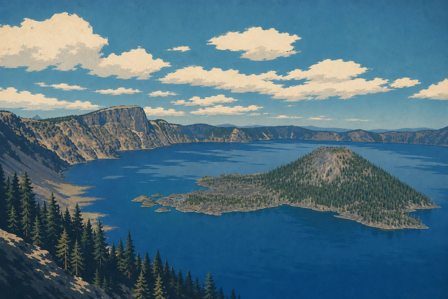
Crater Lake Map: Layout, Areas, and the Official Map to Download
Crater Lake National Park lies in southern Oregon, about 62 miles northeast of Medford. The park fills the Mount Mazama caldera, formed when the volcano collapsed some 7,700 years ago, and covers about 286 square miles around the deepest lake in the United States. The official NPS map, available as a free PDF, is the essential starting point. It shows the two loops of Rim Drive, the park's three entrances, and the main trails.
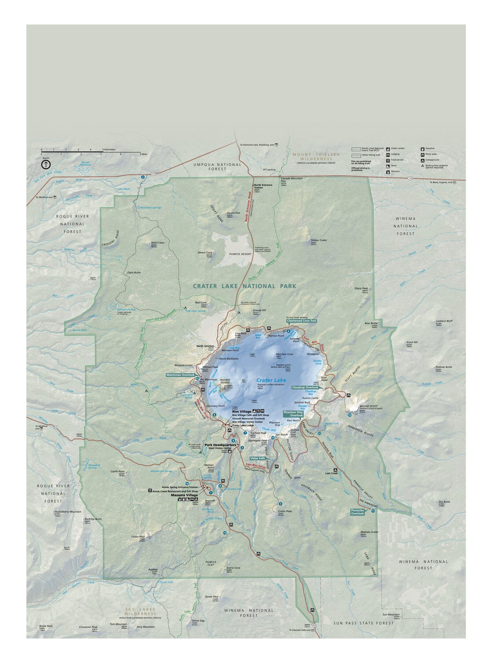
The official park map handed out at entrance stations, with roads, areas, visitor centers and services. View it here or download it for offline use.
Download the map (PDF) Public domain · National Park ServiceWhere Is Crater Lake?
Crater Lake sits in Oregon, at the heart of the Cascade Range, about 267 miles south of Portland and 528 miles north of San Francisco. On a map of the United States, look in south-central Oregon, between Medford to the west and Klamath Falls to the southeast. Conifer forests and lava fields surround the park. From the major cities along the Pacific Coast, plan on 2 to 4 hours of driving, depending on where you're coming from.
Download the Official Crater Lake Map (NPS Unigrid)
The NPS publishes Crater Lake's Unigrid map as a free PDF on nps.gov/crla, under "Maps." It shows Rim Drive, parking areas, campgrounds, trailheads, and numbered overlooks. Rangers hand out a paper copy at the park entrance. Keep it close because cell service is almost nonexistent inside the park.
Crater Lake Areas
The park breaks down into three distinct geographic areas.
Rim Village and the South Area
Rim Village is the park's service hub, accessible from the West Entrance via Highway 62. You'll find Crater Lake Lodge, a café, a shop, and the starting points for several trails, including Garfield Peak Trail. This is the only area that's fully accessible in winter. West Rim Drive remains open depending on weather conditions, while the rest of the park closes to vehicle traffic.
The East Area: East Rim Drive
East Rim Drive connects Rim Village to North Junction along the eastern rim. Overlooks line the route, and Cloudcap Overlook is the highest point in the park accessible by car. This road closes on November 1, or earlier if early snow arrives, and doesn't reopen until June, after plowing is complete.
The North Area: North Junction and Surroundings
North Junction is where Rim Drive meets the North Entrance via Highway 138. The north area is the least visited. From here, you can reach Pumice Flat and stretches of old-growth forest. It's a good choice for a weekday visit or a trip outside the peak season.
Park Entrances and the Scenic Drive Loop
Crater Lake has three entrances:
- West Entrance (Highway 62, from Medford): open year-round.
- South Entrance (Highway 97, then Highway 62, from Klamath Falls): open year-round.
- North Entrance (Highway 138, from Interstate 5): closed in winter and generally reopens in June.
Rim Drive forms a 33-mile loop around the lake. Driving clockwise gives you the best morning light on the lake. The speed limit is 35 mph along the entire route. Without extended stops, allow 2 to 3 hours for the full loop.
To plan your visit and estimate how much time you'll need, see Crater Lake in 1, 2, or 3 days.
Points of Interest and Viewpoints on the Map
Mark these spots on your map before you leave:
- Cleetwood Cove (north): the only official access to the lake's shoreline, via a roughly 1.1-mile one-way trail with 215 feet of elevation gain. It's also the launch point for lake cruises and the only place where swimming is allowed.
- Wizard Island: a volcanic island rising from the center of the lake, accessible by boat from Cleetwood Cove.
- Phantom Ship: a rocky formation above the water, visible from Kerr Notch and Sun Notch along East Rim Drive.
- The Watchman (west side): a lookout with 360-degree views of the lake and the surrounding Cascade Range.
- Discovery Point: the first historic overlook along West Rim Drive, a good stop when you arrive through the West Entrance.
Details on each activity and trail are in the best things to do at Crater Lake and Crater Lake hikes.
For roads, airports, and driving times from the nearest cities, see how to get to Crater Lake.
Hiking Maps and Topographic Guides (Paper)
The NPS Unigrid map covers the park at a small scale. For off-trail hikes or snowshoe trips, a topographic map is essential. National Geographic Trails Illustrated maps, including map no. 713, "Crater Lake National Park," show contour lines, water sources, and trail ratings. You can order them from a specialty bookstore or online.
Frequently Asked Questions
What are the must-see places at Crater Lake?
The must-see spots at Crater Lake are Rim Drive, with its succession of overlooks; Cleetwood Cove, the only shoreline access; Wizard Island; and The Watchman. Our Things to Do page covers them in detail, with timing and seasonal advice.
What makes Crater Lake so special?
Crater Lake is special because it fills the caldera of a volcano that collapsed 7,700 years ago, and it's the deepest lake in the United States at 1,949 feet. Its intense blue color comes from the water's exceptional purity. The lake has no inlets and fills only from precipitation.
Why can't you swim in Crater Lake before 2029?
Swimming in Crater Lake is normally allowed only at Cleetwood Cove, the lake's sole shoreline access point. Trail rehabilitation work has led to temporary access restrictions during some seasons. Check current opening conditions at nps.gov/crla before your visit because dates vary with the progress of the work.
What is the closest town to Crater Lake?
The closest town to Crater Lake is Klamath Falls, about 37 miles southeast via Highway 97. Medford, 62 miles to the west, is larger and has an airport, MFR, with direct flights to the Pacific Coast.