
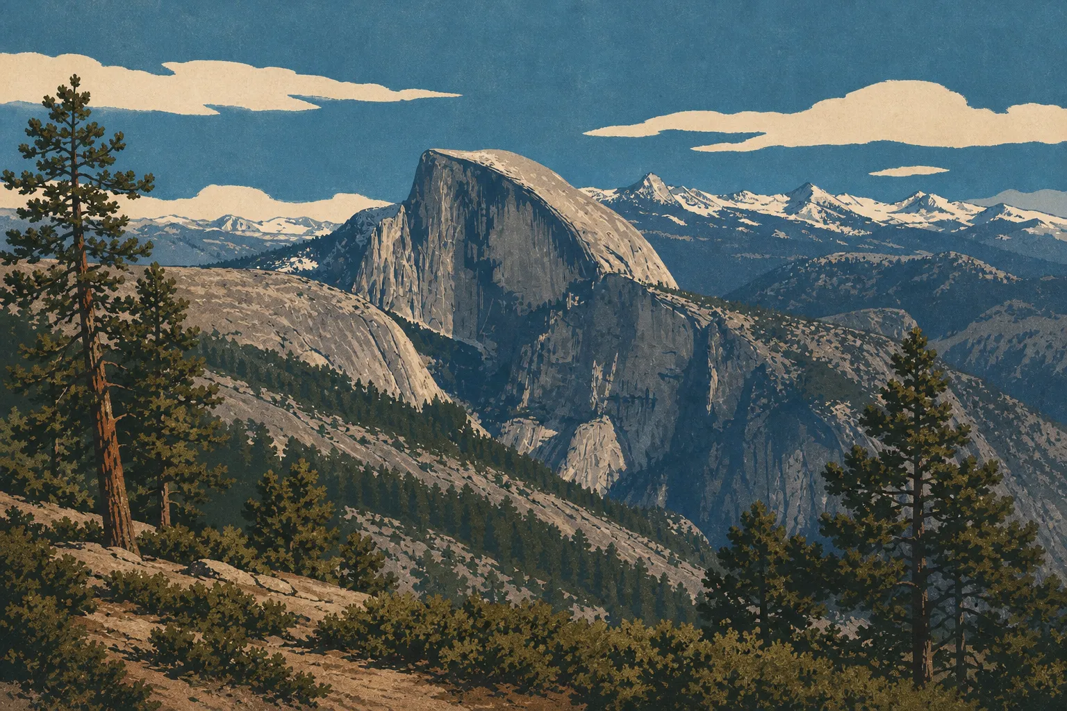
Yosemite Map: Areas, Roads, and the Official Park Map
Yosemite National Park lies in California's Sierra Nevada, about a four-hour drive east of San Francisco. The park covers roughly 1,200 square miles, from 1,970 to 13,100 feet in elevation. The official NPS map is available free as a PDF on the National Park Service website and is handed out at every entrance station.
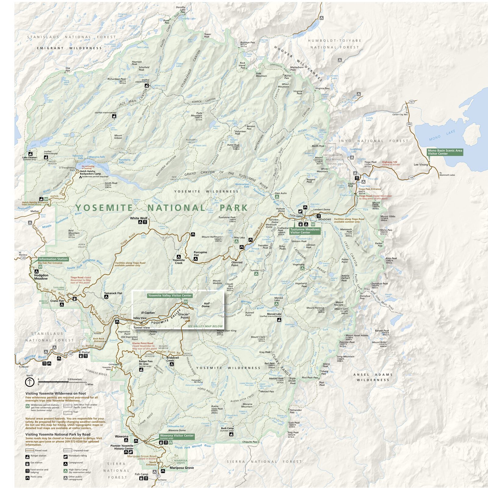
The official park map handed out at entrance stations, with roads, areas, visitor centers and services. View it here or download it for offline use.
Download the map (PDF) Public domain · National Park ServiceWhere Is Yosemite?
Yosemite sits in the central Sierra Nevada of California. Farmland in the Central Valley borders the park to the west. To the east, Tioga Pass connects the park to the Great Basin and the shores of Mono Lake. The park borders the Stanislaus and Sierra national forests and forms part of the Sierra Nevada's larger chain of protected areas.
To locate Yosemite on a map of the United States, plan on about four hours from San Francisco and six hours from Los Angeles. Our complete Yosemite guide puts the park in this broader California geography.
Downloading Yosemite's Official Unigrid NPS Map
Like every American national park, Yosemite has an Unigrid map published by the National Park Service. This double-sided map covers the entire park: roads, campgrounds, major trails, areas, ranger stations, and points of interest. It's available free as a PDF at nps.gov/yose/planyourvisit/maps.htm and is handed out at every entrance when you pay the entrance fee.
One limitation is that the Unigrid map is fairly general. You'll need dedicated topographic maps for technical hikes or trips off established trails (see the section below).
Yosemite's Areas
Yosemite is large: 1,200 square miles, ranging from valleys at 1,970 feet to peaks at 13,100 feet. Knowing its four areas keeps you from thinking that “seeing Yosemite” means staying in the valley.
Yosemite Valley (Yosemite Valley)
This is the park's busiest area: a roughly 6.8-mile-long glacial valley carved at an elevation of 3,940 feet. El Capitan, Half Dome, Yosemite Falls, Bridalveil Fall—all the iconic sites are concentrated here. Highways 41, 140, and 120 from the west lead into the valley year-round. Traffic is heavy and parking is limited in summer, so the free shuttles quickly become essential.
Tuolumne Meadows
At 8,530 feet along Tioga Road (Highway 120), Tuolumne Meadows' alpine meadows offer a radically different side of the park: open spaces, glacier-polished granite, and vast skies. This is the go-to area for high-country hikes and backcountry camping with a permit. Tioga Road closes from November through late May, sometimes staying closed into June depending on snowfall.
Wawona
South of the park and accessible via Highway 41 from Fresno, Wawona includes the historic Wawona Hotel, open since 1879, the Pioneer Yosemite History Center, and the giant sequoias of Mariposa Grove. This area is noticeably quieter than the valley and has a different atmosphere. It's a good option if you want to avoid the crowds and get closer to the Big Trees.
Hetch Hetchy
In the northwest, away from the usual tourist routes, Hetch Hetchy is a reservoir built in 1923 in a valley that once looked like Yosemite Valley. It's accessible year-round from sunrise to sunset, but it's about a 90-minute drive from the valley. Hikers looking for solitude will find little-used trails and views of O'Shaughnessy Dam.
Park Entrances and Driving Across Yosemite
Yosemite has five entrance stations:
- Arch Rock (Highway 140 from Merced): the most direct entrance for reaching the valley from the coast.
- South Entrance (Highway 41 from Fresno): ideal for starting with Wawona and Mariposa Grove.
- Big Oak Flat (Highway 120 west from the Bay Area): access to the north side of the valley.
- Tioga Pass (Highway 120 east from Lee Vining): a spectacular crossing of the Sierra at more than 9,800 feet, closed roughly from November through late May or June.
- Hetch Hetchy: shares an entrance with Big Oak Flat and serves visitors specifically heading to this area.
You can drive across the park from west to east on Tioga Road as long as you visit outside the seasonal closure. In the valley, Valley Loop Road is one-way in sections. During the busy season, it's best to park your vehicle and use the free shuttle network. Our guide to Yosemite shuttles and roads explains the routes and schedules for getting around the valley and reaching Tuolumne Meadows without a car.
The entrance fee is $35 per vehicle, $30 for a motorcycle, or $20 per person entering on foot or by bicycle. The park's annual pass costs $70. For entrance fees and annual passes, see the National Parks Fees & Passes page.
Points of Interest and Viewpoints on the Map
Before entering the park, mark these sites on your map:
El Capitan: a 2,950-foot vertical granite cliff, visible from Valley View and El Capitan Meadow as soon as you enter the valley from the west.
Half Dome: Half Dome's distinctive profile is visible from the valley floor (Cook's Meadow and Mirror Lake) and from above at Glacier Point.
Glacier Point: a viewpoint at 7,220 feet, accessible via Glacier Point Road, which closes in winter. It offers a 180-degree view of Half Dome, the valley, and Yosemite Falls. Our Yosemite highlights guide covers access conditions and the best times to visit.
Yosemite Falls: with a total drop of 2,430 feet over three sections, this is the tallest waterfall in North America. It's visible from the valley floor and reaches its peak flow in May and June.
Bridalveil Fall: the first waterfall you see when entering from the west. There's a dedicated parking area and it's a five-minute walk. It flows year-round, unlike some waterfalls that dry up in late summer.
For trails and secondary sites, our Yosemite hiking guide sorts them by duration and difficulty.
Nearest Cities and Airports
Yosemite has no airport or train station within its boundaries. Here's how to plan your approach:
- Fresno (south, about an hour from the south entrance): Fresno Yosemite International Airport (FYI), the closest airport to the park. It has numerous domestic connections from major U.S. cities.
- Merced (west, about two hours from the valley): the city with the best public transportation connections to the park.
- San Francisco / Oakland (about four hours away): the busiest air hubs for this destination.
- Los Angeles (LAX) (about six hours away): a good option for a Southern California road trip followed by a drive north to Yosemite.
For precise travel times, public transportation connections, and rental costs, our guide to getting to Yosemite compares all the options from each city.
Hiking Maps and Topographic Guides (Print)
The Unigrid map works well for getting oriented between areas. For hiking, two trusted references are worth having:
Tom Harrison Maps publishes laminated topographic maps for each area of the park (Yosemite Valley, Half Dome, Tuolumne Meadows, Hetch Hetchy, and more). They're large-scale and rain-resistant. Always carry one on trails that leave the valley.
National Geographic Trails Illustrated (No. 306 for Yosemite) covers the entire park on a single map, with established trails, campgrounds, and contour lines. It's a good compromise between an overview and useful detail.
You can find these maps at specialty bookstores and outdoor retailers' websites. Order them before you leave. Don't count on finding them easily at the park entrance.
Frequently Asked Questions
Where is Yosemite on a map of the United States?
Yosemite National Park is in California's central Sierra Nevada, about a four-hour drive from San Francisco and six hours from Los Angeles.
Can you download Yosemite's official map?
Yes. The National Park Service provides the Unigrid map as a free PDF at nps.gov/yose/planyourvisit/maps.htm. It's also handed out at every park entrance when you pay the entrance fee.
Can you drive across Yosemite?
Yes, Tioga Road (Highway 120) crosses the park from west to east at more than 9,800 feet. It closes from November through late May or June, depending on snowfall. The roads to the valley (Highways 41, 140, and 120 west) stay open year-round.
What's the best viewpoint in Yosemite?
Glacier Point offers the most complete panorama of Half Dome and the valley from 7,220 feet. Valley View provides the classic view of El Capitan at the entrance to the valley. Our Things to Do page compares these viewpoints in detail.
How long does it take to visit Yosemite?
Plan on two to three days for the valley and Glacier Point. A five-day stay gives you time to explore Tuolumne Meadows and Wawona, too. Our Yosemite itinerary guide offers plans suited to different trip lengths.
Which city is closest to Yosemite?
Merced, to the west, has the best public transportation connections to the park (Amtrak train plus YARTS bus). Fresno, to the south, has the closest international airport.