
Black Canyon of the Gunnison Map: Layout, Areas, and Official Download
In brief: Black Canyon of the Gunnison lies in western Colorado, about 7.5 miles north of Montrose. The official NPS map, in Unigrid format, is available free at the park entrance and as a PDF download from the NPS website. The park has two areas: the South Rim, open 24/7 year-round, and the North Rim, closed from mid-November to early May.
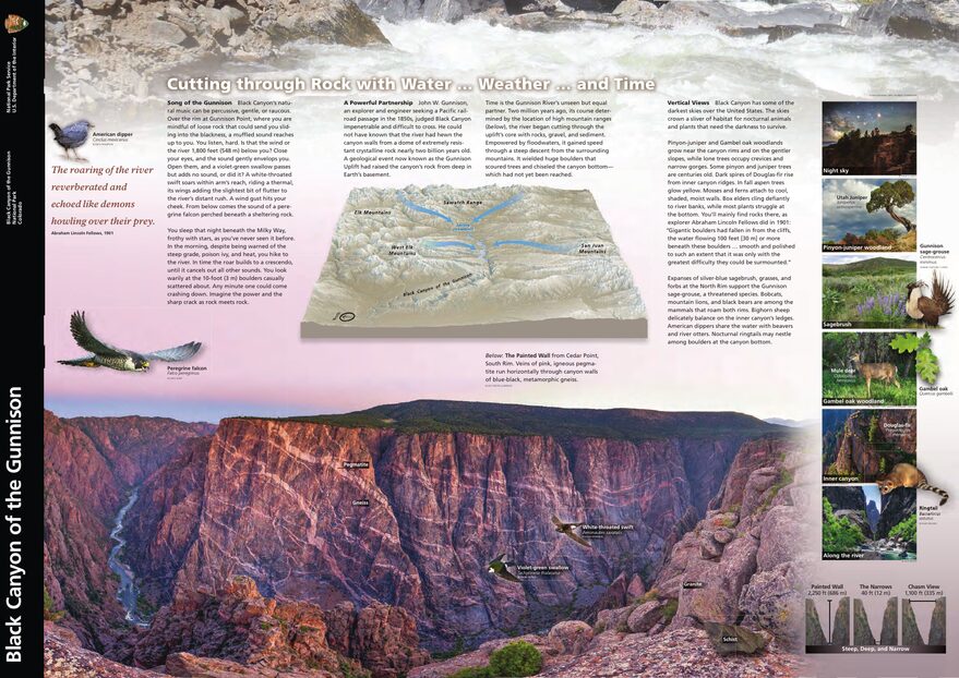
The official park map handed out at entrance stations, with roads, areas, visitor centers and services. View it here or download it for offline use.
Download the map (PDF) Public domain · National Park ServiceWhere Is Black Canyon of the Gunnison?
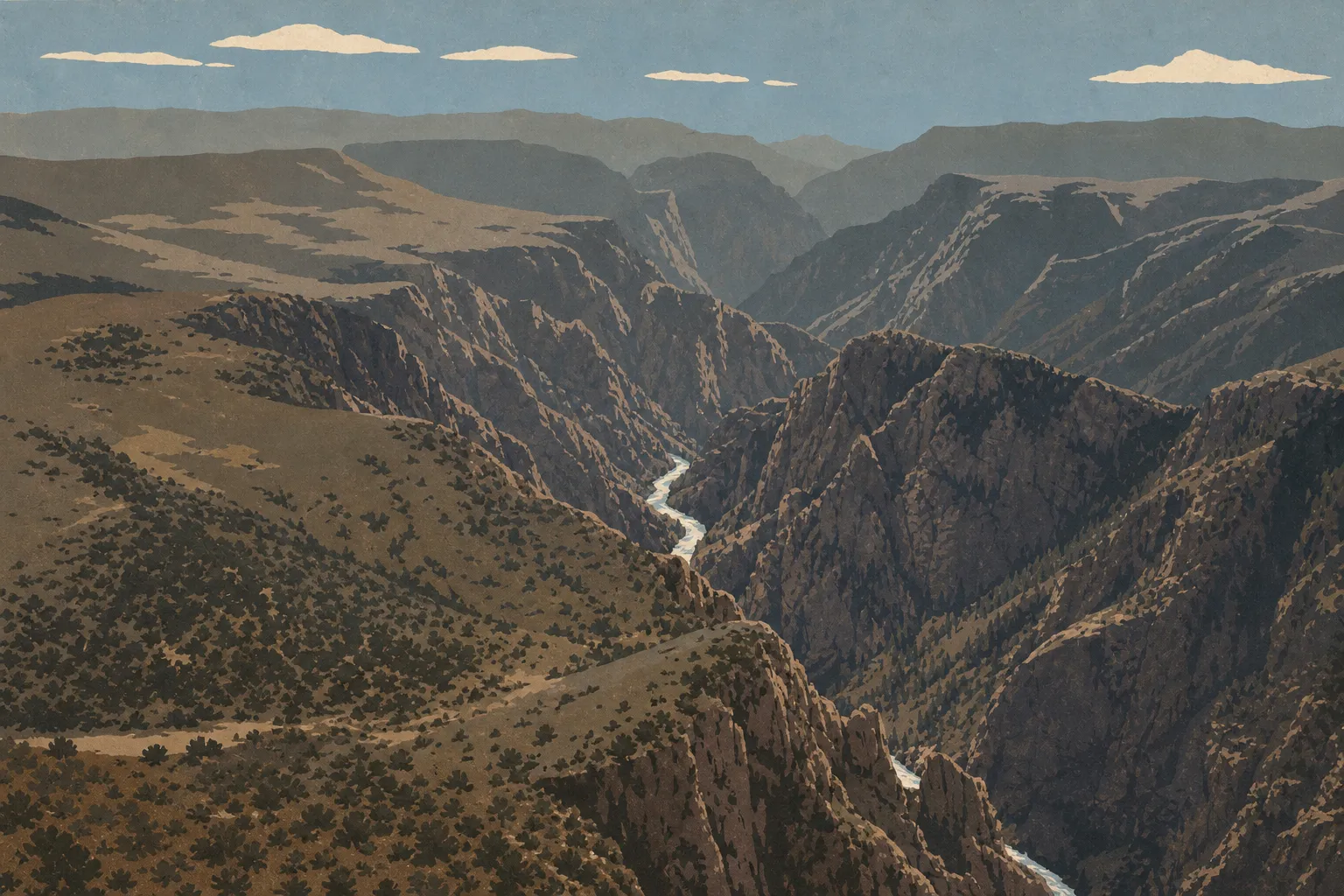
Black Canyon of the Gunnison National Park occupies western Colorado, between the towns of Montrose and Gunnison. It belongs to the broader Colorado Plateau, the semiarid high plateau also shared by Arches, Canyonlands, and Mesa Verde.
The canyon stretches for 53 miles, but the section within the national park, about 12 miles long, contains the steepest stretches: nearly vertical walls, depths reaching 2,720 feet, and a width sometimes less than 130 feet at the bottom. This narrowness is what earned the canyon its nickname, “black.” Some sections receive only 33 minutes of direct sunlight per day, and the bottom remains in near-permanent shadow.
On a map of the United States, the park lies about 205 miles southwest of Denver, in the southern Rockies. Our guide to getting to Black Canyon of the Gunnison covers routes and driving times from the main cities and airports.
Downloading the Official Park Map (NPS Unigrid)
The NPS publishes its Unigrid map free of charge, in the format shared by all U.S. national parks. It covers both rims, access roads, main trails, overlooks, campgrounds, and picnic areas.
To download it, go to the “Maps” page on the official NPS website and select Black Canyon of the Gunnison. The PDF fits on one sheet of paper in landscape orientation. Print it before you leave. Cell service is unreliable in this remote part of Colorado, and entrance staff hand out only one copy per vehicle.
The Park’s Two Areas: South Rim and North Rim
South Rim (South Rim)
South Rim is the main area and stays open 24/7 year-round. It includes the visitor center, South Rim Road, a roughly 7.5-mile scenic drive, the main overlooks, and South Rim Campground. The entrance is 7 miles north of U.S. Highway 50 via CO Highway 347 (GPS address: 9800 Highway 347, Montrose, CO 81401).
When we visited in May, South Rim was already busy by 8 a.m. Arriving before 9 a.m. makes it easier to find a parking spot without waiting at the busiest overlooks. The Black Canyon of the Gunnison camping guide lists lodging options inside the park.
North Rim (North Rim)
North Rim is wilder, with no services available. You reach it from Crawford, about 11 miles southwest via CO Highway 92. North Rim Road closes from mid-November to early May because of snow. Outside that period, a few noteworthy overlooks, including Balanced Rock View and North Rim Overlook, make the detour worthwhile. A basic campground offers a quiet place to stay. Bring water and supplies because there are no provisions available on the north side.
Park Entrances and Internal Roads
No road crosses the canyon from one rim to the other inside the park. South Rim and North Rim are two separate access points. To drive from one area to the other, you have to go around the canyon, which takes about 1.5 hours.
Entrance fees are $30 per vehicle, $25 per motorcycle, and $15 per person on foot or by bicycle. The park also offers a $55 annual pass. If you visit several national parks during the year, the $80 America the Beautiful pass covers the entire system. Our Practical Information, Rules & Safety page explains all of these conditions.
Keep in mind that most South Rim overlooks have no guardrails. Stay in marked areas at all times and slow down on internal roads. Mule deer and deer can cross without warning.
Points of Interest and Overlooks on the Map
The overlooks line South Rim Road and are all accessible by car. Mark these on your map:
- Painted Wall View offers a view of Colorado’s highest vertical cliff, 2,257 feet of wall streaked with light pegmatite veins against dark gneiss. Late-afternoon light brings out the contrast.
- Gunnison Point is the first overlook after the visitor center. It looks down on the Gunnison River, about 1,970 feet below. It’s a useful reference for understanding the canyon’s scale.
- At Chasm View, the opposite wall is only about 985 feet away as the crow flies, with a dizzying drop beneath your feet. The park is so narrow that you can hear the river without seeing it.
- Dragon Point, at the western end of the road, offers an unobstructed view of the downstream canyon and the river’s bends.
The Black Canyon of the Gunnison activities guide and the hiking guide place these points in a suggested itinerary and describe the trails that descend to the canyon floor.
Nearest Towns and Airports
Montrose is the nearest town, about 7.5 miles from the South Rim entrance, and has most of the services you’ll need. The places to stay around Black Canyon of the Gunnison cover Montrose and the areas around the park.
Gunnison is about 53 miles east via U.S. 50.
Grand Junction is about 84 miles northwest. For detailed distances and transportation options, our Access & Transportation guide covers everything you need to know.
Hiking Maps and Paper Topo Guides
The NPS Unigrid map is enough for the overlooks and driving on park roads. If you plan to descend into the canyon on the unmarked routes known as Inner Canyon Routes, a 1:24,000-scale USGS topographic map is recommended. The Grizzly Ridge and Red Rock Canyon quadrangles cover the area.
Specialty travel map stores sell laminated maps of Colorado with insets covering the national parks. Order them before you leave. Specialty retailers are scarce in Montrose.
Frequently Asked Questions
How can I visit Black Canyon of the Gunnison?
You can visit the park by car through the South Rim entrance (CO Highway 347, north of Montrose) or the North Rim entrance (CO Highway 92, southwest of Crawford). South Rim Road connects the main overlooks in half a day. Our Black Canyon of the Gunnison itinerary guide offers plans tailored to the time you have.
What is the nearest town to Black Canyon of the Gunnison?
The nearest town is Montrose, Colorado, about 7.5 miles from the park’s South Rim entrance. It has an airport (MTJ) with nonstop flights from Denver, plus all the amenities you need to start or wrap up a trip.
What town is Black Canyon of the Gunnison in?
The park is administratively part of Montrose County, Colorado. No town lies within the park itself. Montrose is the closest town for services.
Why is it called the Black Canyon?
The canyon is so narrow and deep that some sections receive only 33 minutes of direct sunlight per day. Its naturally dark gneiss and schist walls remain almost constantly in shadow, giving the canyon its distinctive color. It is one of the most striking geological features in the American West.
Can you drive through Black Canyon of the Gunnison?
No. No road connects South Rim and North Rim inside the park. To drive from one area to the other, you have to go around the canyon, which takes about 1.5 hours.
How long does it take to visit the park?
A half-day is enough to drive South Rim Road and see its main overlooks. Plan on a full day if you want to include North Rim or descend into the canyon. Our Itinerary & Timing guide lays out plans based on how much time you have.