
Glacier Map: Regions, Roads, and the Official Park Map
Glacier National Park sits in the northwest corner of Montana, along the Canadian border. The park covers about 1,600 square miles along the Rocky Mountains. The official park map, a free PDF published by the National Park Service, is the first document to download before your trip.
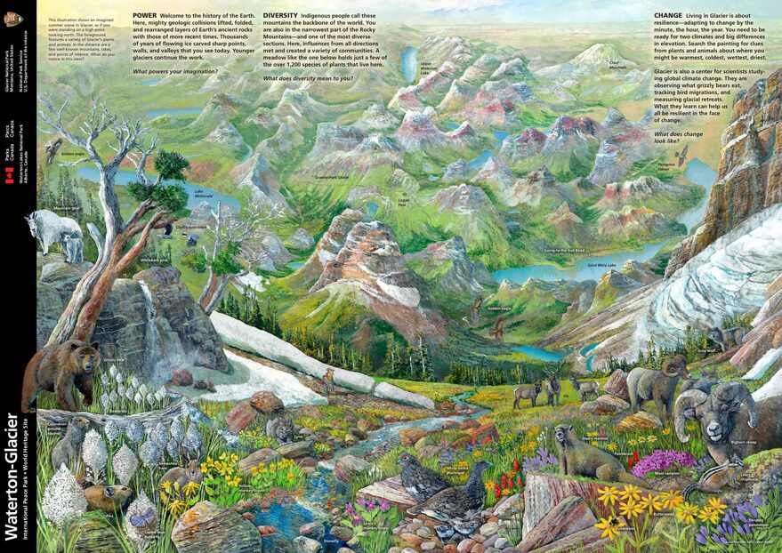
The official park map handed out at entrance stations, with roads, areas, visitor centers and services. View it here or download it for offline use.
Download the map (PDF) Public domain · National Park ServiceWhere Is Glacier National Park?
Glacier lies in northwestern Montana, along the Canadian border. It adjoins Waterton Lakes National Park on the Canadian side. Together, they form Waterton-Glacier International Peace Park, a UNESCO World Heritage Site since 1995.
The park straddles the Continental Divide, the watershed separating the Pacific and Atlantic basins. This location creates two very different environments on the map. The west side has a wet, forested microclimate fed by Pacific air masses. The east side has open landscapes swept by cold, dry Arctic winds. The two sides of the park look nothing alike.
For travel options from major cities and nearby airports, the Glacier Access guide has all the practical details.
Download Glacier's Official Unigrid NPS Map
The NPS publishes Glacier's Unigrid map each season. It's a high-resolution PDF showing the entire park, including its roads, entrances, main trails, and points of interest. It's free on the park's official website, and a folded paper copy is handed out at every entrance station when you pay the entrance fee.
Here's a practical tip: print it on A3 paper before you leave. Cell service is almost nonexistent across most of the park, and navigation apps struggle with the terrain.
Glacier's Regions
The park is divided into six major geographic areas, separated by ridges and passes. The Going-to-the-Sun Road, the only road crossing the park, connects the west side to the east side for about 50 miles.
Lake McDonald Valley
This is the main entrance on the west side. Lake McDonald, the park's largest lake at about 9 miles long, stretches along the bottom of a dense, forested valley. You'll find several campgrounds, Lake McDonald Lodge, a historic hotel dating to the 1910s, and the western end of the Going-to-the-Sun Road. The vegetation looks almost like a wet temperate forest, which surprises visitors expecting alpine scenery right at the entrance.
The Going-to-the-Sun Road Corridor
The road climbs from the McDonald Valley to Logan Pass (6,646 feet), then descends toward St. Mary in the east. This corridor has the park's most photographed overlooks: Weeping Wall, Garden Wall, and Jackson Glacier Overlook. Logan Pass is also the trailhead for Hidden Lake Overlook, one of Glacier's most popular hikes.
The St. Mary Area
East of Logan Pass, the vegetation thins out and the landscape opens into broad meadows beneath a huge sky. St. Mary Lake is the park's second-largest lake. The St. Mary entrance on US-89 is the logical access point for anyone arriving from central or eastern Montana.
Many Glacier
Many Glacier is hikers' favorite area. You reach it via MT-3 from Babb, without using the Going-to-the-Sun Road. Several glaciers are visible on foot, including Grinnell Glacier and Salamander Glacier. Wildlife, especially grizzly bears and mountain goats, is particularly active here. Many Glacier Hotel, facing Swiftcurrent Lake, is one of the park's major historic lodges.
Two Medicine
Two Medicine is the quietest area on the east side and sees fewer visitors than the main routes. Its lakes and ridges, rising above 8,900 feet, offer beautiful panoramas. It's a good option for avoiding the pressure of the high season.
North Fork (Polebridge)
The North Fork area, at the far west end of the park, is its most isolated region. The road to the hamlet of Polebridge is unpaved for several miles. If you're looking for raw nature without infrastructure, you'll find remote lakes such as Bowman Lake and Kintla Lake, abundant wildlife, and no cell service. It's another side of America.
Park Entrances and Driving Across Glacier
Glacier has five main entrances:
- West Glacier (US-2): the west entrance and the starting point for the Going-to-the-Sun Road along Lake McDonald.
- St. Mary (US-89): the east entrance and the eastern terminus of the Going-to-the-Sun Road.
- Many Glacier (MT-3 from Babb): a separate access point, independent of the cross-park road.
- Two Medicine (from East Glacier Park Village): access to the park's southeastern area.
- Polebridge: northwest access via an unpaved road.
You cross the park by car on the Going-to-the-Sun Road. Keep in mind that oversized vehicles, including RVs and trailers, can't use the central section between Avalanche Creek and Logan Pass. These vehicles must go around the park via US-2 to the south. For size restrictions and the free shuttle schedule during the season, Getting Around Glacier covers everything you need to know.
The park is open 24 hours a day, 365 days a year. You still have to pay the entrance fee in the off-season, using self-service stations when no staff are present: $35 per private vehicle, $20 per person on foot or by bicycle, and $30 for a motorcycle. The $70 annual pass pays for itself after visiting two parks in a year. For entrance fees and annual passes, see the National Parks Fees & Passes page.
Points of Interest and Viewpoints on the Map
Mark these places on your map before you leave:
- Logan Pass (6,646 feet): the pass at the top of the Going-to-the-Sun Road, accessible by car or shuttle, and the trailhead for Hidden Lake Overlook.
- Jackson Glacier Overlook: a direct view of a glacier from the road, without leaving your car.
- Grinnell Glacier: accessible on foot from Many Glacier and one of the glaciers closest to visitors.
- St. Mary Falls and Virginia Falls: two linked waterfalls on a short trail suitable for everyone.
- Lake McDonald: a classic sunrise composition, with the colorful ridges reflected in the lake.
- Swiftcurrent Lake (Many Glacier): the lake in front of the historic hotel, surrounded by peaks.
Things to Do in Glacier and the Glacier Hiking Guide cover each site in detail, with distances, elevation gains, and practical advice.
Nearest Towns and Airports
West side: Whitefish is about 19 miles from the West Glacier entrance. It's a convenient base with hotels, restaurants, and an Amtrak stop. Kalispell, about 31 miles away, is home to Glacier Park International Airport (IATA code: FCA), the region's main airport.
East side: East Glacier Park Village sits right at the park entrance and has the historic Glacier Park Lodge. Browning, about 16 miles from the St. Mary entrance, is the main community on the Blackfeet Reservation.
For car rentals, bus connections, and exact distances from major Montana cities, see the Glacier Access guide.
Hiking Maps and Trail Guides (Print)
The NPS Unigrid map gives you a good overview, but it isn't enough for trails in alpine areas. For hiking away from the main routes:
- Trails Illustrated No. 215, “Glacier / Waterton Lakes” (National Geographic): the standard topographic map for Glacier, at a scale of 1:100,000, waterproof, with contour lines and marked trails.
- Falcon Guide, “Hiking Glacier and Waterton Lakes”: detailed trail descriptions, difficulty ratings, and elevation profiles.
These maps and guides are available at the park's visitor centers and at specialty travel bookstores.
Frequently Asked Questions
Where is Glacier National Park?
Glacier National Park is in the northwest corner of the United States, in Montana, along the Canadian border and the Rocky Mountains. Together with Waterton Lakes National Park in Canada, it forms a transboundary natural area designated a UNESCO World Heritage Site.
Can I download the official Glacier National Park map?
Yes. The National Park Service publishes Glacier's Unigrid map as a free PDF on the park's official website. A folded paper version is handed out at every entrance station when you pay the entrance fee.
Can you drive across Glacier National Park?
Yes, via the Going-to-the-Sun Road, which connects the west and east sides for about 50 miles. RVs and wide vehicles can't use the central section. They must take US-2 to the south. The Getting Around Glacier guide explains the size restrictions.
What's the best viewpoint in Glacier National Park?
Logan Pass (6,646 feet), at the top of the Going-to-the-Sun Road, is the most accessible and most popular overlook. Many Glacier offers direct views of several glaciers from its trails. The Things to Do in Glacier guide lists viewpoints along with access conditions and timing advice.
How long do you need to visit Glacier National Park?
The ideal length of a visit depends on your priorities and pace. Our complete Glacier guide gives you an overview of the park, while our Itinerary & Length of Stay page offers one- to seven-day itineraries for planning your trip.
What is the closest town to Glacier National Park?
On the west side, Whitefish is about 19 miles from the main entrance. On the east side, East Glacier Park Village sits right at the park entrance. The region's main airport is in Kalispell, Glacier Park International Airport (FCA), about 31 miles to the west.