
Cuyahoga Valley Itinerary: What to See in 1, 2, or 3 Days
Cuyahoga Valley National Park stretches for about 31 miles between Cleveland and Akron in northeastern Ohio. There’s no entrance fee, visitor quota, or required reservation, which makes the logistics much easier. The valley is green, crossed by a flat towpath and a scenic steam train. There’s no extreme wilderness here, but the variety of landscapes often surprises travelers.
The short answer. Two days cover the park’s essentials without rushing, alternating between the canal-Boston area in the north and center and the sandstone highlands of Virginia Kendall in the south. If you only have one day, focus on Brandywine Falls and The Ledges. Three days let you add the Cuyahoga Valley Scenic Railroad by bike and train, the most unusual combination the park offers.
How Much Time Do You Need to Visit Cuyahoga Valley?
The right amount of time mostly depends on your pace and how you plan to get around.
By car. You can reach all the highlights in one well-organized day. It’s doable, but the schedule will be tight, and you’ll need to resist the urge to linger.
On foot. Plan on two days. The trails aren’t long, but they’re worth taking your time on. The canal/Tinkers Creek area in the north and the Virginia Kendall/Beaver Marsh area in the south each need a full half-day.
By bike. Three days let you connect the two ends of the park on the Towpath Trail, covering about 20 miles in the park, and combine the ride with a train return. This is our go-to plan for visitors with time to spare and strong legs.
The park is open 24 hours a day, every day of the year, with no entrance fee. Some areas close at sunset, including Brandywine Falls, The Ledges, Octagon, Kendall Lake, and Kendall Hills. Plan to visit them in the morning or early afternoon so you don’t get caught out.
Access, Entrances, and Getting Around the Park
Arriving at Cuyahoga Valley
The Boston Mill Visitor Center, at 6947 Riverview Road in Peninsula, is centrally located in the valley and hands out free official NPS Unigrid maps. To reach the park from Cleveland or Akron, the Cuyahoga Valley access guide covers all your options.
Riverview Road and the Main Routes
Riverview Road follows the Cuyahoga River from north to south and serves as the main driving route, with parking areas every 2 to 3 miles. On weekends from May through October, parking near Brandywine Falls and the Towpath Trail fills up by midday, so plan to arrive before 10 a.m.
The Cuyahoga Valley Scenic Railroad (CVSR)
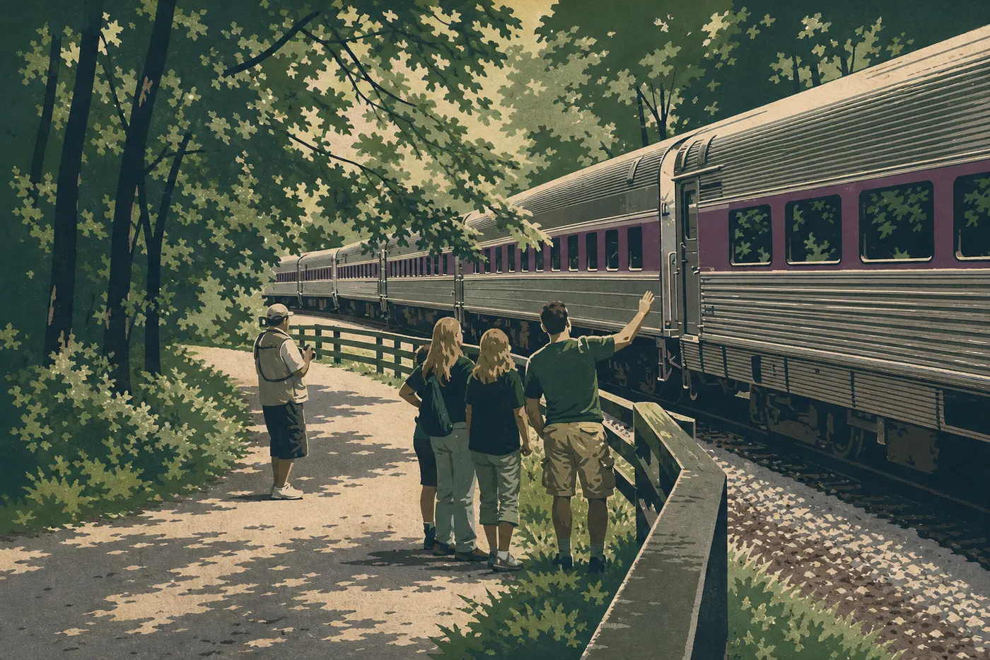
The CVSR is an attraction in its own right, not just a way to get around. This heritage train connects Independence at the north entrance with Akron at the south entrance over about 25 miles, with several stops in the park, including Peninsula, Brecksville, Botzum, and Ira.
The most popular combination is to bike south on the Towpath Trail and take the train back with your bike. The CVSR allows bikes for an additional fee. The train runs on a seasonal schedule and doesn’t operate year-round. Find current CVSR schedules and fares in the Cuyahoga Valley transportation guide.
Cuyahoga Valley’s Sections
North Section: The Canal and Tinkers Creek, from Valley View to Brecksville
This is the park’s historic entrance area, shaped by the route of the Ohio & Erie Canal, built in the 19th century. The Towpath Trail is completely flat here, running between the trees and the water. It’s ideal for a relaxed bike ride or an easy walk.
The Canal Exploration Center in Valley View covers the canal’s history with permanent exhibits and makes a good starting point if you’re coming from Cleveland.
The Tinkers Creek Gorge is a National Natural Landmark. Clay and sandstone banks form an intimate gorge, accessible by a short trail of about 0.6 miles round-trip from the Gorge Parkway parking area.
This section works especially well for families with young children. The terrain is flat, parking is frequent, and there’s no technical difficulty. Cuyahoga Valley with kids lists the best loops for young children.
Central Section: Boston and Brandywine Falls, around Peninsula
This is the park’s lively heart, the area most visitors know by reputation.
Brandywine Falls. An approximately 60-foot waterfall is accessible via a 0.9-mile round-trip trail, with a wooden platform overlooking the falls. The waterfall is spectacular in spring after the rains and more modest in summer. Arrive before 10 a.m. or after 3 p.m. on weekends to avoid the crowds.
Boston Store. This historic 1836 building is connected to the canal era. The visit takes about 20 minutes and provides useful context for the rest of the day.
Peninsula. The town next to the park has cafés, restaurants, and a laid-back small-town American atmosphere. It’s the best base for exploring both sections. Recommended places to eat around Peninsula are listed in our Cuyahoga Valley restaurant guide.
South Section: Virginia Kendall and the Highlands, toward Akron
The terrain changes here. Sandstone from the Pennsylvanian period forms cliffs and “ledges” that rise from the forest, creating a landscape very different from the canal plain.
The Ledges. The loop trail, about 3.1 miles and rated easy to moderate, follows sandstone cliffs rounded by erosion. Ice Box Cave, a crack between two blocks of rock, stays cool even in summer. Allow 1.5 to 2 hours of hiking.
Kendall Lake. This quiet lake has a sandy beach open in summer and a sledding hill in winter. The area closes after sunset.
Beaver Marsh. This wetland was restored in the 1990s after an auto salvage yard was abandoned. Beavers, great blue herons, turtles, and sometimes otters have returned. Access is from the Towpath Trail, about 0.9 miles from the Ira CVSR stop. Our Cuyahoga Valley wildlife guide covers the species found here and the best times to see them.
Happy Days Visitor Center. This is the south section’s visitor center, convenient if you’re entering from Akron.
Day-by-Day Itinerary
Day 1: The Canal, Boston, and Brandywine Falls
Start at the Canal Exploration Center in the north section. Thirty minutes is enough to understand the history of the park and canal. Then head south on the Towpath Trail, by bike or on foot, depending on your preference.
In the middle of the morning, stop in the Boston Store area in the central section. The quick tour of the historic building adds context to the landscape you’re traveling through. Pick up a map at the Boston Mill Visitor Center if you haven’t already.
In the early afternoon, drive to the Brandywine Falls parking area. The loop to the waterfall takes about 45 minutes, including the platform. Spend a few minutes at the viewing platform. Water flow varies considerably by season.
End the day with dinner in Peninsula. The atmosphere is especially relaxed in the evening.
Day 2: Virginia Kendall, The Ledges, and Beaver Marsh
Start early at The Ledges parking area in the south section, around 8 or 9 a.m., to enjoy the cool morning air. The 3.1-mile loop through the sandstone cliffs takes 1.5 hours at an easy pace. Allow 2 hours if you explore Ice Box Cave.
Then head to Kendall Lake for lunch. Picnic tables are available along the shore, and the atmosphere is noticeably quieter than in the Brandywine area.
In the afternoon, walk down to Beaver Marsh from the Ira CVSR stop, following 0.9 miles of the Towpath Trail. This is the best time of day to see beavers, which are active in the late afternoon. If you’d like to try the scenic train, returning from the Botzum or Peninsula stop is a natural option from here.
Day 3: Biking the Towpath and Tinkers Creek Gorge
The third day is for bike riders and serious walkers. The idea is to connect the two ends of the park on the Towpath Trail, covering about 20 miles with almost no elevation gain, after leaving a vehicle at one end the day before.
Leave a car at Rockside Road in the north, near the Canal Exploration Center CVSR stop, and start biking from Happy Days in the south. Or do the reverse and take the train back with your bikes.
In the middle of the morning, plan a detour to Tinkers Creek Gorge from the Gorge Parkway parking area. Allow 1 hour round-trip for a gorge landscape that contrasts with the canal plain.
If you’re traveling with toddlers, our Family Travel page offers an alternative for this third day, centered on picnic areas and short loops in the north section.
Alternatives Based on Your Time
One-day express. Boston Mill Visitor Center for orientation, 20 minutes, plus Brandywine Falls with 45 minutes of walking and The Ledges with 1.5 hours of walking. Three hours of walking in all, with the itinerary finished by midafternoon.
Classic two to three days. Follow the day-by-day itinerary above. It covers the two central sections without rushing and leaves you free to linger wherever you like.
Regional road trip. Cuyahoga Valley fits easily into a Great Lakes or historic Ohio road trip. Pittsburgh is 2 hours east. For multi-park extensions, our Midwest Road Trips offer 5- to 10-day itineraries combining the park, revitalized industrial cities, and Lake Erie.
Itinerary Map
The NPS distributes the official Unigrid map for free at the two main visitor centers, Boston Mill and Happy Days. It shows the sections, the full Towpath Trail route, numbered parking areas, and CVSR access points. Ask for it when you arrive. It’s your essential field reference.
An annotated version of the Day 1, Day 2, and Day 3 stops, including closures and bike access, is available on the Cuyahoga Valley map.
Where to Stay Along the Itinerary
Peninsula is the most central base, less than 10 minutes by car from Brandywine Falls and The Ledges. Brecksville in the north and Hudson to the east also offer accommodations 15 to 20 minutes from the park. The park has no hotel inside its boundaries, but several B&Bs and small hotels sit just outside its northern and southern edges.
Hotels and lodges near the park are listed in our Cuyahoga Valley lodging guide. Our Camping page covers NPS-managed tent sites, while our RV Camping page lists suitable campgrounds nearby.
Extend Your Trip: What to See Around Cuyahoga Valley
Cleveland, 30 minutes north. The city is worth half a day. The Rock and Roll Hall of Fame on the shores of Lake Erie, the West Side Market, and the lakefront make good additions to a nature-focused trip.
Hocking Hills State Park, 2.5 hours south. Caves, waterfalls, and ravines fill this Ohio state park, whose landscapes are very different from Cuyahoga Valley’s. The contrast is striking.
Akron, 30 minutes south. It’s a natural endpoint if you’ve biked the Towpath all the way through. The city is worth an evening if you’re interested in American industrial history.
For a structured trip combining several regional sites, our Great Lakes Region guide offers 5- to 10-day itineraries.
The Best Itinerary for Your Time
Less than a day. Brandywine Falls plus a section of the Towpath Trail from Peninsula. Short, free, and rewarding right away.
One weekend, two days. Spend the first day in the Boston/Brandywine area and the second in the Virginia Kendall/Beaver Marsh area. Two unhurried days with room to improvise.
Three days or more. Add the CVSR by bike and train, Tinkers Creek Gorge, and an evening in Peninsula or Brecksville. For a park this size and with this much variety, you’ll have seen nearly everything.
Our Cuyahoga Valley Guide brings together all the park’s practical information if you want to plan a trip that goes beyond this itinerary.
Frequently Asked Questions
How many days do you need to visit Cuyahoga Valley National Park?
Two days are enough to visit Cuyahoga Valley without rushing. Spend the first day in the canal/Boston area and the second in Virginia Kendall and Beaver Marsh. One day is still possible with an express itinerary focused on Brandywine Falls and The Ledges.
Is there a scenic road through Cuyahoga Valley National Park?
Riverview Road follows the Cuyahoga River for the full length of the park and serves as the main driving route. The Cuyahoga Valley Scenic Railroad offers a scenic rail alternative between Independence in the north and Akron in the south, with several stops in the park where you can get on or off.
What’s the hardest hike in Cuyahoga Valley National Park?
The most demanding hike in Cuyahoga Valley is in the Virginia Kendall area, on the roughest sections of the Buckeye Trail among the sandstone cliffs. The terrain remains moderate by national park standards. There’s no alpine elevation, but some sections are technical and rocky. Our Hiking page ranks all the trails by difficulty.
How long is the Cuyahoga Valley towpath?
The towpath, or Towpath Trail, covers about 20 miles within the national park, from the north section at Valley View to the south section at Botzum, near Akron. It forms part of the Ohio & Erie Canal Towpath Trail, whose full route extends well beyond the park’s boundaries across Ohio.