
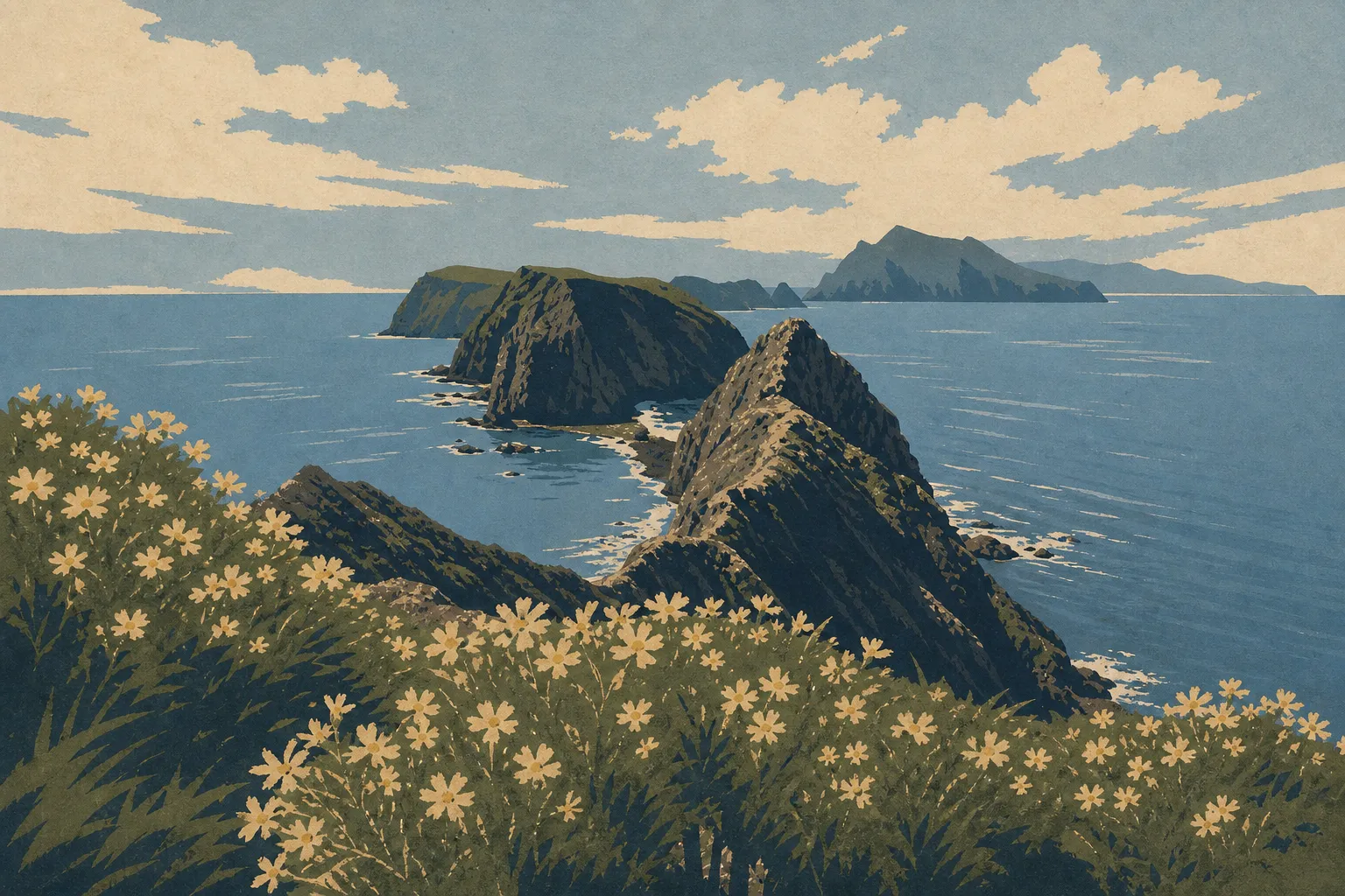
Channel Islands Map: Islands, Access Points, and the Official Park Map
Channel Islands National Park is an archipelago of five islands off the coast of Southern California, between Ventura and Santa Barbara. One thing stands out immediately on the map: no road connects the islands to the mainland. You don't drive into this park; you board a boat or plane. Before you book your trip, get oriented with the map below, then download the official NPS map (Unigrid PDF) from the National Park Service website.
Heads up: don't confuse this park with the British Channel Islands of Jersey and Guernsey in the English Channel. Channel Islands National Park is in California, about 25 miles offshore from Ventura.
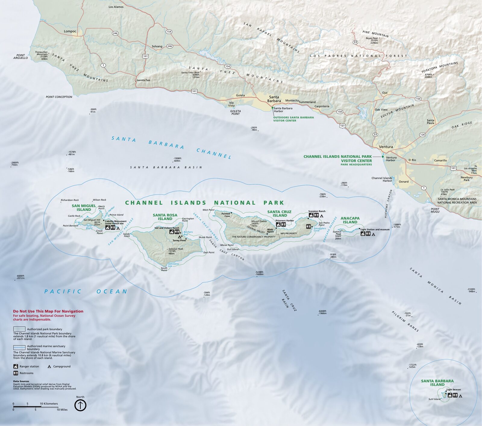
The official park map handed out at entrance stations, with roads, areas, visitor centers and services. View it here or download it for offline use.
Download the map (PDF) Public domain · National Park ServiceWhere Is Channel Islands National Park?
Channel Islands National Park is in Ventura County, in Southern California (state: CA). The five islands cover about 97 square miles, from 12 miles offshore for Anacapa to 60 miles for San Miguel. On a map of the United States, the park is easy to spot off the Pacific Coast, about halfway between Los Angeles to the southeast and Santa Barbara to the northwest. For distances and logistics from the mainland, see the guide to getting to Channel Islands.
Download the Official Channel Islands Map (NPS Unigrid)
The National Park Service publishes a free Unigrid map of Channel Islands as a PDF on nps.gov/chis. It covers all five islands, marked trails, authorized anchorage and landing areas, distances between each island and the mainland, and the boundaries of the adjacent national marine sanctuary.
The map is in English, but NPS symbols are universal and easy to read without a dictionary. Print it on letter-size paper before you leave. Cell service is nearly nonexistent once the boat leaves the dock.
The Five Channel Islands: Five Distinct Experiences
Channel Islands is divided into five distinct islands, each with its own character. Here's the geographic layout from northwest to southeast.
San Miguel
The westernmost, windiest, and wildest island. San Miguel is home to one of the largest concentrations of pinnipeds in the North Pacific, with up to six species of sea lions and seals gathering around Point Bennett. Access depends heavily on weather conditions, so keep your schedule flexible.
Santa Rosa
The second-largest island, Santa Rosa has the park's greatest botanical diversity. You'll find grasslands, sandy beaches along the north coast, and a Torrey pine grove, home to a rare pine species found nowhere else in the park. The trip from Ventura takes about three hours.
Santa Cruz
The largest of the five islands at 96 square miles, and the most visited. Santa Cruz has most of the park's facilities, including campgrounds and marked trails, plus sea caves accessible by kayak, especially the famous Painted Cave. It's often the first island people visit. For activities on the island, things to do in Channel Islands covers all the options.
Anacapa
The closest island to the mainland at 12 miles, Anacapa is actually divided into three aligned islets. Its historic lighthouse, built in 1945, is the park's most iconic landmark. The trip from Ventura takes about an hour, making Anacapa the popular choice for a day trip.
Santa Barbara
The smallest and southernmost of the five islands. It's rarely visited, offering unusual peace and quiet, and it's home to a major colony of Ashy storm-petrels. The trip from Ventura takes more than three hours. You go there knowing exactly what you're looking for.
Getting to the Islands: No Roads or Loops, Only Boats or Planes
Channel Islands is an island chain without roads. You can reach the five islands only by boat or plane from the mainland. For operators, schedules, and reservations, see the guide to getting to Channel Islands.
Points of Interest to Find on the Map
Here are a few landmarks to locate before you leave:
- Painted Cave (Santa Cruz): one of the world's largest sea caves, accessible by kayak from Scorpion Anchorage.
- Point Bennett (San Miguel): the prime spot for viewing seals and sea lions, at the end of the island's only trail, about 17 miles round-trip.
- East Anacapa Lighthouse: built in 1945, it's the park's iconic image, visible from the boat well before you land.
- Torrey pine grove (Santa Rosa): a grove of endemic pines found nowhere else except on the mainland near San Diego.
For the full itinerary and estimated times on each island, Channel Islands hikes and the Things to Do guide lay out the options.
Nearest Cities and Airports
The park's mainland gateway is Ventura, about an hour northwest of Los Angeles via US-101. The Robert J. Lagomarsino Visitor Center (1901 Spinnaker Drive, Ventura) is the natural starting point for any visit. This is where Island Packers boats depart.
Two airports are worth noting on the map:
- Santa Barbara Airport (SBA), about 31 miles northwest of Ventura.
- Los Angeles International Airport (LAX), about 75 miles southeast, with the best domestic and international connections.
For lodging near Ventura Harbor, places to stay around Channel Islands and nearby hotels and lodges cover the options. Channel Islands: The Complete Guide gives you an overview of the park and all its sections.
Hiking Maps and Printed Trail Guides
The NPS Unigrid map is enough for a first visit to Anacapa or Santa Cruz. For the wilder islands, a few additional resources are useful:
- Trails Illustrated (National Geographic): a detailed topographic map with contour lines, available at travel bookstores or online.
- Tom Harrison Maps: a California publisher specializing in maps, with a laminated, waterproof version designed to withstand marine moisture.
These paper maps are especially valuable on San Miguel and Santa Rosa, where trails are lightly marked and cell service is absent.
Frequently Asked Questions
Where is Channel Islands National Park on a map of the United States?
Channel Islands National Park lies off the coast of Southern California, in Ventura County, between Los Angeles and Santa Barbara. The five islands are 12 to 60 miles offshore, from Anacapa to San Miguel. Don't confuse them with the British Channel Islands of Jersey and Guernsey in the English Channel.
Is there an official Channel Islands map to download?
Yes. The National Park Service's Unigrid map is available as a free PDF on nps.gov/chis. It covers all five islands, marked trails, anchorage areas, and the boundaries of the marine sanctuary.
Can you drive across Channel Islands?
No. Channel Islands is an island chain without a road network. No road connects the islands to one another or to the mainland. You can get there only by boat, with Island Packers from Ventura, or by plane to Santa Rosa.
What is the closest city to Channel Islands?
Ventura is the closest city and the park's main logistics hub. Both the NPS visitor center and the Island Packers landing dock are there.
How long does it take to visit Channel Islands?
A day is enough for Anacapa or Santa Cruz. To explore several islands or camp, plan on two to five days. The Channel Islands itinerary guide lays out options based on your pace and priorities.
What are the five islands in Channel Islands National Park?
The park's five islands are San Miguel, Santa Rosa, Santa Cruz, Anacapa, and Santa Barbara. Each has its own character, wildlife, and level of accessibility.