
Getting Around Mesa Verde: Access, Entrance, Winding Roads, and Parking
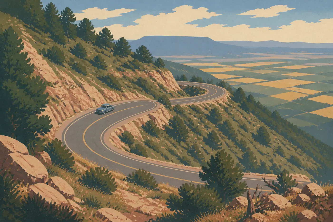
At Mesa Verde, everything starts with a climb. From Highway 160, a road leaves the plain and winds uphill to the mesa. There is no shuttle or bus. Your car does all the work, from the entrance to the cliff dwellings.
Quick answer: You can visit Mesa Verde only in a personal vehicle. The park has no internal shuttle. The main road climbs about 21 miles from the entrance to the main archaeological sites.
How to Get to Mesa Verde
Mesa Verde is in southwestern Colorado, on Highway 160, 10 miles east of Cortez. For airports, distances from major cities, and rental car options, the Mesa Verde access guide brings together all the key information.
The Park Entrance: One Gate That's Easy to Find
Mesa Verde has just one entrance, on Highway 160. You can't miss it. A road leaves the highway and immediately starts climbing.
The Visitor and Research Center is about 0.6 miles past the fee station, on the right as you drive uphill. This is where you buy tickets for guided tours of the cliff dwellings, including Cliff Palace and Balcony House, pick up a park map, and get current road conditions. We recommend stopping here even if you booked online. Rangers sometimes report last-minute site closures.
The America the Beautiful pass ($80 per year) is accepted and quickly pays for itself if you're visiting several parks. For entrance fees and annual passes, see the national parks fees and passes page. The Visitor and Research Center is open year-round except Thanksgiving, Christmas, and January 1.
Getting Around the Park
By Car
A personal vehicle is the only motorized way to get around Mesa Verde. From the entrance, the main road climbs about 21 miles to the heart of the mesa. The first 7.5 miles are the steepest, with hairpin turns and sweeping views over Montezuma Valley. The speed limit is 35 mph on the main road and lower near the sites.
Two main branches serve the park:
- Chapin Mesa: The main area, open year-round. It includes Cliff Palace Loop Road, Mesa Top Loop, and the Chapin Mesa Archaeological Museum.
- Wetherill Mesa: The western area, open from June through mid-October. The road is long and closed to trailers and vehicles weighing more than 8,000 pounds.
Rain and snow can quickly make conditions worse on the mesa. In winter, snow tires or chains may be required. Always check conditions at the Visitor and Research Center before heading up.
By Shuttle
Mesa Verde has no internal shuttle. Unlike Zion and other heavily visited parks, the park relies entirely on personal vehicles. You need your own car for every trip within the park.
By Bike
Bikes are allowed on the park's paved roads. In practice, the grade on the access road makes cycling very demanding, with several hundred feet of elevation gain in the first few miles. Bikes aren't allowed on the trails. If you want to ride, bring a bike in excellent condition, with flawless brakes for the descent, and make sure you're well trained.
Where to Park: Lots and Practical Tips
Each major site has its own parking lot, but capacity remains limited during the busy season:
- Morefield Campground (about 3.7 miles from the entrance): A staging area for RVs and vehicles with trailers. If you're towing a trailer, leave it here before continuing to Chapin Mesa.
- Visitor and Research Center: The main lot, suitable for all vehicles, including RVs without trailers.
- Chapin Mesa Archaeological Museum: The park's busiest parking lot. Before 9:30 a.m., you'll easily find a space. After 10 a.m. in July and August, it's often full.
- Cliff Palace Loop and Mesa Top Loop: Small lots along the road. During the busy season, you may have to wait a few minutes.
- Wetherill Mesa: A parking lot at the end of the road, reserved for light-duty vehicles without trailers.
Mesa Verde does not offer parking reservations. The basic rule is to arrive before 9 a.m. for the busiest areas. To plan around crowds by month, the best times to visit Mesa Verde guide provides seasonal guidance.
Distances and Drive Times Between Areas
Mesa Verde is more compact than Yellowstone or the Grand Canyon, but internal distances take time to cover. The road is narrow and winding, and speed limits are strictly enforced.
| Route | Approx. distance | Estimated time |
|---|---|---|
| Entrance → Visitor and Research Center | about 0.6 miles | 2 min |
| Entrance → Morefield Campground | about 3.7 miles | 8 min |
| Entrance → Chapin Mesa Archaeological Museum | about 21 miles | 40 min |
| Entrance → Wetherill Mesa | about 31 miles | 55 min |
| Chapin Mesa ↔ Wetherill Mesa | about 19 miles | 35 min |
These times don't include stops at overlooks or waits in parking lots. To build your itinerary, the Mesa Verde itinerary guide offers examples for one, two, or three days.
RVs, Vans, Accessibility, and Pets
RVs and Trailers
The main road is accessible to RVs without special restrictions as far as the Chapin Mesa area. Trailers, however, aren't allowed beyond Morefield Campground. If you're towing a caravan or trailer, leave it at the campground and continue with the tow vehicle alone.
The road to Wetherill Mesa is closed to trailers and vehicles weighing more than 8,000 pounds, with no exceptions. Service areas and suitable sites are listed in the Mesa Verde RV guide.
Accessibility
The Visitor and Research Center, the Chapin Mesa Archaeological Museum, and several scenic overlooks are wheelchair accessible. The guided tours of Cliff Palace and Balcony House involve ladders, narrow tunnels, and uneven ground. They aren't suitable for everyone with mobility limitations. Rangers can direct you to accessible sites when you arrive at the Visitor and Research Center.
Pets
Dogs are allowed in the park, but only on paved roads, in parking lots, and at the campground. They're not allowed on trails or in archaeological areas. Leashes are required at all times and may be no longer than 6 feet. In hot weather, above 77°F, never leave your pet in a vehicle parked in the sun.
Practical Transportation Info: Fuel, Cell Service, and Apps
Fuel
A gas station is available at Far View, about 15.5 miles from the entrance, and is open seasonally, generally from mid-May through mid-October. Outside that period, or if it's closed, fill up in Cortez or Mancos before entering the park. Once you're on the mesa, you won't have another option.
Cell Service
Cell service is nearly nonexistent throughout the park. You may get a few bars during the first few miles after the entrance, but they disappear as you climb to the mesa. On Chapin Mesa and Wetherill Mesa, count on having no service. Download offline maps through Google Maps or Maps.me, along with the NPS app, before entering the park.
Recommended App
The free NPS App for iOS and Android lets you download the park map for offline use, check site hours and trail conditions, and receive park alerts when you're in an area with coverage. The paper map handed out at the entrance remains a reliable backup if your battery dies.
Frequently Asked Questions
How do you get around Mesa Verde?
You get around Mesa Verde exclusively by personal vehicle. The park has no internal shuttle. The main road winds up from the entrance to the mesa, where two branches serve Chapin Mesa, open year-round, and Wetherill Mesa, open from June through mid-October.
Can you visit Mesa Verde by car?
Yes. It's the only way to get around the park. Mesa Verde has neither a shuttle nor internal public transportation. You need your own vehicle for every trip.
Where can you park at Mesa Verde?
Each site has its own parking lot, including the Visitor and Research Center, the Chapin Mesa Archaeological Museum, Cliff Palace Loop, and Wetherill Mesa. During the busy season, in July and August, lots fill up before 10 a.m. RVs with trailers must park at Morefield Campground.
Which is the best entrance to Mesa Verde?
Mesa Verde National Park has only one entrance, on Highway 160, 10 miles east of Cortez. It provides direct access to the Visitor and Research Center, where you buy tickets for guided tours.
Is there cell service at Mesa Verde?
No, or almost none. Service disappears quickly as you climb to the mesa. Download offline maps and the NPS app before entering the park.
How much does it cost to enter Mesa Verde?
The America the Beautiful pass is accepted. For detailed fees and the different passes, see the national parks fees and passes page.
How long does it take to visit Mesa Verde?
The ideal length of a visit depends on how many guided tours you want to take and which areas you want to cover. Plan on one to three days, depending on the sites you want to see. The Itinerary and Length page offers examples by trip length.