
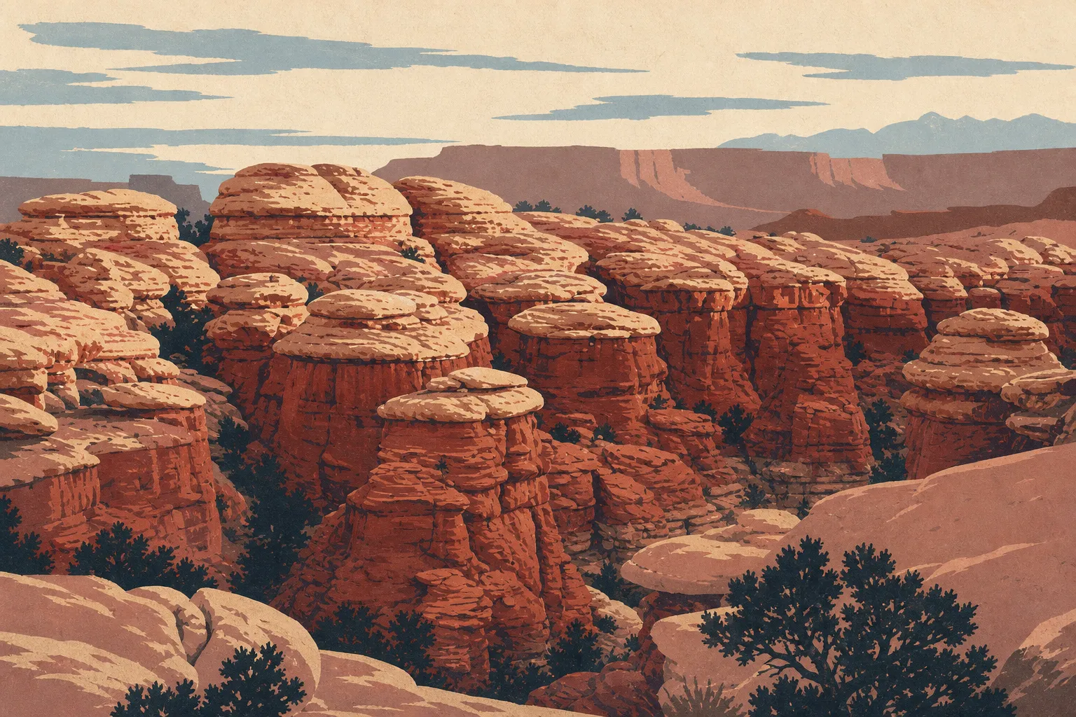
Canyonlands Map: Districts, Access Roads, and the Official Map
Canyonlands is in southeastern Utah, in the American Southwest. The park covers 527 square miles of the Colorado Plateau, divided into three districts by the Colorado River and the Green River. No internal roads connect these districts. Each has its own entrance, which makes a big difference when planning your trip. The official NPS map is available as a free PDF on the NPS website.
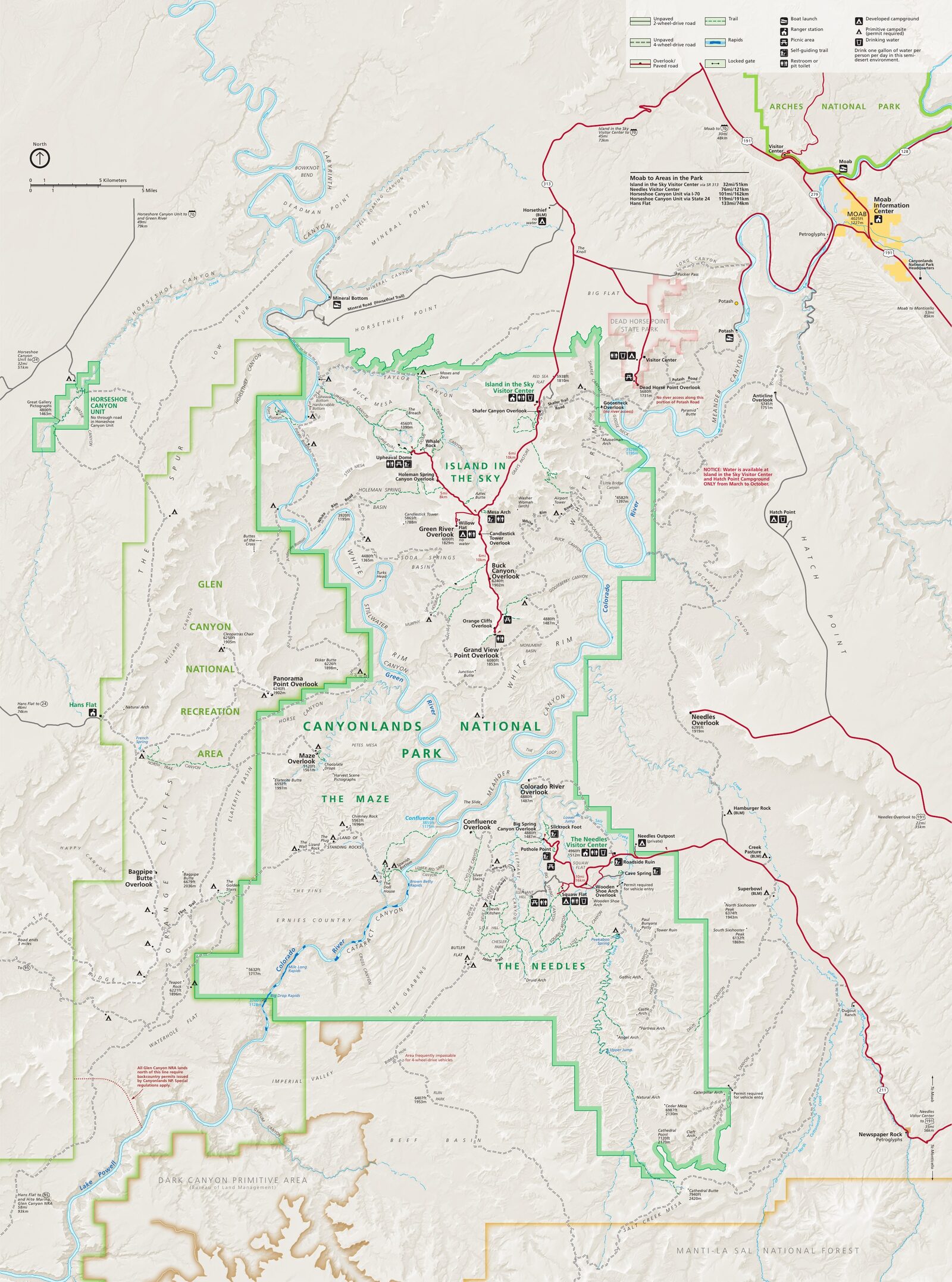
The official park map handed out at entrance stations, with roads, areas, visitor centers and services. View it here or download it for offline use.
Download the map (PDF) Public domain · National Park ServiceWhere Is Canyonlands?
Canyonlands National Park is in San Juan County, southeastern Utah. To find it on a map of the United States, start in Salt Lake City and head due south for about 230 miles to Moab, the park's gateway town. From there, the park stretches southwest.
Arches National Park is less than an hour northeast, and Dead Horse Point State Park borders the entrance to Island in the Sky. With so many sites close together, the area makes a natural destination to explore in our regional guide.
Download the Official Canyonlands Map (NPS Unigrid)
The NPS publishes the Canyonlands Unigrid map, a high-resolution PDF covering all three districts, access roads, trailheads, and camping areas. You can download it free from the Maps page at nps.gov/cany.
Print it before you leave. Cell service is almost nonexistent across most of the park, especially in The Needles and The Maze. Rangers also hand out free paper maps at the entrance, but supplies run out quickly during peak season.
Canyonlands Districts
Three districts, three distinct experiences, and three separate access points. No roads connect them inside the park, so keep that in mind before planning your route.
Island in the Sky
Island in the Sky is the northern district. It's a horseshoe-shaped mesa perched about 1,970 feet above the canyons. From Moab, it takes about 40 minutes to get there via UT 313.
The main road follows the rim of the plateau to Grand View Point, with overlooks appearing every few miles. This is the busiest district and the easiest to explore in a standard vehicle. White Rim Road, a roughly 100-mile loop around the plateau, is limited to 4WD vehicles and mountain bikes with a permit obtained in advance.
The Needles
The Needles occupies the park's southeastern corner, about a 1.5-hour drive from Moab via US 191 and UT 211. Its red-and-white striped spires give the district its character. It's wilder than Island in the Sky, with more hiking trails, backcountry areas, and far fewer people.
Chesler Park and The Joint Trail are among the district's signature hikes.
The Maze
The Maze is the western district and one of the most remote areas in the continental United States. There are no paved roads to reach it. Expect several hours on dirt roads from Moab or Hanksville. This district is for multi-day expeditions in a 4WD vehicle with a complete self-sufficient setup. Use it on the map to understand the park's scale, not as a day-trip destination.
Park Entrances and Driving Between Districts
You can't drive from one Canyonlands district to another. The two rivers form natural barriers that roads cannot cross, and no internal road connects the districts for standard vehicles. On the map, the three sections look like one continuous area. In practice, you have to return to US 191 between each one.
The entrance fee is $30 per vehicle, valid for 7 days at Island in the Sky and The Needles. The annual Canyonlands pass costs $55. The America the Beautiful pass ($80) covers all U.S. federal recreation sites, including nearby Arches. Distances and driving times from the main cities are covered in the Canyonlands access guide.
Points of Interest and Viewpoints on the Map
On Island in the Sky, mark three overlooks on your map before you leave: Grand View Point, Buck Canyon Overlook, and White Rim Overlook. You can reach all of them by car without a strenuous hike.
In The Needles, Confluence Overlook is the highlight. An 11.2-mile round-trip hike takes you to the edge of a cliff overlooking the confluence of the Colorado River and the Green River. When we visited, late-afternoon light turned the bends in the rivers into a golden maze. The time required and access details for each site are covered in the Canyonlands activities guide.
Nearest Towns and Airports
Moab, Utah, is the essential base. Hotels, grocery stores, and rental car agencies are all concentrated there. Island in the Sky is about 31 miles north, and The Needles is about 81 miles south.
For air travel, two airports serve the area:
- Grand Junction Regional Airport (GJT), Colorado, is the closest, about 2 hours from Moab.
- Salt Lake City International Airport (SLC) is the main gateway, about 3.5 hours from Moab.
Lodging in Moab and near the park entrances is listed in the Canyonlands lodging guide.
Hiking Maps and Topographic Guides
The NPS Unigrid map is enough for a typical visit. For backcountry travel in The Needles or an expedition into The Maze, a 1:24,000-scale topographic map is essential. Nat Geo Trails Illustrated publishes a dedicated Canyonlands map, available from Cartovia and specialized travel bookstores. Some trailheads have a free box of paper maps at the start of the trail, but don't count on finding one during peak season.
Frequently Asked Questions
Where is Canyonlands on a map of the United States?
Canyonlands National Park is in southeastern Utah, about 230 miles south of Salt Lake City and 31 miles northwest of Moab.
Is there an official Canyonlands map, and can I download it?
Yes. The NPS publishes a free official Unigrid map as a PDF on the Maps page at nps.gov/cany. It covers all three districts, access roads, and the main trailheads.
Can you drive across Canyonlands?
You can't drive from one district to another. The three districts have no internal roads connecting them, so you have to return to the main road between entrances.
What's the best viewpoint in Canyonlands?
Grand View Point on Island in the Sky is the easiest viewpoint to reach by car. For hikers, Confluence Overlook in The Needles offers unmatched views of the confluence of the two rivers.
How long does it take to visit Canyonlands?
It depends on which districts you visit. The Canyonlands itinerary guide covers options ranging from a half day to several days.
What is the closest town to Canyonlands?
Moab, Utah, is the closest town and the park's natural base for supplies, about 31 miles from Island in the Sky and about 81 miles from The Needles.